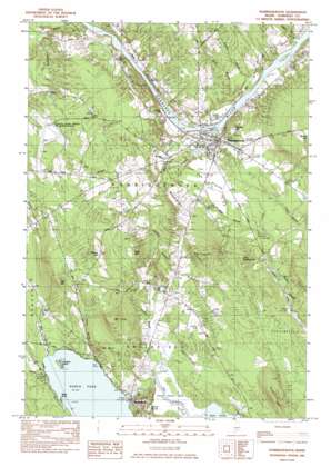
Norridgewock Topo Map Maine
To zoom in, hover over the map of Norridgewock
USGS Topo Quad 44069f7 - 1:24,000 scale
| Topo Map Name: | Norridgewock |
| USGS Topo Quad ID: | 44069f7 |
| Print Size: | ca. 21 1/4" wide x 27" high |
| Southeast Coordinates: | 44.625° N latitude / 69.75° W longitude |
| Map Center Coordinates: | 44.6875° N latitude / 69.8125° W longitude |
| U.S. State: | ME |
| Filename: | o44069f7.jpg |
| Download Map JPG Image: | Norridgewock topo map 1:24,000 scale |
| Map Type: | Topographic |
| Topo Series: | 7.5´ |
| Map Scale: | 1:24,000 |
| Source of Map Images: | United States Geological Survey (USGS) |
| Alternate Map Versions: |
Norridgewock NE ME 1975, updated 1980 Download PDF Buy paper map Norridgewock ME 1982, updated 1982 Download PDF Buy paper map Norridgewock ME 1982, updated 1982 Download PDF Buy paper map Norridgewock ME 2011 Download PDF Buy paper map Norridgewock ME 2014 Download PDF Buy paper map |
1:24,000 Topo Quads surrounding Norridgewock
> Back to 44069e1 at 1:100,000 scale
> Back to 44068a1 at 1:250,000 scale
> Back to U.S. Topo Maps home
Norridgewock topo map: Gazetteer
Norridgewock: Airports
Central Maine Airport of Norridgewock elevation 81m 265′Norridgewock: Bridges
Norridgewock Bridge elevation 47m 154′Norridgewock: Capes
Birch Point elevation 83m 272′Norridgewock: Dams
East Pond Dam elevation 80m 262′Mill Stream Dam elevation 47m 154′
Norridgewock: Flats
The Plains elevation 74m 242′Norridgewock: Islands
Pomleau Island elevation 77m 252′Norridgewock: Lakes
East Pond elevation 108m 354′Little Pond elevation 88m 288′
North Pond elevation 77m 252′
Smith Pond elevation 84m 275′
Norridgewock: Parks
Oosoola Park elevation 48m 157′Norridgewock: Populated Places
Norridgewock elevation 61m 200′Smithfield elevation 77m 252′
Norridgewock: Rapids
Bombazee Rips elevation 64m 209′Norridgewock: Reservoirs
East Pond elevation 80m 262′Mill Stream elevation 47m 154′
Norridgewock: Streams
Alder Brook elevation 63m 206′Bog Stream elevation 78m 255′
Bombazee Brook elevation 61m 200′
Clark Brook elevation 81m 265′
Jones Brook elevation 59m 193′
Leech Brook elevation 77m 252′
Mill Stream elevation 47m 154′
Pattee Brook elevation 82m 269′
Rogers Brook elevation 48m 157′
Sucker Brook elevation 81m 265′
The Serpentine elevation 77m 252′
Tobey Brook elevation 63m 206′
Turner Brook elevation 49m 160′
Norridgewock: Summits
Bear Mountain elevation 175m 574′Burrill Hill elevation 88m 288′
Dodling Hill elevation 182m 597′
Green Hill elevation 177m 580′
Little Dodling Hill elevation 118m 387′
McIntrye Hill elevation 64m 209′
Mount Bett elevation 102m 334′
Mount Tom elevation 223m 731′
Oak Hill elevation 150m 492′
Ross Hill elevation 131m 429′
Sunset Hill elevation 100m 328′
Wilder Hill elevation 140m 459′
Norridgewock: Swamps
East Pond Bog elevation 81m 265′Norridgewock digital topo map on disk
Buy this Norridgewock topo map showing relief, roads, GPS coordinates and other geographical features, as a high-resolution digital map file on DVD:
Maine, New Hampshire, Rhode Island & Eastern Massachusetts
Buy digital topo maps: Maine, New Hampshire, Rhode Island & Eastern Massachusetts


