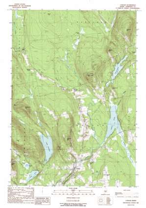
Canaan Topo Map Maine
To zoom in, hover over the map of Canaan
USGS Topo Quad 44069g5 - 1:24,000 scale
| Topo Map Name: | Canaan |
| USGS Topo Quad ID: | 44069g5 |
| Print Size: | ca. 21 1/4" wide x 27" high |
| Southeast Coordinates: | 44.75° N latitude / 69.5° W longitude |
| Map Center Coordinates: | 44.8125° N latitude / 69.5625° W longitude |
| U.S. State: | ME |
| Filename: | o44069g5.jpg |
| Download Map JPG Image: | Canaan topo map 1:24,000 scale |
| Map Type: | Topographic |
| Topo Series: | 7.5´ |
| Map Scale: | 1:24,000 |
| Source of Map Images: | United States Geological Survey (USGS) |
| Alternate Map Versions: |
Skowhegan SE ME 1975, updated 1980 Download PDF Buy paper map Canaan ME 1989, updated 1989 Download PDF Buy paper map Canaan ME 2011 Download PDF Buy paper map Canaan ME 2014 Download PDF Buy paper map |
1:24,000 Topo Quads surrounding Canaan
> Back to 44069e1 at 1:100,000 scale
> Back to 44068a1 at 1:250,000 scale
> Back to U.S. Topo Maps home
Canaan topo map: Gazetteer
Canaan: Gaps
The Notch elevation 123m 403′Canaan: Lakes
Lake George elevation 70m 229′Morrill Pond elevation 90m 295′
Mud Pond elevation 87m 285′
Oaks Pond elevation 49m 160′
Round Pond elevation 53m 173′
Sibley Pond elevation 69m 226′
Canaan: Populated Places
Browns Corner elevation 89m 291′Canaan elevation 71m 232′
Gould Corner elevation 97m 318′
Mitchell Corner elevation 95m 311′
Canaan: Post Offices
Canaan Post Office elevation 98m 321′Canaan: Streams
Black Stream elevation 68m 223′Cooper Brook elevation 70m 229′
East Branch Black Stream elevation 72m 236′
Lambert Brook elevation 50m 164′
Stafford Brook elevation 48m 157′
West Branch Black Stream elevation 72m 236′
Whitcombe Brook elevation 69m 226′
Canaan: Summits
Burrill Hill elevation 147m 482′Chase Hill elevation 230m 754′
Church Hill elevation 118m 387′
Comeouter Hill elevation 129m 423′
Foster Hill elevation 223m 731′
Goodwin Hill elevation 251m 823′
Goodwin Hill elevation 233m 764′
Jewell Hill elevation 184m 603′
Nelson Hill elevation 134m 439′
Tibbetts Hill elevation 199m 652′
Whittemore Hill elevation 215m 705′
Canaan: Swamps
Canaan Bog elevation 71m 232′Juniper Bog elevation 102m 334′
Canaan digital topo map on disk
Buy this Canaan topo map showing relief, roads, GPS coordinates and other geographical features, as a high-resolution digital map file on DVD:
Maine, New Hampshire, Rhode Island & Eastern Massachusetts
Buy digital topo maps: Maine, New Hampshire, Rhode Island & Eastern Massachusetts


