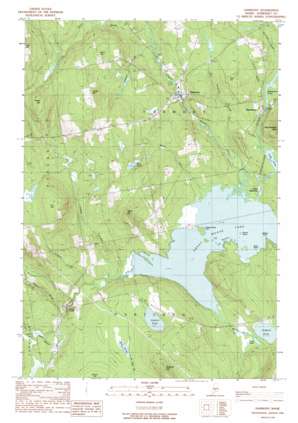
Harmony Topo Map Maine
To zoom in, hover over the map of Harmony
USGS Topo Quad 44069h5 - 1:24,000 scale
| Topo Map Name: | Harmony |
| USGS Topo Quad ID: | 44069h5 |
| Print Size: | ca. 21 1/4" wide x 27" high |
| Southeast Coordinates: | 44.875° N latitude / 69.5° W longitude |
| Map Center Coordinates: | 44.9375° N latitude / 69.5625° W longitude |
| U.S. State: | ME |
| Filename: | o44069h5.jpg |
| Download Map JPG Image: | Harmony topo map 1:24,000 scale |
| Map Type: | Topographic |
| Topo Series: | 7.5´ |
| Map Scale: | 1:24,000 |
| Source of Map Images: | United States Geological Survey (USGS) |
| Alternate Map Versions: |
Skowhegan NE ME 1975, updated 1980 Download PDF Buy paper map Harmony ME 1989, updated 1989 Download PDF Buy paper map Harmony ME 2011 Download PDF Buy paper map Harmony ME 2014 Download PDF Buy paper map |
1:24,000 Topo Quads surrounding Harmony
> Back to 44069e1 at 1:100,000 scale
> Back to 44068a1 at 1:250,000 scale
> Back to U.S. Topo Maps home
Harmony topo map: Gazetteer
Harmony: Capes
Halfway Point elevation 76m 249′Passaconaway Point elevation 74m 242′
Harmony: Channels
The Narrows elevation 74m 242′Harmony: Dams
Higgins Brook Dam elevation 90m 295′Harmony: Islands
Birch Island elevation 74m 242′Ledge Island (historical) elevation 74m 242′
Round Island elevation 75m 246′
Harmony: Lakes
Bog Pond elevation 120m 393′Lake Como elevation 80m 262′
Mud Pond elevation 78m 255′
Perry Pond elevation 151m 495′
Stafford Pond elevation 80m 262′
Starbird Pond elevation 130m 426′
Harmony: Populated Places
Castle Harmony elevation 76m 249′Corson Corner elevation 80m 262′
Harmony elevation 93m 305′
Mainstream elevation 112m 367′
Harmony: Reservoirs
Higgins Brook elevation 90m 295′Harmony: Streams
Black Stream elevation 74m 242′Brown Brook elevation 75m 246′
Church Brook elevation 93m 305′
Grant Brook elevation 103m 337′
Higgins Stream elevation 75m 246′
Joaquin Brook elevation 76m 249′
Kimball Brook elevation 154m 505′
Lemon Stream elevation 75m 246′
Little Ferguson Brook elevation 75m 246′
Magoon Brook elevation 77m 252′
Tuttle Brook elevation 80m 262′
Whitehouse Brook elevation 142m 465′
Withee Brook elevation 74m 242′
Harmony: Summits
Carson Hill elevation 240m 787′Dore Hill elevation 263m 862′
Fox Hill elevation 230m 754′
Grant Hill elevation 233m 764′
Hurd Hill elevation 162m 531′
Peeks Hill elevation 229m 751′
Stafford Hill elevation 186m 610′
Talbot Hill elevation 178m 583′
Harmony digital topo map on disk
Buy this Harmony topo map showing relief, roads, GPS coordinates and other geographical features, as a high-resolution digital map file on DVD:
Maine, New Hampshire, Rhode Island & Eastern Massachusetts
Buy digital topo maps: Maine, New Hampshire, Rhode Island & Eastern Massachusetts


