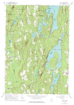
Fayette Topo Map Maine
To zoom in, hover over the map of Fayette
USGS Topo Quad 44070d1 - 1:24,000 scale
| Topo Map Name: | Fayette |
| USGS Topo Quad ID: | 44070d1 |
| Print Size: | ca. 21 1/4" wide x 27" high |
| Southeast Coordinates: | 44.375° N latitude / 70° W longitude |
| Map Center Coordinates: | 44.4375° N latitude / 70.0625° W longitude |
| U.S. State: | ME |
| Filename: | o44070d1.jpg |
| Download Map JPG Image: | Fayette topo map 1:24,000 scale |
| Map Type: | Topographic |
| Topo Series: | 7.5´ |
| Map Scale: | 1:24,000 |
| Source of Map Images: | United States Geological Survey (USGS) |
| Alternate Map Versions: |
Fayette ME 1966, updated 1968 Download PDF Buy paper map Fayette ME 1966, updated 1976 Download PDF Buy paper map Fayette ME 2011 Download PDF Buy paper map Fayette ME 2014 Download PDF Buy paper map |
1:24,000 Topo Quads surrounding Fayette
> Back to 44070a1 at 1:100,000 scale
> Back to 44070a1 at 1:250,000 scale
> Back to U.S. Topo Maps home
Fayette topo map: Gazetteer
Fayette: Dams
Echo Lake Dam Number 1 elevation 97m 318′Echo Lake Dam Number 2 elevation 97m 318′
Taylor Pond Dam elevation 99m 324′
Fayette: Islands
Birch Island elevation 113m 370′Causeway Island elevation 110m 360′
Echo Island elevation 100m 328′
Gooseneck Island elevation 110m 360′
Spruce Island elevation 110m 360′
Turtle Island elevation 99m 324′
Fayette: Lakes
Basin Pond elevation 125m 410′Burgess Pond elevation 114m 374′
Cranberry Pond elevation 115m 377′
David Pond elevation 119m 390′
Hales Pond elevation 125m 410′
Mosher Pond elevation 111m 364′
Parker Pond elevation 109m 357′
Rack Pond elevation 111m 364′
Round Pond elevation 115m 377′
Schoolhouse Pond elevation 110m 360′
Tilton Pond elevation 123m 403′
Turner Pond elevation 112m 367′
Fayette: Populated Places
Fayette elevation 103m 337′Fayette Corner elevation 169m 554′
Kents Hill elevation 164m 538′
North Fayette elevation 152m 498′
Richmond Mill elevation 125m 410′
Sanderson Corners elevation 137m 449′
Twelve Corners elevation 115m 377′
West Mount Vernon elevation 100m 328′
Fayette: Reservoirs
Echo Lake elevation 97m 318′Taylor Pond elevation 99m 324′
Fayette: Streams
Hopkins Stream elevation 99m 324′Fayette: Summits
Baldwin Hill elevation 239m 784′Fayette Ridge elevation 262m 859′
Gordon Hill elevation 231m 757′
Knowles Hill elevation 225m 738′
Manter Hill elevation 168m 551′
Oak Hill elevation 221m 725′
Pine Hill elevation 253m 830′
Fayette digital topo map on disk
Buy this Fayette topo map showing relief, roads, GPS coordinates and other geographical features, as a high-resolution digital map file on DVD:
Maine, New Hampshire, Rhode Island & Eastern Massachusetts
Buy digital topo maps: Maine, New Hampshire, Rhode Island & Eastern Massachusetts


