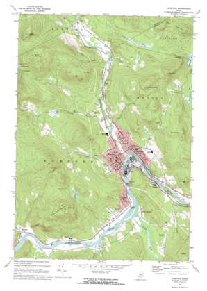
Rumford Topo Map Maine
To zoom in, hover over the map of Rumford
USGS Topo Quad 44070e5 - 1:24,000 scale
| Topo Map Name: | Rumford |
| USGS Topo Quad ID: | 44070e5 |
| Print Size: | ca. 21 1/4" wide x 27" high |
| Southeast Coordinates: | 44.5° N latitude / 70.5° W longitude |
| Map Center Coordinates: | 44.5625° N latitude / 70.5625° W longitude |
| U.S. State: | ME |
| Filename: | o44070e5.jpg |
| Download Map JPG Image: | Rumford topo map 1:24,000 scale |
| Map Type: | Topographic |
| Topo Series: | 7.5´ |
| Map Scale: | 1:24,000 |
| Source of Map Images: | United States Geological Survey (USGS) |
| Alternate Map Versions: |
Rumford ME 1969, updated 1972 Download PDF Buy paper map Rumford ME 1969, updated 1972 Download PDF Buy paper map Rumford ME 2011 Download PDF Buy paper map Rumford ME 2014 Download PDF Buy paper map |
1:24,000 Topo Quads surrounding Rumford
> Back to 44070e1 at 1:100,000 scale
> Back to 44070a1 at 1:250,000 scale
> Back to U.S. Topo Maps home
Rumford topo map: Gazetteer
Rumford: Airports
Hunt Airfield elevation 129m 423′Rumford: Dams
Middle Dam elevation 152m 498′Old Rumford Dam elevation 140m 459′
Thurston Mill Dam elevation 153m 501′
Upper Dam elevation 187m 613′
Rumford: Falls
Rumford Falls elevation 159m 521′Rumford: Gaps
Swains Notch elevation 412m 1351′Rumford: Islands
Wheeler Island elevation 186m 610′Rumford: Lakes
Halfmoon Pond elevation 151m 495′Joes Pond elevation 377m 1236′
Swains Pond elevation 397m 1302′
Rumford: Populated Places
Frye elevation 175m 574′Hale elevation 172m 564′
Mexico elevation 146m 479′
Ridlonville elevation 134m 439′
Rumford elevation 147m 482′
Rumford Center elevation 188m 616′
Smith Crossing elevation 136m 446′
South Rumford elevation 192m 629′
Virginia elevation 207m 679′
Rumford: Post Offices
Ridlonville Post Office (historical) elevation 134m 439′Rumford: Reservoirs
Androscoggin River Reservoir elevation 187m 613′Androscoggin River Reservoir elevation 152m 498′
Androscoggin River Reservoir elevation 140m 459′
Swift River Reservoir elevation 153m 501′
Rumford: Streams
Bean Brook elevation 155m 508′Goff Brook elevation 162m 531′
Logan Brook elevation 183m 600′
Mitchell Brook elevation 164m 538′
Scotty Brook elevation 134m 439′
Split Brook elevation 184m 603′
Swift River elevation 129m 423′
Thurston Brook elevation 185m 606′
Walton Brook elevation 166m 544′
Wyman Brook elevation 125m 410′
Zircon Brook elevation 185m 606′
Rumford: Summits
Carr Mountain elevation 459m 1505′Farrington Mountain elevation 324m 1062′
Glass Face Mountain elevation 573m 1879′
Lake Mountain elevation 360m 1181′
Mann Hill elevation 397m 1302′
North Twin Mountain elevation 654m 2145′
South Twin Mountain elevation 655m 2148′
Thompson Hill elevation 500m 1640′
Rumford digital topo map on disk
Buy this Rumford topo map showing relief, roads, GPS coordinates and other geographical features, as a high-resolution digital map file on DVD:
Maine, New Hampshire, Rhode Island & Eastern Massachusetts
Buy digital topo maps: Maine, New Hampshire, Rhode Island & Eastern Massachusetts


