New Sharon Topo Map Maine
To zoom in, hover over the map of New Sharon
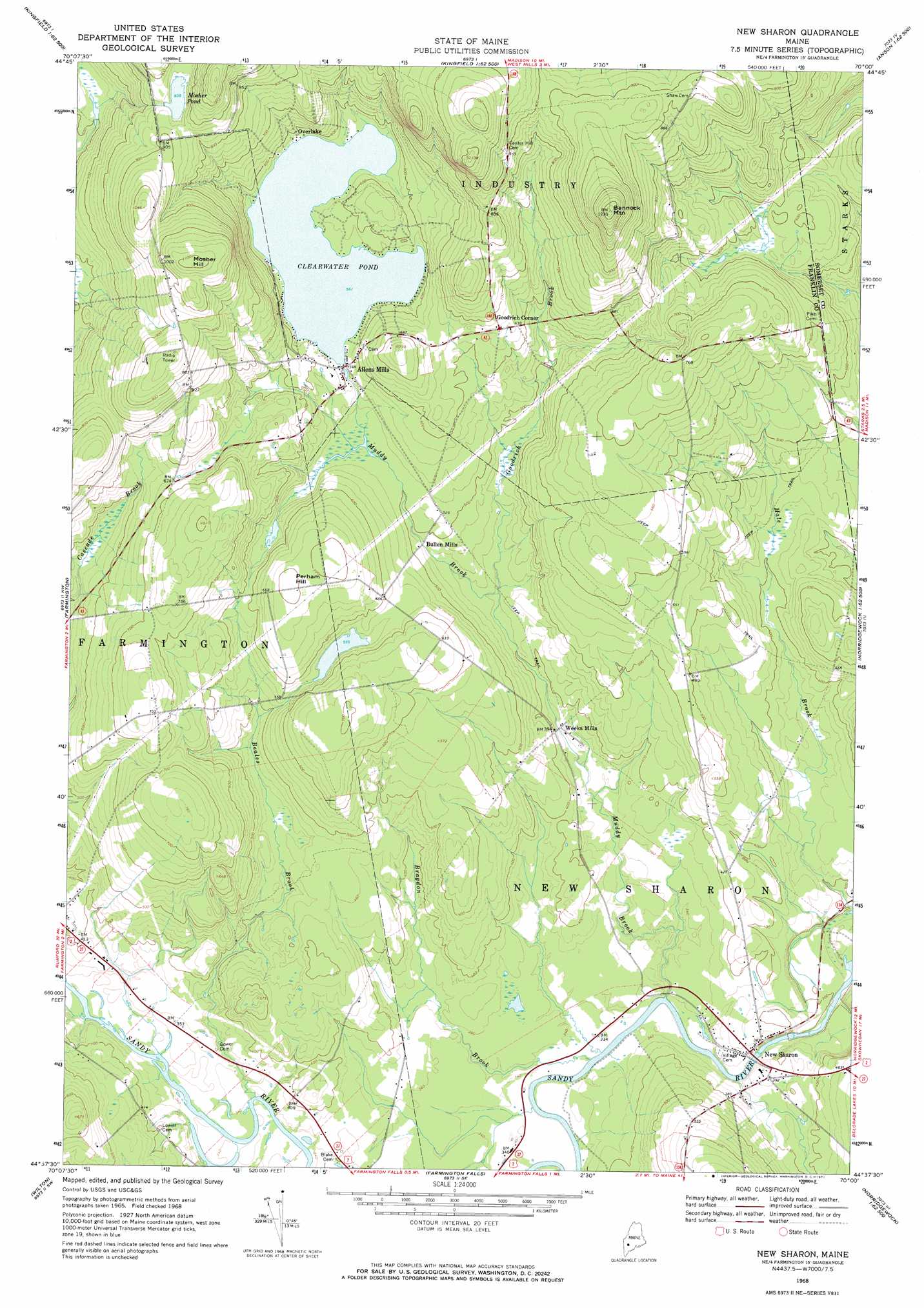
USGS Topo Quad 44070f1 - 1:24,000 scale
| Topo Map Name: | New Sharon |
| USGS Topo Quad ID: | 44070f1 |
| Print Size: | ca. 21 1/4" wide x 27" high |
| Southeast Coordinates: | 44.625° N latitude / 70° W longitude |
| Map Center Coordinates: | 44.6875° N latitude / 70.0625° W longitude |
| U.S. State: | ME |
| Filename: | o44070f1.jpg |
| Download Map JPG Image: | New Sharon topo map 1:24,000 scale |
| Map Type: | Topographic |
| Topo Series: | 7.5´ |
| Map Scale: | 1:24,000 |
| Source of Map Images: | United States Geological Survey (USGS) |
| Alternate Map Versions: |
New Sharon ME 1968, updated 1971 Download PDF Buy paper map New Sharon ME 2011 Download PDF Buy paper map New Sharon ME 2014 Download PDF Buy paper map |
1:24,000 Topo Quads surrounding New Sharon
Mount Abraham |
Kingfield |
New Portland |
Embden Pond |
Solon |
Phillips |
Strong |
New Vineyard |
Madison West |
Madison East |
Mount Blue |
Farmington |
New Sharon |
Mercer |
Norridgewock |
East Dixfield |
Wilton |
Farmington Falls |
Belgrade Lakes |
Rome |
Canton |
Livermore Falls |
Fayette |
Readfield |
Belgrade |
> Back to 44070e1 at 1:100,000 scale
> Back to 44070a1 at 1:250,000 scale
> Back to U.S. Topo Maps home
New Sharon topo map: Gazetteer
New Sharon: Lakes
Clearwater Pond elevation 171m 561′New Sharon: Populated Places
Allens Mills elevation 172m 564′Bullen Mills elevation 141m 462′
Goodrich Corner elevation 204m 669′
New Sharon elevation 111m 364′
Overlake elevation 176m 577′
Weeks Mills elevation 113m 370′
New Sharon: Reservoirs
Mosher Pond elevation 255m 836′New Sharon: Streams
Beales Brook elevation 101m 331′Bragdon Brook elevation 97m 318′
Goodrich Brook elevation 128m 419′
Muddy Brook elevation 101m 331′
New Sharon: Summits
Bannock Mountain elevation 374m 1227′Mosher Hill elevation 338m 1108′
Perham Hill elevation 216m 708′
New Sharon digital topo map on disk
Buy this New Sharon topo map showing relief, roads, GPS coordinates and other geographical features, as a high-resolution digital map file on DVD:
Maine, New Hampshire, Rhode Island & Eastern Massachusetts
Buy digital topo maps: Maine, New Hampshire, Rhode Island & Eastern Massachusetts