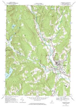
Farmington Topo Map Maine
To zoom in, hover over the map of Farmington
USGS Topo Quad 44070f2 - 1:24,000 scale
| Topo Map Name: | Farmington |
| USGS Topo Quad ID: | 44070f2 |
| Print Size: | ca. 21 1/4" wide x 27" high |
| Southeast Coordinates: | 44.625° N latitude / 70.125° W longitude |
| Map Center Coordinates: | 44.6875° N latitude / 70.1875° W longitude |
| U.S. State: | ME |
| Filename: | o44070f2.jpg |
| Download Map JPG Image: | Farmington topo map 1:24,000 scale |
| Map Type: | Topographic |
| Topo Series: | 7.5´ |
| Map Scale: | 1:24,000 |
| Source of Map Images: | United States Geological Survey (USGS) |
| Alternate Map Versions: |
Farmington ME 1968, updated 1971 Download PDF Buy paper map Farmington ME 2011 Download PDF Buy paper map Farmington ME 2014 Download PDF Buy paper map |
1:24,000 Topo Quads surrounding Farmington
> Back to 44070e1 at 1:100,000 scale
> Back to 44070a1 at 1:250,000 scale
> Back to U.S. Topo Maps home
Farmington topo map: Gazetteer
Farmington: Dams
Staples Pond Dam elevation 214m 702′Temple Stream Dam elevation 112m 367′
Farmington: Lakes
Ballard Pond elevation 216m 708′Drury Pond elevation 170m 557′
Mud Pond elevation 179m 587′
Varnum Pond elevation 230m 754′
Farmington: Populated Places
Fairbanks elevation 124m 406′Farmington elevation 126m 413′
Temple elevation 165m 541′
West Farmington elevation 121m 396′
Farmington: Reservoirs
Staples Pond elevation 214m 702′Temple Stream Reservoir elevation 112m 367′
Farmington: Streams
Adams Brook elevation 124m 406′Barker Stream elevation 108m 354′
Beaver Brook elevation 107m 351′
Cascade Brook elevation 103m 337′
Gus Mitchell Brook elevation 167m 547′
Hardy Brook elevation 107m 351′
Henry Mitchell Brook elevation 164m 538′
Temple Stream elevation 103m 337′
Winter Brook elevation 117m 383′
Farmington: Summits
Cowen Hill elevation 313m 1026′Porter Hill elevation 312m 1023′
Powderhouse Hill elevation 200m 656′
Titcomb Hill elevation 267m 875′
Voter Hill elevation 325m 1066′
Farmington digital topo map on disk
Buy this Farmington topo map showing relief, roads, GPS coordinates and other geographical features, as a high-resolution digital map file on DVD:
Maine, New Hampshire, Rhode Island & Eastern Massachusetts
Buy digital topo maps: Maine, New Hampshire, Rhode Island & Eastern Massachusetts


