Madrid Topo Map Maine
To zoom in, hover over the map of Madrid
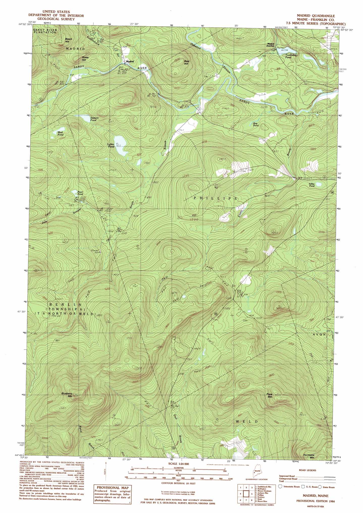
USGS Topo Quad 44070g4 - 1:24,000 scale
| Topo Map Name: | Madrid |
| USGS Topo Quad ID: | 44070g4 |
| Print Size: | ca. 21 1/4" wide x 27" high |
| Southeast Coordinates: | 44.75° N latitude / 70.375° W longitude |
| Map Center Coordinates: | 44.8125° N latitude / 70.4375° W longitude |
| U.S. State: | ME |
| Filename: | o44070g4.jpg |
| Download Map JPG Image: | Madrid topo map 1:24,000 scale |
| Map Type: | Topographic |
| Topo Series: | 7.5´ |
| Map Scale: | 1:24,000 |
| Source of Map Images: | United States Geological Survey (USGS) |
| Alternate Map Versions: |
Madrid ME 1977, updated 1983 Download PDF Buy paper map Madrid ME 1984, updated 1985 Download PDF Buy paper map Madrid ME 2011 Download PDF Buy paper map Madrid ME 2014 Download PDF Buy paper map |
1:24,000 Topo Quads surrounding Madrid
Kennebago Lake |
Quill Hill |
Black Nubble |
Sugarloaf Mountain |
Poplar Mountain |
Rangeley |
Saddleback Mountain |
Redington |
Mount Abraham |
Kingfield |
Houghton |
Jackson Mountain |
Madrid |
Phillips |
Strong |
Ellis Pond |
Roxbury |
Weld |
Mount Blue |
Farmington |
East Andover |
Rumford |
Dixfield |
East Dixfield |
Wilton |
> Back to 44070e1 at 1:100,000 scale
> Back to 44070a1 at 1:250,000 scale
> Back to U.S. Topo Maps home
Madrid topo map: Gazetteer
Madrid: Lakes
Adley Pond elevation 296m 971′Bog Pond elevation 224m 734′
Lufkin Pond elevation 278m 912′
Mud Pond elevation 348m 1141′
Pearl Pond elevation 347m 1138′
Stetson Pond elevation 350m 1148′
Toothaker Pond elevation 242m 793′
Madrid: Populated Places
Butterfield (historical) elevation 276m 905′Madrid elevation 261m 856′
Madrid Junction elevation 247m 810′
Madrid: Streams
Cottle Brook elevation 207m 679′Crossman Stream elevation 293m 961′
Jont Stream elevation 295m 967′
Orbeton Stream elevation 218m 715′
Saddleback Stream elevation 257m 843′
South Branch Sandy River elevation 229m 751′
Madrid: Summits
Bear Hill elevation 396m 1299′Beech Hill elevation 482m 1581′
Blueberry Mountain elevation 881m 2890′
Pope Mountain elevation 642m 2106′
Rowe Hill elevation 351m 1151′
Madrid digital topo map on disk
Buy this Madrid topo map showing relief, roads, GPS coordinates and other geographical features, as a high-resolution digital map file on DVD:
Maine, New Hampshire, Rhode Island & Eastern Massachusetts
Buy digital topo maps: Maine, New Hampshire, Rhode Island & Eastern Massachusetts