Metallak Mountain Topo Map Maine
To zoom in, hover over the map of Metallak Mountain
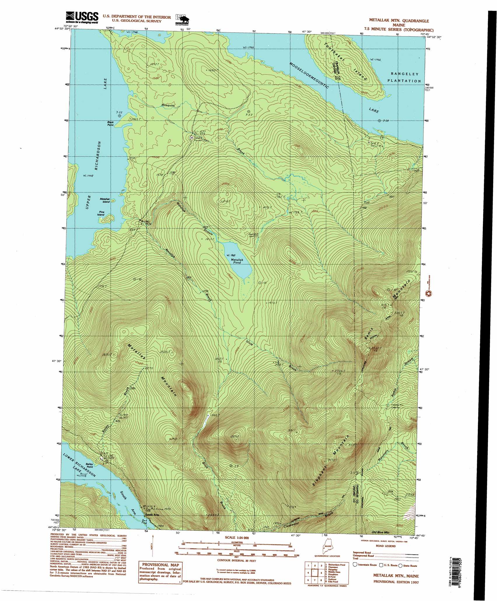
USGS Topo Quad 44070g7 - 1:24,000 scale
| Topo Map Name: | Metallak Mountain |
| USGS Topo Quad ID: | 44070g7 |
| Print Size: | ca. 21 1/4" wide x 27" high |
| Southeast Coordinates: | 44.75° N latitude / 70.75° W longitude |
| Map Center Coordinates: | 44.8125° N latitude / 70.8125° W longitude |
| U.S. State: | ME |
| Filename: | o44070g7.jpg |
| Download Map JPG Image: | Metallak Mountain topo map 1:24,000 scale |
| Map Type: | Topographic |
| Topo Series: | 7.5´ |
| Map Scale: | 1:24,000 |
| Source of Map Images: | United States Geological Survey (USGS) |
| Alternate Map Versions: |
Metallak Mountain ME 1977, updated 1983 Download PDF Buy paper map Metallak Mountain ME 1977, updated 1984 Download PDF Buy paper map Metallak Mtn ME 1984, updated 1985 Download PDF Buy paper map Metallak Mtn ME 1984, updated 1985 Download PDF Buy paper map Metallak Mtn ME 1997, updated 1999 Download PDF Buy paper map Metallak Mountain ME 2011 Download PDF Buy paper map Metallak Mountain ME 2014 Download PDF Buy paper map |
1:24,000 Topo Quads surrounding Metallak Mountain
Bosebuck Mountain |
Lincoln Pond |
Kennebago |
Kennebago Lake |
Quill Hill |
Wilsons Mills |
Richardson Pond |
Oquossoc |
Rangeley |
Saddleback Mountain |
Umbagog Lake North |
Middle Dam |
Metallak Mountain |
Houghton |
Jackson Mountain |
Umbagog Lake South |
B Pond |
Andover |
Ellis Pond |
Roxbury |
Success Pond |
Old Speck Mountain |
Puzzle Mountain |
East Andover |
Rumford |
> Back to 44070e1 at 1:100,000 scale
> Back to 44070a1 at 1:250,000 scale
> Back to U.S. Topo Maps home
Metallak Mountain topo map: Gazetteer
Metallak Mountain: Bays
South Arm Lower Richardson Lake elevation 442m 1450′Metallak Mountain: Capes
Bailey Point elevation 442m 1450′Black Point elevation 441m 1446′
Whitneys Point elevation 444m 1456′
Metallak Mountain: Islands
Metallak Island elevation 442m 1450′Pine Island elevation 450m 1476′
Toothaker Island elevation 483m 1584′
Metallak Mountain: Lakes
Metallak Pond elevation 567m 1860′Upper Richardson Lake elevation 441m 1446′
Metallak Mountain: Populated Places
South Arm elevation 449m 1473′Metallak Mountain: Streams
Bailey Brook elevation 451m 1479′Icicle Brook elevation 568m 1863′
Metallak Brook elevation 456m 1496′
Metallak Stream elevation 442m 1450′
Mosquito Brook elevation 443m 1453′
Metallak Mountain: Summits
Bemis Mountain elevation 1085m 3559′Elephant Mountain elevation 1139m 3736′
Metallak Mountain elevation 867m 2844′
Metallak Mountain digital topo map on disk
Buy this Metallak Mountain topo map showing relief, roads, GPS coordinates and other geographical features, as a high-resolution digital map file on DVD:
Maine, New Hampshire, Rhode Island & Eastern Massachusetts
Buy digital topo maps: Maine, New Hampshire, Rhode Island & Eastern Massachusetts