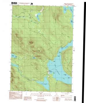
Middle Dam Topo Map Maine
To zoom in, hover over the map of Middle Dam
USGS Topo Quad 44070g8 - 1:24,000 scale
| Topo Map Name: | Middle Dam |
| USGS Topo Quad ID: | 44070g8 |
| Print Size: | ca. 21 1/4" wide x 27" high |
| Southeast Coordinates: | 44.75° N latitude / 70.875° W longitude |
| Map Center Coordinates: | 44.8125° N latitude / 70.9375° W longitude |
| U.S. State: | ME |
| Filename: | o44070g8.jpg |
| Download Map JPG Image: | Middle Dam topo map 1:24,000 scale |
| Map Type: | Topographic |
| Topo Series: | 7.5´ |
| Map Scale: | 1:24,000 |
| Source of Map Images: | United States Geological Survey (USGS) |
| Alternate Map Versions: |
Middle Dam ME 1977, updated 1983 Download PDF Buy paper map Middle Dam ME 1984, updated 1985 Download PDF Buy paper map Middle Dam ME 1997, updated 1999 Download PDF Buy paper map Middle Dam ME 2011 Download PDF Buy paper map Middle Dam ME 2014 Download PDF Buy paper map |
1:24,000 Topo Quads surrounding Middle Dam
> Back to 44070e1 at 1:100,000 scale
> Back to 44070a1 at 1:250,000 scale
> Back to U.S. Topo Maps home
Middle Dam topo map: Gazetteer
Middle Dam: Bays
Cranberry Cove elevation 441m 1446′Halfmoon Cove elevation 441m 1446′
Spaulding Cove elevation 441m 1446′
Middle Dam: Capes
Horse Beef Point elevation 441m 1446′Jackson Point elevation 444m 1456′
Portland Point elevation 443m 1453′
Rifle Point elevation 441m 1446′
Middle Dam: Channels
The Narrows elevation 441m 1446′Middle Dam: Dams
Middle Dam elevation 439m 1440′Middle Dam: Islands
Hardscrabble Island elevation 441m 1446′Spirt Island elevation 441m 1446′
Middle Dam: Lakes
Bigelow Pond elevation 397m 1302′Cranberry Pond elevation 428m 1404′
Fox Pond elevation 410m 1345′
Long Pond elevation 401m 1315′
Pond in the River elevation 427m 1400′
Skunk Pond elevation 399m 1309′
Sunday Pond elevation 429m 1407′
Middle Dam: Populated Places
Middle Dam elevation 450m 1476′Middle Dam: Reservoirs
Lower Richardson Lake elevation 440m 1443′Richardson Lake elevation 439m 1440′
Middle Dam: Ridges
Carry Ridge elevation 585m 1919′Inlet Ridge elevation 613m 2011′
Middle Dam: Streams
Ash Brook elevation 399m 1309′Birch Brook elevation 403m 1322′
Blackcat Brook elevation 441m 1446′
Rand Brook elevation 441m 1446′
Middle Dam: Summits
Johnson Mountain elevation 675m 2214′Moose Mountain elevation 670m 2198′
South Mountain elevation 677m 2221′
Middle Dam: Trails
Old Magalloway Trail elevation 464m 1522′Middle Dam digital topo map on disk
Buy this Middle Dam topo map showing relief, roads, GPS coordinates and other geographical features, as a high-resolution digital map file on DVD:
Maine, New Hampshire, Rhode Island & Eastern Massachusetts
Buy digital topo maps: Maine, New Hampshire, Rhode Island & Eastern Massachusetts


