Redington Topo Map Maine
To zoom in, hover over the map of Redington
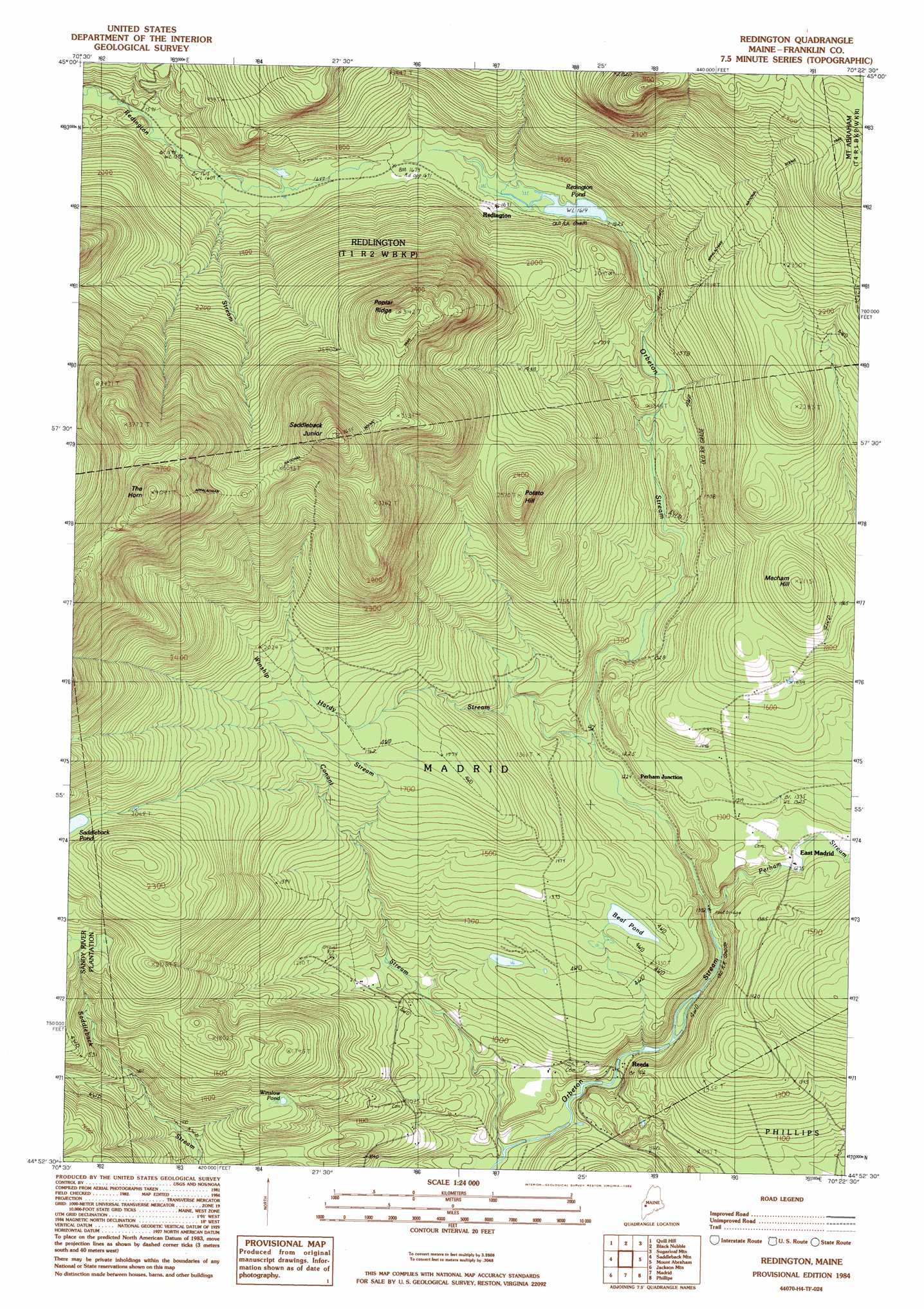
USGS Topo Quad 44070h4 - 1:24,000 scale
| Topo Map Name: | Redington |
| USGS Topo Quad ID: | 44070h4 |
| Print Size: | ca. 21 1/4" wide x 27" high |
| Southeast Coordinates: | 44.875° N latitude / 70.375° W longitude |
| Map Center Coordinates: | 44.9375° N latitude / 70.4375° W longitude |
| U.S. State: | ME |
| Filename: | o44070h4.jpg |
| Download Map JPG Image: | Redington topo map 1:24,000 scale |
| Map Type: | Topographic |
| Topo Series: | 7.5´ |
| Map Scale: | 1:24,000 |
| Source of Map Images: | United States Geological Survey (USGS) |
| Alternate Map Versions: |
Redington ME 1977, updated 1983 Download PDF Buy paper map Redington ME 1984, updated 1985 Download PDF Buy paper map Redington ME 1984, updated 1985 Download PDF Buy paper map Redington ME 2011 Download PDF Buy paper map Redington ME 2014 Download PDF Buy paper map |
1:24,000 Topo Quads surrounding Redington
Black Mountain |
Tim Mountain |
Stratton |
The Horns |
Little Bigelow Mountain |
Kennebago Lake |
Quill Hill |
Black Nubble |
Sugarloaf Mountain |
Poplar Mountain |
Rangeley |
Saddleback Mountain |
Redington |
Mount Abraham |
Kingfield |
Houghton |
Jackson Mountain |
Madrid |
Phillips |
Strong |
Ellis Pond |
Roxbury |
Weld |
Mount Blue |
Farmington |
> Back to 44070e1 at 1:100,000 scale
> Back to 44070a1 at 1:250,000 scale
> Back to U.S. Topo Maps home
Redington topo map: Gazetteer
Redington: Lakes
Beal Pond elevation 406m 1332′Redington Pond elevation 493m 1617′
Saddleback Pond elevation 643m 2109′
Winslow Pond elevation 415m 1361′
Redington: Populated Places
East Madrid elevation 380m 1246′Perham Junction elevation 377m 1236′
Redington elevation 506m 1660′
Reeds elevation 278m 912′
Redington: Ridges
Poplar Ridge elevation 935m 3067′Redington: Streams
Conant Stream elevation 246m 807′Hardy Stream elevation 375m 1230′
Perham Stream elevation 330m 1082′
Winship Stream elevation 451m 1479′
Redington: Summits
Mecham Hill elevation 634m 2080′Potato Hill elevation 779m 2555′
Saddleback Junior elevation 1108m 3635′
The Horn elevation 1203m 3946′
Redington digital topo map on disk
Buy this Redington topo map showing relief, roads, GPS coordinates and other geographical features, as a high-resolution digital map file on DVD:
Maine, New Hampshire, Rhode Island & Eastern Massachusetts
Buy digital topo maps: Maine, New Hampshire, Rhode Island & Eastern Massachusetts