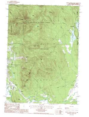
North Conway East Topo Map New Hampshire
To zoom in, hover over the map of North Conway East
USGS Topo Quad 44071a1 - 1:24,000 scale
| Topo Map Name: | North Conway East |
| USGS Topo Quad ID: | 44071a1 |
| Print Size: | ca. 21 1/4" wide x 27" high |
| Southeast Coordinates: | 44° N latitude / 71° W longitude |
| Map Center Coordinates: | 44.0625° N latitude / 71.0625° W longitude |
| U.S. States: | NH, ME |
| Filename: | o44071a1.jpg |
| Download Map JPG Image: | North Conway East topo map 1:24,000 scale |
| Map Type: | Topographic |
| Topo Series: | 7.5´ |
| Map Scale: | 1:24,000 |
| Source of Map Images: | United States Geological Survey (USGS) |
| Alternate Map Versions: |
North Conway East NH 1987, updated 1987 Download PDF Buy paper map North Conway East NH 1995, updated 2000 Download PDF Buy paper map North Conway East NH 2012 Download PDF Buy paper map North Conway East NH 2015 Download PDF Buy paper map |
| FStopo: | US Forest Service topo North Conway East is available: Download FStopo PDF Download FStopo TIF |
1:24,000 Topo Quads surrounding North Conway East
> Back to 44071a1 at 1:100,000 scale
> Back to 44070a1 at 1:250,000 scale
> Back to U.S. Topo Maps home
North Conway East topo map: Gazetteer
North Conway East: Airports
White Mountain Airport elevation 150m 492′North Conway East: Benches
Redstone Ledge elevation 292m 958′North Conway East: Dams
Upper Kimball Lake Dam elevation 132m 433′North Conway East: Lakes
Pudding Pond elevation 160m 524′Shingle Pond elevation 522m 1712′
Upper Kimball Pond elevation 130m 426′
North Conway East: Parks
Conway State Forest elevation 415m 1361′Merriman State Forest elevation 560m 1837′
North Conway East: Populated Places
East Conway elevation 123m 403′Kearsarge elevation 206m 675′
Redstone elevation 148m 485′
South Chatham elevation 128m 419′
North Conway East: Post Offices
Kearsarge Post Office elevation 208m 682′North Conway East: Reservoirs
Upper Kimball Lake elevation 132m 433′North Conway East: Ridges
Green Hills elevation 603m 1978′North Conway East: Streams
Anderson Brook elevation 130m 426′Artist Brook elevation 149m 488′
Black Brook elevation 126m 413′
Hoyt Brook elevation 723m 2372′
Mason Brook elevation 127m 416′
Middle Brook elevation 130m 426′
Moat Brook elevation 139m 456′
Province Brook elevation 118m 387′
Province Brook elevation 117m 383′
North Conway East: Summits
Barlett Mountain elevation 786m 2578′Black Cap elevation 718m 2355′
Cranmore Mountain elevation 510m 1673′
Hurricane Mountain elevation 639m 2096′
Kearsarge North elevation 991m 3251′
Mack Hill elevation 326m 1069′
Middle Mountain elevation 549m 1801′
Peaked Hill elevation 533m 1748′
Peaked Mountain elevation 510m 1673′
Pine Hill elevation 269m 882′
Rattlesnake Mountain elevation 480m 1574′
Rickers Knoll elevation 746m 2447′
The Twins elevation 745m 2444′
North Conway East: Trails
Gemini Trail elevation 605m 1984′Kearsarge Trail elevation 516m 1692′
Mount Pequawket Trail elevation 549m 1801′
Number Five Ski Trail elevation 553m 1814′
Province Brook Trail elevation 239m 784′
Shingle Pond Trail elevation 334m 1095′
Weeks Brook Trail elevation 250m 820′
North Conway East digital topo map on disk
Buy this North Conway East topo map showing relief, roads, GPS coordinates and other geographical features, as a high-resolution digital map file on DVD:
Maine, New Hampshire, Rhode Island & Eastern Massachusetts
Buy digital topo maps: Maine, New Hampshire, Rhode Island & Eastern Massachusetts


