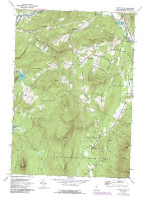
Sugar Hill Topo Map New Hampshire
To zoom in, hover over the map of Sugar Hill
USGS Topo Quad 44071b7 - 1:24,000 scale
| Topo Map Name: | Sugar Hill |
| USGS Topo Quad ID: | 44071b7 |
| Print Size: | ca. 21 1/4" wide x 27" high |
| Southeast Coordinates: | 44.125° N latitude / 71.75° W longitude |
| Map Center Coordinates: | 44.1875° N latitude / 71.8125° W longitude |
| U.S. State: | NH |
| Filename: | o44071b7.jpg |
| Download Map JPG Image: | Sugar Hill topo map 1:24,000 scale |
| Map Type: | Topographic |
| Topo Series: | 7.5´ |
| Map Scale: | 1:24,000 |
| Source of Map Images: | United States Geological Survey (USGS) |
| Alternate Map Versions: |
Sugar Hill NH 1967, updated 1973 Download PDF Buy paper map Sugar Hill NH 1967, updated 1988 Download PDF Buy paper map Sugar Hill NH 1967, updated 1988 Download PDF Buy paper map Sugar Hill NH 1995, updated 2000 Download PDF Buy paper map Sugar Hill NH 2012 Download PDF Buy paper map Sugar Hill NH 2015 Download PDF Buy paper map |
| FStopo: | US Forest Service topo Sugar Hill is available: Download FStopo PDF Download FStopo TIF |
1:24,000 Topo Quads surrounding Sugar Hill
> Back to 44071a1 at 1:100,000 scale
> Back to 44070a1 at 1:250,000 scale
> Back to U.S. Topo Maps home
Sugar Hill topo map: Gazetteer
Sugar Hill: Airports
Franconia Airport elevation 294m 964′Sugar Hill: Dams
Chandler Pond Dam elevation 362m 1187′Coffin Pond Dam elevation 273m 895′
Pearl Lake Dam elevation 311m 1020′
Sugar Hill: Lakes
Chandler Pond elevation 335m 1099′Sugar Hill: Populated Places
Easton elevation 355m 1164′Jericho elevation 449m 1473′
Sugar Hill elevation 405m 1328′
Sugar Hill: Reservoirs
Chandler Pond elevation 362m 1187′Coffin Pond elevation 273m 895′
Pearl Lake elevation 311m 1020′
Sugar Hill: Streams
Bowen Brook elevation 275m 902′Coppermine Brook elevation 296m 971′
Ham Branch elevation 279m 915′
Indian Brook elevation 268m 879′
Judd Brook elevation 318m 1043′
Kendall Brook elevation 310m 1017′
Reel Brook elevation 366m 1200′
Scotland Brook elevation 311m 1020′
Slide Brook elevation 363m 1190′
Whipple Brook elevation 221m 725′
Sugar Hill: Summits
Bald Peak elevation 750m 2460′Bronson Hill elevation 628m 2060′
Cobble Hill elevation 701m 2299′
Cole Hill elevation 802m 2631′
Cooley Hill elevation 757m 2483′
Garnet Hill elevation 584m 1916′
Northey Hill elevation 482m 1581′
Ore Hill elevation 612m 2007′
Pine Hill elevation 481m 1578′
Pond Hill elevation 454m 1489′
Sugar Hill elevation 401m 1315′
Sugar Hill: Trails
Cobble Hill Trail elevation 503m 1650′Jericho Road Trail elevation 584m 1916′
Sugar Hill digital topo map on disk
Buy this Sugar Hill topo map showing relief, roads, GPS coordinates and other geographical features, as a high-resolution digital map file on DVD:
Maine, New Hampshire, Rhode Island & Eastern Massachusetts
Buy digital topo maps: Maine, New Hampshire, Rhode Island & Eastern Massachusetts


