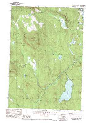
Maidstone Lake Topo Map Vermont
To zoom in, hover over the map of Maidstone Lake
USGS Topo Quad 44071f6 - 1:24,000 scale
| Topo Map Name: | Maidstone Lake |
| USGS Topo Quad ID: | 44071f6 |
| Print Size: | ca. 21 1/4" wide x 27" high |
| Southeast Coordinates: | 44.625° N latitude / 71.625° W longitude |
| Map Center Coordinates: | 44.6875° N latitude / 71.6875° W longitude |
| U.S. States: | VT, NH |
| Filename: | o44071f6.jpg |
| Download Map JPG Image: | Maidstone Lake topo map 1:24,000 scale |
| Map Type: | Topographic |
| Topo Series: | 7.5´ |
| Map Scale: | 1:24,000 |
| Source of Map Images: | United States Geological Survey (USGS) |
| Alternate Map Versions: |
Maidstone Lake VT 1988, updated 1988 Download PDF Buy paper map Maidstone Lake VT 2012 Download PDF Buy paper map Maidstone Lake VT 2015 Download PDF Buy paper map |
1:24,000 Topo Quads surrounding Maidstone Lake
> Back to 44071e1 at 1:100,000 scale
> Back to 44070a1 at 1:250,000 scale
> Back to U.S. Topo Maps home
Maidstone Lake topo map: Gazetteer
Maidstone Lake: Dams
Walker Dam elevation 357m 1171′Maidstone Lake: Forests
Maidstone State Park elevation 483m 1584′Maidstone Lake: Lakes
Dennis Pond elevation 312m 1023′Little Wheeler Pond elevation 314m 1030′
Maidstone Lake elevation 398m 1305′
Mud Pond elevation 318m 1043′
Notch Pond elevation 478m 1568′
South American Pond elevation 532m 1745′
Tuttle Pond elevation 310m 1017′
Unknown Pond elevation 520m 1706′
West Mountain Pond elevation 378m 1240′
Wheeler Pond elevation 313m 1026′
Maidstone Lake: Populated Places
Browns Mill elevation 328m 1076′Brunswick Springs elevation 301m 987′
Bullthroat elevation 398m 1305′
Maidstone Lake: Streams
Dennis Pond Brook elevation 277m 908′Fitch Brook elevation 416m 1364′
Granby Stream elevation 362m 1187′
Madison Brook elevation 448m 1469′
Maidstone Brook elevation 349m 1145′
North Branch Paul Stream elevation 467m 1532′
Notch Pond Brook elevation 316m 1036′
Telephone Brook elevation 319m 1046′
West Mountain Brook elevation 322m 1056′
Maidstone Lake: Summits
Bull Mountain elevation 784m 2572′Notch Pond Mountain elevation 623m 2043′
West Mountain elevation 828m 2716′
Maidstone Lake: Swamps
Ferdinand Bog elevation 448m 1469′Granby Bog elevation 414m 1358′
Maidstone Lake: Trails
Loon Trail elevation 408m 1338′Moose Trail elevation 419m 1374′
Shore Trail elevation 402m 1318′
Maidstone Lake digital topo map on disk
Buy this Maidstone Lake topo map showing relief, roads, GPS coordinates and other geographical features, as a high-resolution digital map file on DVD:
Maine, New Hampshire, Rhode Island & Eastern Massachusetts
Buy digital topo maps: Maine, New Hampshire, Rhode Island & Eastern Massachusetts


