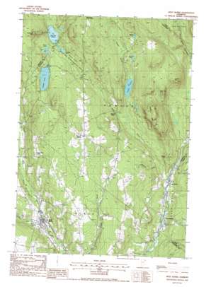
West Burke Topo Map Vermont
To zoom in, hover over the map of West Burke
USGS Topo Quad 44071f8 - 1:24,000 scale
| Topo Map Name: | West Burke |
| USGS Topo Quad ID: | 44071f8 |
| Print Size: | ca. 21 1/4" wide x 27" high |
| Southeast Coordinates: | 44.625° N latitude / 71.875° W longitude |
| Map Center Coordinates: | 44.6875° N latitude / 71.9375° W longitude |
| U.S. State: | VT |
| Filename: | o44071f8.jpg |
| Download Map JPG Image: | West Burke topo map 1:24,000 scale |
| Map Type: | Topographic |
| Topo Series: | 7.5´ |
| Map Scale: | 1:24,000 |
| Source of Map Images: | United States Geological Survey (USGS) |
| Alternate Map Versions: |
West Burke VT 1988, updated 1988 Download PDF Buy paper map West Burke VT 1988, updated 1988 Download PDF Buy paper map West Burke VT 2012 Download PDF Buy paper map West Burke VT 2015 Download PDF Buy paper map |
1:24,000 Topo Quads surrounding West Burke
> Back to 44071e1 at 1:100,000 scale
> Back to 44070a1 at 1:250,000 scale
> Back to U.S. Topo Maps home
West Burke topo map: Gazetteer
West Burke: Islands
Connor Island elevation 569m 1866′West Burke: Lakes
Bald Hill Pond elevation 548m 1797′Beck Pond elevation 477m 1564′
Brown Pond elevation 568m 1863′
Center Pond elevation 398m 1305′
Newark Pond elevation 559m 1833′
Sawdust Pond elevation 541m 1774′
Walker Pond elevation 535m 1755′
West Burke: Parks
Bald Hill Wildlife Management Area elevation 586m 1922′West Burke: Populated Places
East Haven elevation 308m 1010′Hartwellville elevation 300m 984′
Newark Hollow elevation 392m 1286′
West Burke elevation 276m 905′
West Burke: Streams
Flower Brook elevation 285m 935′Mill Brook elevation 321m 1053′
Sleeper Brook elevation 400m 1312′
Sutton River elevation 275m 902′
Whetstone Brook elevation 323m 1059′
West Burke: Summits
Hawk Rock elevation 571m 1873′McSherry Mountain elevation 738m 2421′
Packer Mountain elevation 649m 2129′
Sugar Hill elevation 436m 1430′
Walker Mountain elevation 585m 1919′
West Burke digital topo map on disk
Buy this West Burke topo map showing relief, roads, GPS coordinates and other geographical features, as a high-resolution digital map file on DVD:
Maine, New Hampshire, Rhode Island & Eastern Massachusetts
Buy digital topo maps: Maine, New Hampshire, Rhode Island & Eastern Massachusetts


