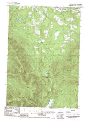
Blue Mountain Topo Map New Hampshire
To zoom in, hover over the map of Blue Mountain
USGS Topo Quad 44071g4 - 1:24,000 scale
| Topo Map Name: | Blue Mountain |
| USGS Topo Quad ID: | 44071g4 |
| Print Size: | ca. 21 1/4" wide x 27" high |
| Southeast Coordinates: | 44.75° N latitude / 71.375° W longitude |
| Map Center Coordinates: | 44.8125° N latitude / 71.4375° W longitude |
| U.S. State: | NH |
| Filename: | o44071g4.jpg |
| Download Map JPG Image: | Blue Mountain topo map 1:24,000 scale |
| Map Type: | Topographic |
| Topo Series: | 7.5´ |
| Map Scale: | 1:24,000 |
| Source of Map Images: | United States Geological Survey (USGS) |
| Alternate Map Versions: |
Blue Mountain NH 1988, updated 1988 Download PDF Buy paper map Blue Mountain NH 1996, updated 2000 Download PDF Buy paper map Bunnell Mountain NH 2012 Download PDF Buy paper map Bunnell Mountain NH 2015 Download PDF Buy paper map |
| FStopo: | US Forest Service topo Blue Mountain is available: Download FStopo PDF Download FStopo TIF |
1:24,000 Topo Quads surrounding Blue Mountain
> Back to 44071e1 at 1:100,000 scale
> Back to 44070a1 at 1:250,000 scale
> Back to U.S. Topo Maps home
Blue Mountain topo map: Gazetteer
Blue Mountain: Dams
Lime Pond Dam elevation 424m 1391′Blue Mountain: Gaps
Cleveland Notch elevation 831m 2726′Cranberry Bog Notch elevation 602m 1975′
Gadwah Notch elevation 896m 2939′
Gore Notch elevation 1001m 3284′
Moran Notch elevation 772m 2532′
Blue Mountain: Lakes
Cranberry Bog Pond elevation 547m 1794′Fish Pond elevation 424m 1391′
Nash Bog Pond elevation 477m 1564′
Blue Mountain: Populated Places
Bungy elevation 505m 1656′Blue Mountain: Reservoirs
Lime Pond elevation 424m 1391′Blue Mountain: Streams
Boy Brook elevation 448m 1469′Columbia Brook elevation 526m 1725′
East Branch Simms Stream elevation 428m 1404′
Johnson Brook elevation 489m 1604′
Moran Brook elevation 483m 1584′
Number Three Brook elevation 485m 1591′
Pike Brook elevation 487m 1597′
Roaring Brook elevation 391m 1282′
Uran Brook elevation 440m 1443′
West Branch Simms Stream elevation 417m 1368′
Blue Mountain: Summits
Bunnell Mountain elevation 1134m 3720′Carlton Hill elevation 546m 1791′
Castle Mountain elevation 1075m 3526′
Cilley Hill elevation 541m 1774′
Fitch Mountain elevation 1038m 3405′
Gore Mountain elevation 1100m 3608′
Marshall Hill elevation 545m 1788′
Muise Mountain elevation 1096m 3595′
Notch Mountain elevation 1031m 3382′
West Peak elevation 1073m 3520′
Blue Mountain: Swamps
Blueberry Swamp elevation 486m 1594′Blue Mountain digital topo map on disk
Buy this Blue Mountain topo map showing relief, roads, GPS coordinates and other geographical features, as a high-resolution digital map file on DVD:
Maine, New Hampshire, Rhode Island & Eastern Massachusetts
Buy digital topo maps: Maine, New Hampshire, Rhode Island & Eastern Massachusetts


