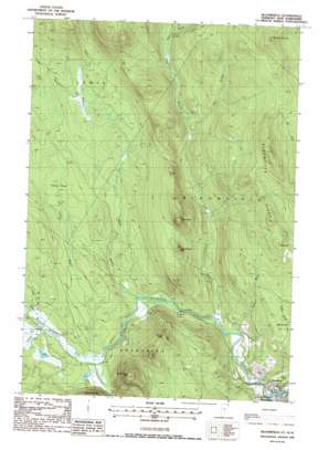
Bloomfield Topo Map Vermont
To zoom in, hover over the map of Bloomfield
USGS Topo Quad 44071g6 - 1:24,000 scale
| Topo Map Name: | Bloomfield |
| USGS Topo Quad ID: | 44071g6 |
| Print Size: | ca. 21 1/4" wide x 27" high |
| Southeast Coordinates: | 44.75° N latitude / 71.625° W longitude |
| Map Center Coordinates: | 44.8125° N latitude / 71.6875° W longitude |
| U.S. States: | VT, NH |
| Filename: | o44071g6.jpg |
| Download Map JPG Image: | Bloomfield topo map 1:24,000 scale |
| Map Type: | Topographic |
| Topo Series: | 7.5´ |
| Map Scale: | 1:24,000 |
| Source of Map Images: | United States Geological Survey (USGS) |
| Alternate Map Versions: |
Bloomfield VT 1988, updated 1988 Download PDF Buy paper map Bloomfield VT 2012 Download PDF Buy paper map Bloomfield VT 2015 Download PDF Buy paper map |
1:24,000 Topo Quads surrounding Bloomfield
> Back to 44071e1 at 1:100,000 scale
> Back to 44070a1 at 1:250,000 scale
> Back to U.S. Topo Maps home
Bloomfield topo map: Gazetteer
Bloomfield: Dams
Big Dam elevation 367m 1204′Brooks Dam elevation 378m 1240′
Buzzell Dam elevation 407m 1335′
Dam Number One elevation 328m 1076′
Dam Number Three elevation 393m 1289′
Dam Number Two elevation 369m 1210′
Peanut Dam elevation 377m 1236′
Stone Dam elevation 318m 1043′
Bloomfield: Populated Places
Bloomfield elevation 274m 898′North Stratford elevation 278m 912′
Bloomfield: Post Offices
North Straford Post Office elevation 275m 902′Bloomfield: Ridges
Bloomfield Ridge elevation 612m 2007′Bloomfield: Streams
Black Branch Nulhegan River elevation 319m 1046′East Branch Nulhegan River elevation 282m 925′
First Brook elevation 269m 882′
Fisher Brook elevation 398m 1305′
Hibbard Brook elevation 283m 928′
Logger Branch elevation 379m 1243′
Mink Brook elevation 377m 1236′
North Branch Nulhegan River elevation 347m 1138′
Nulhegan River elevation 271m 889′
Second Brook elevation 301m 987′
Yellow Branch Nulhegan River elevation 346m 1135′
Bloomfield: Summits
French Mountain elevation 563m 1847′Little Potash Mountain elevation 504m 1653′
North Notch Mountain elevation 661m 2168′
Potash Mountain elevation 617m 2024′
Spencer Hill elevation 440m 1443′
Bloomfield: Swamps
Yellow Bogs elevation 372m 1220′Bloomfield digital topo map on disk
Buy this Bloomfield topo map showing relief, roads, GPS coordinates and other geographical features, as a high-resolution digital map file on DVD:
Maine, New Hampshire, Rhode Island & Eastern Massachusetts
Buy digital topo maps: Maine, New Hampshire, Rhode Island & Eastern Massachusetts


