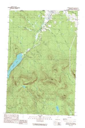
Norton Pond Topo Map Vermont
To zoom in, hover over the map of Norton Pond
USGS Topo Quad 44071h7 - 1:24,000 scale
| Topo Map Name: | Norton Pond |
| USGS Topo Quad ID: | 44071h7 |
| Print Size: | ca. 21 1/4" wide x 27" high |
| Southeast Coordinates: | 44.875° N latitude / 71.75° W longitude |
| Map Center Coordinates: | 44.9375° N latitude / 71.8125° W longitude |
| U.S. State: | VT |
| Filename: | o44071h7.jpg |
| Download Map JPG Image: | Norton Pond topo map 1:24,000 scale |
| Map Type: | Topographic |
| Topo Series: | 7.5´ |
| Map Scale: | 1:24,000 |
| Source of Map Images: | United States Geological Survey (USGS) |
| Alternate Map Versions: |
Norton Pond VT 1989, updated 1989 Download PDF Buy paper map Norton Pond VT 2012 Download PDF Buy paper map Norton Pond VT 2015 Download PDF Buy paper map |
1:24,000 Topo Quads surrounding Norton Pond
West Charleston |
Morgan Center |
Norton Pond |
Averill Lake |
Monadnock Mountain |
Westmore |
Island Pond |
Spectacle Pond |
Bloomfield |
Tinkerville |
Sutton |
West Burke |
Seneca Mountain |
Maidstone Lake |
Stratford |
> Back to 44071e1 at 1:100,000 scale
> Back to 44070a1 at 1:250,000 scale
> Back to U.S. Topo Maps home
Norton Pond topo map: Gazetteer
Norton Pond: Dams
Norton Pond Dam elevation 407m 1335′Swanson Dam elevation 387m 1269′
Norton Pond: Lakes
Lewis Pond elevation 557m 1827′Unknown Pond elevation 709m 2326′
Norton Pond: Reservoirs
Norton Pond elevation 407m 1335′Norton Pond: Streams
Davis Brook elevation 395m 1295′Gaudette Brook elevation 392m 1286′
Logger Brook elevation 461m 1512′
Mosher Meadow Brook elevation 392m 1286′
Number Five Brook elevation 390m 1279′
Number Six Brook elevation 384m 1259′
Station Brook elevation 403m 1322′
Sucker Brook elevation 408m 1338′
Sutton Brook elevation 401m 1315′
Norton Pond: Summits
Church Hill elevation 459m 1505′Gore Mountain elevation 1015m 3330′
Hedgehog Hill elevation 548m 1797′
Lewis Mountain elevation 777m 2549′
Middle Mountain elevation 899m 2949′
Round Mountain elevation 1015m 3330′
Norton Pond: Trails
Gaudette Tote Road elevation 537m 1761′Gore Trail elevation 574m 1883′
Mount Gore Trail elevation 571m 1873′
Number Six Road elevation 452m 1482′
Norton Pond digital topo map on disk
Buy this Norton Pond topo map showing relief, roads, GPS coordinates and other geographical features, as a high-resolution digital map file on DVD:
Maine, New Hampshire, Rhode Island & Eastern Massachusetts
Buy digital topo maps: Maine, New Hampshire, Rhode Island & Eastern Massachusetts


