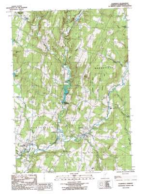
Plainfield Topo Map Vermont
To zoom in, hover over the map of Plainfield
USGS Topo Quad 44072c4 - 1:24,000 scale
| Topo Map Name: | Plainfield |
| USGS Topo Quad ID: | 44072c4 |
| Print Size: | ca. 21 1/4" wide x 27" high |
| Southeast Coordinates: | 44.25° N latitude / 72.375° W longitude |
| Map Center Coordinates: | 44.3125° N latitude / 72.4375° W longitude |
| U.S. State: | VT |
| Filename: | o44072c4.jpg |
| Download Map JPG Image: | Plainfield topo map 1:24,000 scale |
| Map Type: | Topographic |
| Topo Series: | 7.5´ |
| Map Scale: | 1:24,000 |
| Source of Map Images: | United States Geological Survey (USGS) |
| Alternate Map Versions: |
Plainfield VT 1986, updated 1987 Download PDF Buy paper map Plainfield VT 2012 Download PDF Buy paper map Plainfield VT 2015 Download PDF Buy paper map |
1:24,000 Topo Quads surrounding Plainfield
> Back to 44072a1 at 1:100,000 scale
> Back to 44072a1 at 1:250,000 scale
> Back to U.S. Topo Maps home
Plainfield topo map: Gazetteer
Plainfield: Bridges
Coburn Covered Bridge elevation 203m 666′Martin Covered Bridge elevation 226m 741′
Plainfield: Dams
North Montpelier Pond Upper Dam elevation 216m 708′Plainfield: Forests
Calais Town Forest elevation 384m 1259′Plainfield Town Forest elevation 325m 1066′
Plainfield: Lakes
Crystal Pool elevation 308m 1010′Sodom Pond elevation 314m 1030′
Plainfield: Parks
Kents Corner Historic District elevation 344m 1128′Plainfield Village Historic District elevation 239m 784′
Plainfield: Populated Places
East Calais elevation 259m 849′East Montpelier elevation 226m 741′
Kents Corners elevation 344m 1128′
North Montpelier elevation 226m 741′
Plainfield elevation 232m 761′
Plainfield: Post Offices
East Montpelier Post Office elevation 220m 721′Plainfield Post Office elevation 230m 754′
Plainfield: Reservoirs
North Montpelier Pond elevation 226m 741′North Montpelier Pond elevation 216m 708′
Plainfield: Streams
Beaver Meadow Brook elevation 239m 784′Carr Brook elevation 226m 741′
Cold Brook elevation 240m 787′
Great Brook elevation 223m 731′
Guernsey Brook elevation 282m 925′
King Brook elevation 233m 764′
Kingsbury Branch elevation 203m 666′
Kingsbury Brook elevation 214m 702′
Lye Brook elevation 316m 1036′
Mallory Brook elevation 198m 649′
Nasmith Brook elevation 233m 764′
Pekin Brook elevation 213m 698′
Potter Brook elevation 374m 1227′
Sodom Pond Brook elevation 202m 662′
Still Brook elevation 213m 698′
Wells Brook elevation 226m 741′
Plainfield: Summits
Bartlett Hill elevation 408m 1338′Blackberry Hill elevation 436m 1430′
Gritt Hill elevation 448m 1469′
Hollister Hill elevation 417m 1368′
Knob Hill elevation 403m 1322′
Maple Hill elevation 482m 1581′
Plainfield digital topo map on disk
Buy this Plainfield topo map showing relief, roads, GPS coordinates and other geographical features, as a high-resolution digital map file on DVD:
New York, Vermont, Connecticut & Western Massachusetts
Buy digital topo maps: New York, Vermont, Connecticut & Western Massachusetts


