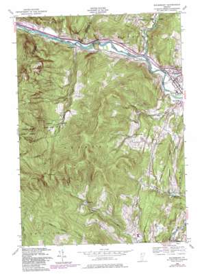
Waterbury Topo Map Vermont
To zoom in, hover over the map of Waterbury
USGS Topo Quad 44072c7 - 1:24,000 scale
| Topo Map Name: | Waterbury |
| USGS Topo Quad ID: | 44072c7 |
| Print Size: | ca. 21 1/4" wide x 27" high |
| Southeast Coordinates: | 44.25° N latitude / 72.75° W longitude |
| Map Center Coordinates: | 44.3125° N latitude / 72.8125° W longitude |
| U.S. State: | VT |
| Filename: | o44072c7.jpg |
| Download Map JPG Image: | Waterbury topo map 1:24,000 scale |
| Map Type: | Topographic |
| Topo Series: | 7.5´ |
| Map Scale: | 1:24,000 |
| Source of Map Images: | United States Geological Survey (USGS) |
| Alternate Map Versions: |
Waterbury VT 1948, updated 1953 Download PDF Buy paper map Waterbury VT 1948, updated 1969 Download PDF Buy paper map Waterbury VT 1948, updated 1976 Download PDF Buy paper map Waterbury VT 1948, updated 1981 Download PDF Buy paper map Waterbury VT 2012 Download PDF Buy paper map Waterbury VT 2015 Download PDF Buy paper map |
1:24,000 Topo Quads surrounding Waterbury
> Back to 44072a1 at 1:100,000 scale
> Back to 44072a1 at 1:250,000 scale
> Back to U.S. Topo Maps home
Waterbury topo map: Gazetteer
Waterbury: Crossings
Interchange 10 elevation 140m 459′Waterbury: Dams
Bolton Falls Number 1 Dam elevation 112m 367′Eight Trout Club Dam elevation 209m 685′
Waterbury: Falls
Bolton Falls elevation 107m 351′Moretown Falls elevation 176m 577′
Waterbury: Flats
Beaver Meadow elevation 648m 2125′Waterbury: Parks
Monroe State Park elevation 457m 1499′Waterbury Village Historic District elevation 130m 426′
Waterbury: Populated Places
Dowsville elevation 393m 1289′Duxbury elevation 128m 419′
Moretown elevation 183m 600′
North Duxbury elevation 115m 377′
Waterbury elevation 130m 426′
Waterbury: Reservoirs
Butler Pond elevation 124m 406′Light Trout Club Lake elevation 209m 685′
Waterbury: Streams
Bat Harris Brook elevation 212m 695′Cunningham Brook elevation 210m 688′
Graves Brook elevation 121m 396′
Little River elevation 118m 387′
Pinneo Brook elevation 102m 334′
Ridley Brook elevation 102m 334′
Waterbury: Summits
Crossett Hill elevation 694m 2276′Waterbury digital topo map on disk
Buy this Waterbury topo map showing relief, roads, GPS coordinates and other geographical features, as a high-resolution digital map file on DVD:
New York, Vermont, Connecticut & Western Massachusetts
Buy digital topo maps: New York, Vermont, Connecticut & Western Massachusetts


