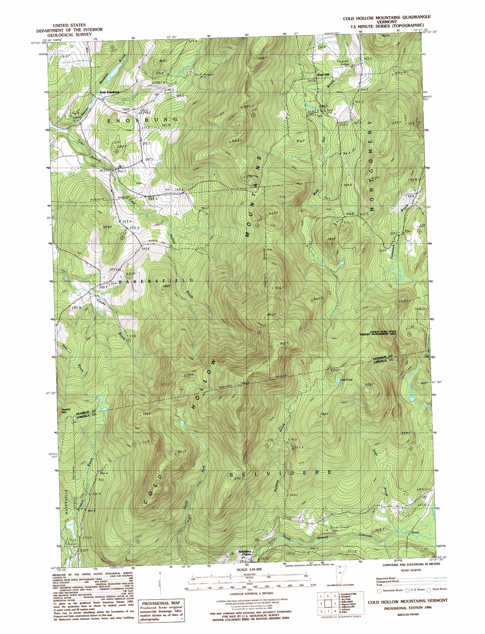
Cold Hollow Mountains Topo Map Vermont
To zoom in, hover over the map of Cold Hollow Mountains
USGS Topo Quad 44072g6 - 1:24,000 scale
| Topo Map Name: | Cold Hollow Mountains |
| USGS Topo Quad ID: | 44072g6 |
| Print Size: | ca. 21 1/4" wide x 27" high |
| Southeast Coordinates: | 44.75° N latitude / 72.625° W longitude |
| Map Center Coordinates: | 44.8125° N latitude / 72.6875° W longitude |
| U.S. State: | VT |
| Filename: | o44072g6.jpg |
| Download Map JPG Image: | Cold Hollow Mountains topo map 1:24,000 scale |
| Map Type: | Topographic |
| Topo Series: | 7.5´ |
| Map Scale: | 1:24,000 |
| Source of Map Images: | United States Geological Survey (USGS) |
| Alternate Map Versions: |
Cold Hollow Mountains VT 1986, updated 1987 Download PDF Buy paper map Cold Hollow Mountains VT 2012 Download PDF Buy paper map Cold Hollow Mountains VT 2015 Download PDF Buy paper map |
1:24,000 Topo Quads surrounding Cold Hollow Mountains
Sheldon Springs |
Enosburg Falls |
Richford |
Jay Peak |
North Troy |
Fairfield |
Bakersfield |
Cold Hollow Mountains |
Hazens Notch |
Lowell |
Gilson Mountain |
Jeffersonville |
Johnson |
Eden |
Albany |
Underhill |
Mount Mansfield |
Whiteface Mountain |
Morrisville |
W0Lcott |
> Back to 44072e1 at 1:100,000 scale
> Back to 44072a1 at 1:250,000 scale
> Back to U.S. Topo Maps home
Cold Hollow Mountains topo map: Gazetteer
Cold Hollow Mountains: Bridges
West Hill Covered Bridge elevation 263m 862′Cold Hollow Mountains: Lakes
Lost Pond elevation 742m 2434′Cold Hollow Mountains: Populated Places
Belvidere Center elevation 263m 862′East Enosburg elevation 237m 777′
West Hill elevation 313m 1026′
Cold Hollow Mountains: Ranges
Cold Hollow Mountains elevation 999m 3277′Cold Hollow Mountains: Streams
Beaver Meadow Brook elevation 188m 616′Cold Hollow Brook elevation 242m 793′
Otter Brook elevation 352m 1154′
Perkins Brook elevation 361m 1184′
Rattling Brook elevation 318m 1043′
Cold Hollow Mountains: Summits
Hodgkins-Lackey Hill elevation 367m 1204′Peaked Mountain elevation 577m 1893′
Cold Hollow Mountains digital topo map on disk
Buy this Cold Hollow Mountains topo map showing relief, roads, GPS coordinates and other geographical features, as a high-resolution digital map file on DVD:
New York, Vermont, Connecticut & Western Massachusetts
Buy digital topo maps: New York, Vermont, Connecticut & Western Massachusetts