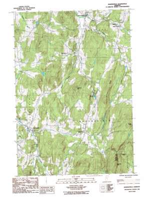
Bakersfield Topo Map Vermont
To zoom in, hover over the map of Bakersfield
USGS Topo Quad 44072g7 - 1:24,000 scale
| Topo Map Name: | Bakersfield |
| USGS Topo Quad ID: | 44072g7 |
| Print Size: | ca. 21 1/4" wide x 27" high |
| Southeast Coordinates: | 44.75° N latitude / 72.75° W longitude |
| Map Center Coordinates: | 44.8125° N latitude / 72.8125° W longitude |
| U.S. State: | VT |
| Filename: | o44072g7.jpg |
| Download Map JPG Image: | Bakersfield topo map 1:24,000 scale |
| Map Type: | Topographic |
| Topo Series: | 7.5´ |
| Map Scale: | 1:24,000 |
| Source of Map Images: | United States Geological Survey (USGS) |
| Alternate Map Versions: |
Bakersfield VT 1986, updated 1987 Download PDF Buy paper map Bakersfield VT 2012 Download PDF Buy paper map Bakersfield VT 2015 Download PDF Buy paper map |
1:24,000 Topo Quads surrounding Bakersfield
> Back to 44072e1 at 1:100,000 scale
> Back to 44072a1 at 1:250,000 scale
> Back to U.S. Topo Maps home
Bakersfield topo map: Gazetteer
Bakersfield: Benches
Checkerberry Ledge elevation 327m 1072′Bakersfield: Bridges
East Fairfield Covered Bridge elevation 116m 380′Bakersfield: Dams
Browns Pond Dam elevation 197m 646′Bakersfield: Lakes
Saddle Pond elevation 337m 1105′Bakersfield: Populated Places
Bakersfield elevation 222m 728′Bordoville elevation 224m 734′
East Fairfield elevation 126m 413′
Gilberts Tannery elevation 164m 538′
West Enosburg elevation 137m 449′
Bakersfield: Reservoirs
Browns Pond elevation 197m 646′Bakersfield: Ridges
Butternut Ridge elevation 364m 1194′Bakersfield: Streams
Beaver Meadow Brook elevation 149m 488′Bogue Branch elevation 149m 488′
Cooks Brook elevation 202m 662′
Ross Brook elevation 241m 790′
The Branch elevation 123m 403′
Bakersfield: Summits
Burnt Mountain elevation 513m 1683′Giddings Hill elevation 396m 1299′
Leach Hill elevation 376m 1233′
Shattuck Mountain elevation 497m 1630′
Bakersfield digital topo map on disk
Buy this Bakersfield topo map showing relief, roads, GPS coordinates and other geographical features, as a high-resolution digital map file on DVD:
New York, Vermont, Connecticut & Western Massachusetts
Buy digital topo maps: New York, Vermont, Connecticut & Western Massachusetts


