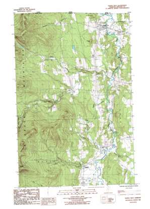
North Troy Topo Map Vermont
To zoom in, hover over the map of North Troy
USGS Topo Quad 44072h4 - 1:24,000 scale
| Topo Map Name: | North Troy |
| USGS Topo Quad ID: | 44072h4 |
| Print Size: | ca. 21 1/4" wide x 27" high |
| Southeast Coordinates: | 44.875° N latitude / 72.375° W longitude |
| Map Center Coordinates: | 44.9375° N latitude / 72.4375° W longitude |
| U.S. State: | VT |
| Filename: | o44072h4.jpg |
| Download Map JPG Image: | North Troy topo map 1:24,000 scale |
| Map Type: | Topographic |
| Topo Series: | 7.5´ |
| Map Scale: | 1:24,000 |
| Source of Map Images: | United States Geological Survey (USGS) |
| Alternate Map Versions: |
North Troy VT 1986, updated 1986 Download PDF Buy paper map North Troy VT 2012 Download PDF Buy paper map North Troy VT 2015 Download PDF Buy paper map |
1:24,000 Topo Quads surrounding North Troy
Richford |
Jay Peak |
North Troy |
Newport Center |
Newport |
Cold Hollow Mountains |
Hazens Notch |
Lowell |
Irasburg |
Orleans |
Johnson |
Eden |
Albany |
Craftsbury |
Crystal Lake |
> Back to 44072e1 at 1:100,000 scale
> Back to 44072a1 at 1:250,000 scale
> Back to U.S. Topo Maps home
North Troy topo map: Gazetteer
North Troy: Bridges
River Road Covered Bridge elevation 190m 623′North Troy: Dams
Bakers Falls Dam elevation 211m 692′North Troy: Falls
Big Falls elevation 188m 616′North Troy: Forests
Westfield Municipal Forest elevation 313m 1026′North Troy: Populated Places
Jay elevation 284m 931′North Troy elevation 171m 561′
Troy elevation 226m 741′
Westfield elevation 247m 810′
North Troy: Post Offices
North Troy Post Office elevation 185m 606′North Troy: Reservoirs
Phillips Pond elevation 298m 977′North Troy: Streams
Beetle Brook elevation 225m 738′Buybee Brook elevation 202m 662′
Coburn Brook elevation 226m 741′
Crook Brook elevation 264m 866′
Jay Branch elevation 189m 620′
Lilly Branch elevation 231m 757′
Mill Brook elevation 232m 761′
Taft Brook elevation 228m 748′
North Troy: Summits
Domeys Dome elevation 882m 2893′Gilpin Mountain elevation 860m 2821′
Warner Hill elevation 312m 1023′
North Troy digital topo map on disk
Buy this North Troy topo map showing relief, roads, GPS coordinates and other geographical features, as a high-resolution digital map file on DVD:
New York, Vermont, Connecticut & Western Massachusetts
Buy digital topo maps: New York, Vermont, Connecticut & Western Massachusetts


