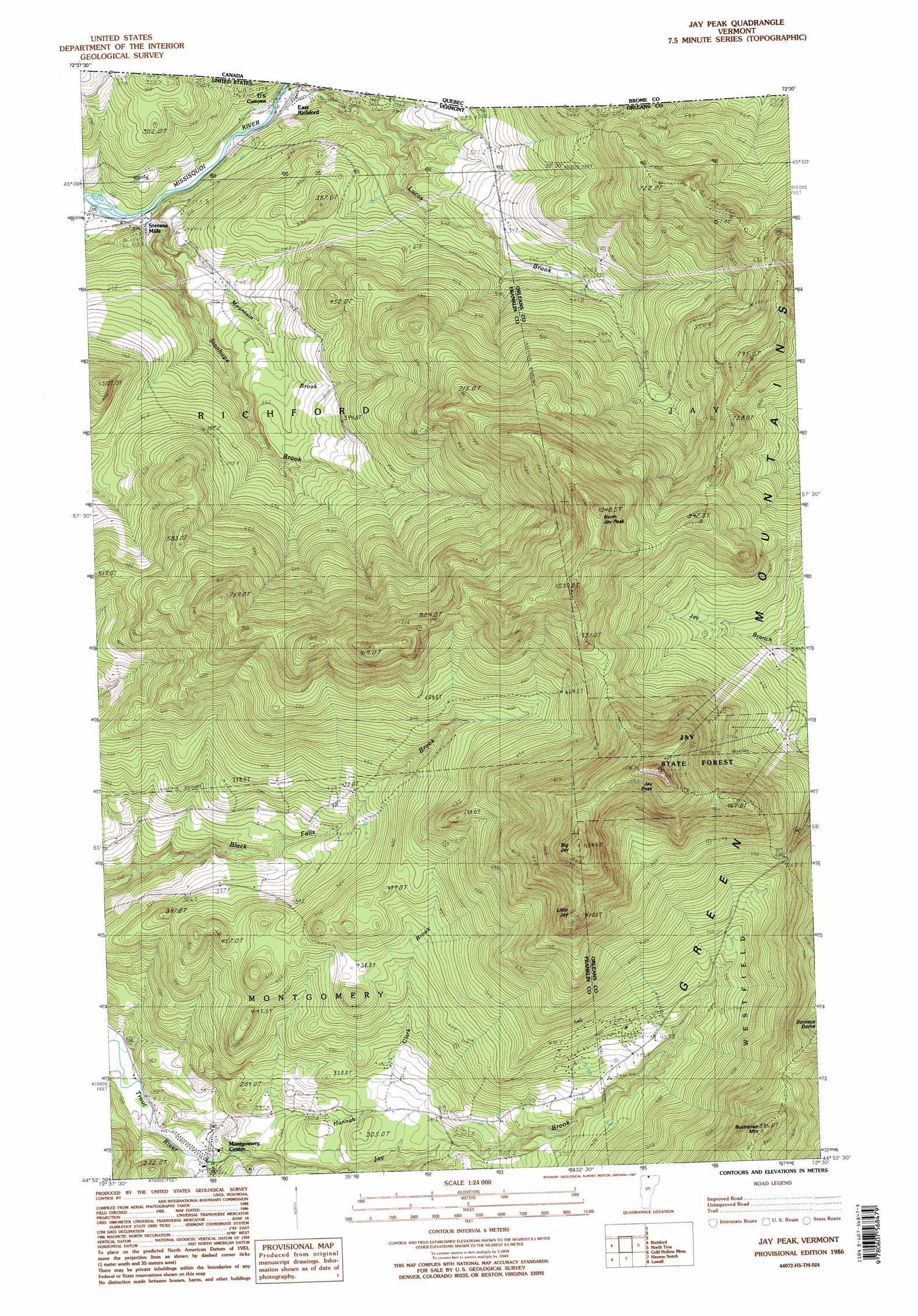
Jay Peak Topo Map Vermont
To zoom in, hover over the map of Jay Peak
USGS Topo Quad 44072h5 - 1:24,000 scale
| Topo Map Name: | Jay Peak |
| USGS Topo Quad ID: | 44072h5 |
| Print Size: | ca. 21 1/4" wide x 27" high |
| Southeast Coordinates: | 44.875° N latitude / 72.5° W longitude |
| Map Center Coordinates: | 44.9375° N latitude / 72.5625° W longitude |
| U.S. State: | VT |
| Filename: | o44072h5.jpg |
| Download Map JPG Image: | Jay Peak topo map 1:24,000 scale |
| Map Type: | Topographic |
| Topo Series: | 7.5´ |
| Map Scale: | 1:24,000 |
| Source of Map Images: | United States Geological Survey (USGS) |
| Alternate Map Versions: |
Jay Peak VT 1986, updated 1987 Download PDF Buy paper map Jay Peak VT 1986, updated 1987 Download PDF Buy paper map Jay Peak VT 2012 Download PDF Buy paper map Jay Peak VT 2015 Download PDF Buy paper map |
1:24,000 Topo Quads surrounding Jay Peak
Enosburg Falls |
Richford |
Jay Peak |
North Troy |
Newport Center |
Bakersfield |
Cold Hollow Mountains |
Hazens Notch |
Lowell |
Irasburg |
Jeffersonville |
Johnson |
Eden |
Albany |
Craftsbury |
> Back to 44072e1 at 1:100,000 scale
> Back to 44072a1 at 1:250,000 scale
> Back to U.S. Topo Maps home
Jay Peak topo map: Gazetteer
Jay Peak: Forests
Jay State Forest elevation 1089m 3572′Jay Peak: Populated Places
Montgomery Center elevation 191m 626′Stevens Mills elevation 147m 482′
Jay Peak: Streams
Hannah Clark Brook elevation 165m 541′Jay Brook elevation 267m 875′
Mountain Brook elevation 146m 479′
South Branch Trout River elevation 157m 515′
Stanhope Brook elevation 148m 485′
Wade Brook elevation 260m 853′
Jay Peak: Summits
Big Jay elevation 1115m 3658′Buchanan Mountain elevation 875m 2870′
Jay Peak elevation 1148m 3766′
Little Jay elevation 928m 3044′
North Jay Peak elevation 1026m 3366′
Jay Peak digital topo map on disk
Buy this Jay Peak topo map showing relief, roads, GPS coordinates and other geographical features, as a high-resolution digital map file on DVD:
New York, Vermont, Connecticut & Western Massachusetts
Buy digital topo maps: New York, Vermont, Connecticut & Western Massachusetts