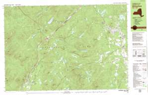
Witherbee Topo Map New York
To zoom in, hover over the map of Witherbee
USGS Topo Quad 44073a5 - 1:25,000 scale
| Topo Map Name: | Witherbee |
| USGS Topo Quad ID: | 44073a5 |
| Print Size: | ca. 39" wide x 24" high |
| Southeast Coordinates: | 44° N latitude / 73.5° W longitude |
| Map Center Coordinates: | 44.0625° N latitude / 73.625° W longitude |
| U.S. State: | NY |
| Filename: | k44073a5.jpg |
| Download Map JPG Image: | Witherbee topo map 1:25,000 scale |
| Map Type: | Topographic |
| Topo Series: | 7.5´x15´ |
| Map Scale: | 1:25,000 |
| Source of Map Images: | United States Geological Survey (USGS) |
| Alternate Map Versions: |
Witherbee NY 1978, updated 1979 Download PDF Buy paper map Witherbee NY 1999, updated 2000 Download PDF Buy paper map |
1:24,000 Topo Quads surrounding Witherbee
> Back to 44073a1 at 1:100,000 scale
> Back to 44072a1 at 1:250,000 scale
> Back to U.S. Topo Maps home
Witherbee topo map: Gazetteer
Witherbee: Benches
Broughton Ledge elevation 518m 1699′Witherbee: Flats
Four Mile Meadow elevation 380m 1246′Witherbee: Lakes
Ash Craft Pond elevation 365m 1197′Big Lock Pond elevation 445m 1459′
Birch Pond elevation 395m 1295′
Brother Ponds elevation 387m 1269′
Bullet Pond elevation 487m 1597′
Bullpout Pond elevation 355m 1164′
Bullpout Pond elevation 406m 1332′
Clap Pond elevation 485m 1591′
Courtney Pond elevation 296m 971′
Cranberry Pond elevation 456m 1496′
Eagles Nest Pond elevation 445m 1459′
Ensign Pond elevation 365m 1197′
Feeder Pond elevation 407m 1335′
Fifth Pond elevation 470m 1541′
Gui Pond elevation 315m 1033′
Hatching Pond elevation 485m 1591′
Holiday Pond elevation 298m 977′
Howard Pond elevation 375m 1230′
Joe Pond elevation 437m 1433′
Jug Pond elevation 298m 977′
Ledge Pond elevation 375m 1230′
Lillypad Pond elevation 466m 1528′
Little Howard Pond elevation 375m 1230′
Lost Pond elevation 425m 1394′
Makomis Pond elevation 316m 1036′
Mill Pond elevation 455m 1492′
Moriah Pond elevation 428m 1404′
Moss Ponds elevation 384m 1259′
Mud Pond elevation 475m 1558′
Munson Pond elevation 369m 1210′
Murrey Pond elevation 455m 1492′
New Pond elevation 384m 1259′
Newport Pond elevation 385m 1263′
Parch Pond elevation 466m 1528′
Pine Pond elevation 324m 1062′
Rhododendron Pond elevation 469m 1538′
Rockport Pond elevation 445m 1459′
Round Pond elevation 524m 1719′
Round Pond elevation 366m 1200′
Russett Pond elevation 455m 1492′
Secret Pond elevation 435m 1427′
Shingletree Pond elevation 316m 1036′
Smith Pond elevation 415m 1361′
Stump Pond elevation 305m 1000′
Tanaher Pond elevation 455m 1492′
Triangle Pond elevation 376m 1233′
Trout Pond elevation 376m 1233′
Tub Mill Pond elevation 415m 1361′
Twin Pond elevation 515m 1689′
Twin Ponds elevation 365m 1197′
Upper Feeder Pond elevation 441m 1446′
Witherbee: Populated Places
Grover Hills elevation 323m 1059′Mineville elevation 395m 1295′
Moriah elevation 259m 849′
Moriah Center elevation 241m 790′
Underwood elevation 334m 1095′
Witherbee elevation 383m 1256′
Witherbee: Reservoirs
Bartlett Pond elevation 369m 1210′Witherbee: Streams
Ash Craft Brook elevation 307m 1007′Crowfoot Brook elevation 306m 1003′
East Mill Brook elevation 270m 885′
Lindsey Brook elevation 296m 971′
Moss Pond Brook elevation 317m 1040′
New Pond Brook elevation 306m 1003′
Newport Brook elevation 344m 1128′
North Fork Boquet River elevation 335m 1099′
Slide Brook elevation 273m 895′
South Fork Boquet River elevation 335m 1099′
West Mill Brook elevation 270m 885′
Witherbee: Summits
Armstrong Mountain elevation 618m 2027′Bald Peak elevation 705m 2312′
Barton Mountain elevation 574m 1883′
Bear Mountain elevation 694m 2276′
Belfry Mountain elevation 564m 1850′
Buck Mountain elevation 641m 2103′
Camel Mountain elevation 820m 2690′
Camels Hump elevation 848m 2782′
Catamount Mountain elevation 434m 1423′
Claybed Mountain elevation 464m 1522′
Feeder Mountain elevation 503m 1650′
Greenough Mountain elevation 482m 1581′
Harris Hill elevation 673m 2208′
Howard Mountain elevation 520m 1706′
Jug Mountain elevation 528m 1732′
Little Far Mountain elevation 535m 1755′
Lock Mountain elevation 629m 2063′
Makomis Mountain elevation 498m 1633′
Mile Square Mountain elevation 532m 1745′
Moriah Pond Mountain elevation 560m 1837′
Mount Tom elevation 503m 1650′
Old Far Mountain elevation 713m 2339′
Potter Hill elevation 484m 1587′
Saunders Mountain elevation 604m 1981′
Split Rock Mountain elevation 594m 1948′
Spotted Mountain elevation 1056m 3464′
Stiles Hill elevation 682m 2237′
Trout Pond Hill elevation 504m 1653′
Wyman Mountain elevation 1007m 3303′
Witherbee: Swamps
Deadwater Pond elevation 295m 967′East Mill Flow elevation 358m 1174′
Witherbee digital topo map on disk
Buy this Witherbee topo map showing relief, roads, GPS coordinates and other geographical features, as a high-resolution digital map file on DVD:
New York, Vermont, Connecticut & Western Massachusetts
Buy digital topo maps: New York, Vermont, Connecticut & Western Massachusetts


