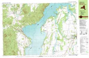
Vergennes West Topo Map Vermont
To zoom in, hover over the map of Vergennes West
USGS Topo Quad 44073b3 - 1:25,000 scale
| Topo Map Name: | Vergennes West |
| USGS Topo Quad ID: | 44073b3 |
| Print Size: | ca. 39" wide x 24" high |
| Southeast Coordinates: | 44.125° N latitude / 73.25° W longitude |
| Map Center Coordinates: | 44.1875° N latitude / 73.375° W longitude |
| U.S. States: | VT, NY |
| Filename: | k44073b3.jpg |
| Download Map JPG Image: | Vergennes West topo map 1:25,000 scale |
| Map Type: | Topographic |
| Topo Series: | 7.5´x15´ |
| Map Scale: | 1:25,000 |
| Source of Map Images: | United States Geological Survey (USGS) |
| Alternate Map Versions: |
Westport VT 1980, updated 1981 Download PDF Buy paper map Westport VT 1980, updated 1981 Download PDF Buy paper map Westport VT 1980, updated 1990 Download PDF Buy paper map Westport VT 1999, updated 2000 Download PDF Buy paper map |
1:24,000 Topo Quads surrounding Vergennes West
> Back to 44073a1 at 1:100,000 scale
> Back to 44072a1 at 1:250,000 scale
> Back to U.S. Topo Maps home
Vergennes West topo map: Gazetteer
Vergennes West: Airports
Basin Harbor Airport elevation 47m 154′Westport Airport elevation 83m 272′
Vergennes West: Bays
Arnold Bay elevation 29m 95′Barn Rock Bay elevation 29m 95′
Basin Harbor elevation 30m 98′
Button Bay elevation 29m 95′
Cold Spring Bay elevation 29m 95′
Cole Bay elevation 29m 95′
Fields Bay elevation 29m 95′
Hawkins Bay elevation 29m 95′
Hunter Bay elevation 29m 95′
Kingsland Bay elevation 29m 95′
Louis Clearing Bay elevation 29m 95′
North Harbor elevation 29m 95′
North West Bay elevation 29m 95′
Partridge Harbor elevation 29m 95′
Porter Bay elevation 29m 95′
Rock Harbor elevation 29m 95′
Snake Den Harbor elevation 29m 95′
South Bay elevation 29m 95′
Spaulding Bay elevation 29m 95′
White Bay elevation 29m 95′
Young Bay elevation 29m 95′
Vergennes West: Capes
Barber Point elevation 39m 127′Barn Rock elevation 60m 196′
Bluff Point elevation 38m 124′
Fort Cassin Point elevation 37m 121′
Furnace Point elevation 29m 95′
Grosse Point elevation 44m 144′
Macdonough Point elevation 41m 134′
Mile Point elevation 39m 127′
Moore Point elevation 29m 95′
Summer Point elevation 41m 134′
Vergennes West: Channels
The Narrows elevation 29m 95′The Narrows elevation 29m 95′
Vergennes West: Cliffs
Palisades elevation 61m 200′Scotch Bonnet elevation 57m 187′
Vergennes West: Dams
Stone Bridge Dam elevation 33m 108′Vergennes West: Islands
Button Island elevation 29m 95′Cole Island elevation 29m 95′
Diamond Island elevation 29m 95′
Diamond Island elevation 29m 95′
Mud Island elevation 29m 95′
Rock Island elevation 29m 95′
Ship Point elevation 29m 95′
Vergennes West: Lakes
Rogers Pond elevation 162m 531′Vergennes West: Parks
Button Bay State Park elevation 29m 95′Dead Creek Wildlife Management Area elevation 44m 144′
Kings Bay State Park elevation 35m 114′
Little Otter Creek Wildlife Management Area elevation 32m 104′
Vergennes West: Populated Places
Ecole Champlain elevation 41m 134′Panton elevation 60m 196′
Rock Landing elevation 32m 104′
Vergennes elevation 59m 193′
Wadhams elevation 89m 291′
Westport elevation 37m 121′
Vergennes West: Post Offices
Vergennes Post Office elevation 69m 226′Vergennes West: Streams
Crooked Brook elevation 87m 285′Dead Creek elevation 36m 118′
East Slang Creek elevation 22m 72′
Goose Creek elevation 39m 127′
Hammond Brook elevation 57m 187′
Hoisington Brook elevation 29m 95′
Holcomb Slang Creek elevation 36m 118′
Lewis Creek elevation 29m 95′
Little Otter Creek elevation 43m 141′
Otter Creek elevation 29m 95′
South Slang Creek elevation 28m 91′
Stacy Brook elevation 36m 118′
Vergennes West: Summits
Ainger Hill elevation 201m 659′Bart Royce Hill elevation 252m 826′
Coon Mountain elevation 310m 1017′
Harper Mountain elevation 510m 1673′
Hoisington Mountain elevation 444m 1456′
Kronks Hill elevation 204m 669′
Moore Mountain elevation 551m 1807′
Payne Hill elevation 261m 856′
Peach Blow Hill elevation 214m 702′
Phinney Hill elevation 212m 695′
Smith Hill elevation 329m 1079′
Split Rock Mountain elevation 315m 1033′
Stanton Hill elevation 247m 810′
Stockwell Mountain elevation 389m 1276′
The Pinnacle elevation 271m 889′
Toll Gate Hill elevation 247m 810′
Trainor Hill elevation 239m 784′
Twin Hill elevation 193m 633′
Vergennes West digital topo map on disk
Buy this Vergennes West topo map showing relief, roads, GPS coordinates and other geographical features, as a high-resolution digital map file on DVD:
New York, Vermont, Connecticut & Western Massachusetts
Buy digital topo maps: New York, Vermont, Connecticut & Western Massachusetts


