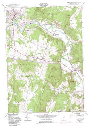
Essex Junction Topo Map Vermont
To zoom in, hover over the map of Essex Junction
USGS Topo Quad 44073d1 - 1:24,000 scale
| Topo Map Name: | Essex Junction |
| USGS Topo Quad ID: | 44073d1 |
| Print Size: | ca. 21 1/4" wide x 27" high |
| Southeast Coordinates: | 44.375° N latitude / 73° W longitude |
| Map Center Coordinates: | 44.4375° N latitude / 73.0625° W longitude |
| U.S. State: | VT |
| Filename: | o44073d1.jpg |
| Download Map JPG Image: | Essex Junction topo map 1:24,000 scale |
| Map Type: | Topographic |
| Topo Series: | 7.5´ |
| Map Scale: | 1:24,000 |
| Source of Map Images: | United States Geological Survey (USGS) |
| Alternate Map Versions: |
Essex Junction VT 1948, updated 1953 Download PDF Buy paper map Essex Junction VT 1948, updated 1968 Download PDF Buy paper map Essex Junction VT 1948, updated 1973 Download PDF Buy paper map Essex Junction VT 1948, updated 1977 Download PDF Buy paper map Essex Junction VT 1948, updated 1987 Download PDF Buy paper map Essex Junction VT 2012 Download PDF Buy paper map Essex Junction VT 2015 Download PDF Buy paper map |
1:24,000 Topo Quads surrounding Essex Junction
> Back to 44073a1 at 1:100,000 scale
> Back to 44072a1 at 1:250,000 scale
> Back to U.S. Topo Maps home
Essex Junction topo map: Gazetteer
Essex Junction: Airports
IBM Heliport elevation 107m 351′Williston Armory Heliport elevation 151m 495′
Essex Junction: Crossings
Interchange 11 elevation 91m 298′Interchange 12 elevation 131m 429′
Essex Junction: Dams
Essex Number 19 Dam elevation 62m 203′Essex Junction: Forests
Essex Junction Village Forest elevation 147m 482′Essex Junction: Parks
Champlain Valley Exposition elevation 109m 357′Williston Village Historic District elevation 150m 492′
Essex Junction: Populated Places
Essex Junction elevation 105m 344′Fays Corner elevation 173m 567′
Kirby Corner elevation 105m 344′
North Williston elevation 93m 305′
Tafts Corner elevation 119m 390′
Williston elevation 151m 495′
Essex Junction: Streams
Alder Brook elevation 83m 272′Johnnie Brook elevation 90m 295′
Mill Brook elevation 85m 278′
Essex Junction: Summits
Chamberlain Hill elevation 285m 935′Saxon Hill elevation 294m 964′
Yantz Hill elevation 353m 1158′
Essex Junction digital topo map on disk
Buy this Essex Junction topo map showing relief, roads, GPS coordinates and other geographical features, as a high-resolution digital map file on DVD:
New York, Vermont, Connecticut & Western Massachusetts
Buy digital topo maps: New York, Vermont, Connecticut & Western Massachusetts


