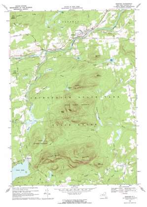
Redford Topo Map New York
To zoom in, hover over the map of Redford
USGS Topo Quad 44073e7 - 1:24,000 scale
| Topo Map Name: | Redford |
| USGS Topo Quad ID: | 44073e7 |
| Print Size: | ca. 21 1/4" wide x 27" high |
| Southeast Coordinates: | 44.5° N latitude / 73.75° W longitude |
| Map Center Coordinates: | 44.5625° N latitude / 73.8125° W longitude |
| U.S. State: | NY |
| Filename: | o44073e7.jpg |
| Download Map JPG Image: | Redford topo map 1:24,000 scale |
| Map Type: | Topographic |
| Topo Series: | 7.5´ |
| Map Scale: | 1:24,000 |
| Source of Map Images: | United States Geological Survey (USGS) |
| Alternate Map Versions: |
Redford NY 1968, updated 1970 Download PDF Buy paper map Redford NY 2010 Download PDF Buy paper map Redford NY 2013 Download PDF Buy paper map Redford NY 2016 Download PDF Buy paper map |
1:24,000 Topo Quads surrounding Redford
> Back to 44073e1 at 1:100,000 scale
> Back to 44072a1 at 1:250,000 scale
> Back to U.S. Topo Maps home
Redford topo map: Gazetteer
Redford: Flats
Keniston Meadows elevation 437m 1433′Redford: Lakes
Mud Pond elevation 448m 1469′Mud Pond elevation 359m 1177′
Ore Pond elevation 361m 1184′
Tefft Pond elevation 396m 1299′
Whistle Pond elevation 430m 1410′
Redford: Populated Places
Clayburg elevation 342m 1122′Hawkeye elevation 427m 1400′
Redford elevation 357m 1171′
Swastika elevation 348m 1141′
Redford: Ridges
Hardhack Ridge elevation 497m 1630′Potter Mountains elevation 651m 2135′
Silver Lake Mountains elevation 601m 1971′
Redford: Streams
Allegany Brook elevation 364m 1194′Demar Brook elevation 353m 1158′
Mud Pond Brook elevation 317m 1040′
North Branch Saranac River elevation 335m 1099′
Silver Lake Brook elevation 396m 1299′
Stord Brook elevation 354m 1161′
Taylor Pond Outlet elevation 347m 1138′
Redford: Summits
Columbe Mountain elevation 478m 1568′Ellis Mountain elevation 636m 2086′
Little Ellis Mountain elevation 496m 1627′
Little Potter Mountain elevation 523m 1715′
Signal Peak elevation 581m 1906′
Tolman Mountain elevation 722m 2368′
Redford: Trails
Silver Lake Mountain Trail elevation 550m 1804′Redford digital topo map on disk
Buy this Redford topo map showing relief, roads, GPS coordinates and other geographical features, as a high-resolution digital map file on DVD:
New York, Vermont, Connecticut & Western Massachusetts
Buy digital topo maps: New York, Vermont, Connecticut & Western Massachusetts


