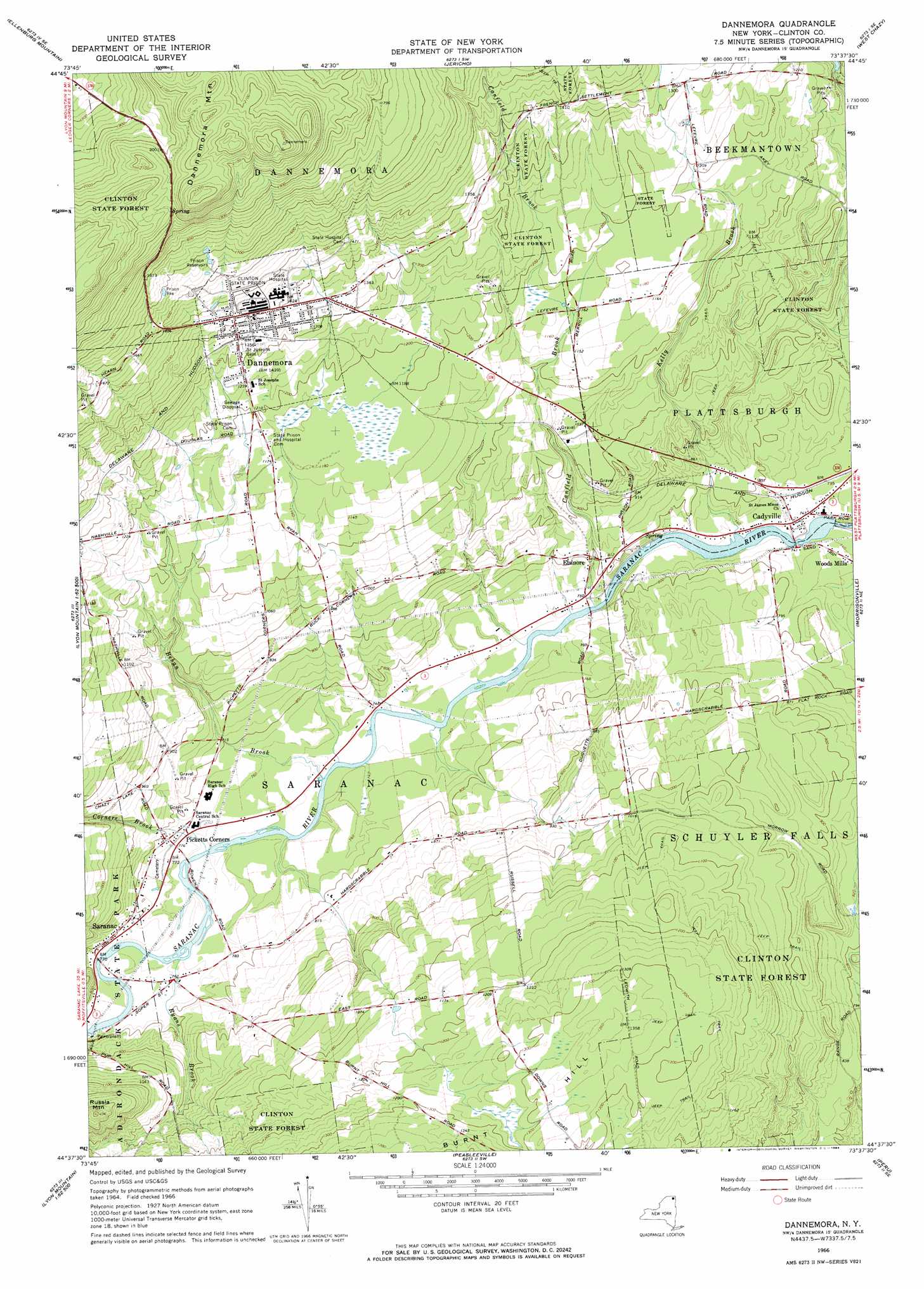
Dannemora Topo Map New York
To zoom in, hover over the map of Dannemora
USGS Topo Quad 44073f6 - 1:24,000 scale
| Topo Map Name: | Dannemora |
| USGS Topo Quad ID: | 44073f6 |
| Print Size: | ca. 21 1/4" wide x 27" high |
| Southeast Coordinates: | 44.625° N latitude / 73.625° W longitude |
| Map Center Coordinates: | 44.6875° N latitude / 73.6875° W longitude |
| U.S. State: | NY |
| Filename: | o44073f6.jpg |
| Download Map JPG Image: | Dannemora topo map 1:24,000 scale |
| Map Type: | Topographic |
| Topo Series: | 7.5´ |
| Map Scale: | 1:24,000 |
| Source of Map Images: | United States Geological Survey (USGS) |
| Alternate Map Versions: |
Dannemora NY 1966, updated 1968 Download PDF Buy paper map Dannemora NY 1966, updated 1984 Download PDF Buy paper map Dannemora NY 2010 Download PDF Buy paper map Dannemora NY 2013 Download PDF Buy paper map Dannemora NY 2016 Download PDF Buy paper map |
1:24,000 Topo Quads surrounding Dannemora
Churubusco |
Ellenburg Depot |
Altona |
Mooers |
Champlain |
Ellenburg Center |
Ellenburg Mountain |
Jericho |
West Chazy |
Beekmantown |
Lyon Mountain |
Moffitsville |
Dannemora |
Morrisonville |
Plattsburgh |
Alder Brook |
Redford |
Peasleeville |
Peru |
Keeseville |
Wilmington |
Clintonville |
> Back to 44073e1 at 1:100,000 scale
> Back to 44072a1 at 1:250,000 scale
> Back to U.S. Topo Maps home
Dannemora topo map: Gazetteer
Dannemora: Populated Places
Cadyville elevation 227m 744′Dannemora elevation 431m 1414′
Elsinore elevation 246m 807′
Saranac elevation 243m 797′
Dannemora: Streams
Behan Brook elevation 220m 721′Canfield Brook elevation 221m 725′
Corners Brook elevation 219m 718′
Kelly Brook elevation 220m 721′
Ryans Brook elevation 226m 741′
Dannemora: Summits
Dannemora Mountain elevation 683m 2240′Russia Mountain elevation 428m 1404′
Dannemora digital topo map on disk
Buy this Dannemora topo map showing relief, roads, GPS coordinates and other geographical features, as a high-resolution digital map file on DVD:
New York, Vermont, Connecticut & Western Massachusetts
Buy digital topo maps: New York, Vermont, Connecticut & Western Massachusetts