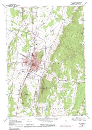
Saint Albans Topo Map Vermont
To zoom in, hover over the map of Saint Albans
USGS Topo Quad 44073g1 - 1:24,000 scale
| Topo Map Name: | Saint Albans |
| USGS Topo Quad ID: | 44073g1 |
| Print Size: | ca. 21 1/4" wide x 27" high |
| Southeast Coordinates: | 44.75° N latitude / 73° W longitude |
| Map Center Coordinates: | 44.8125° N latitude / 73.0625° W longitude |
| U.S. State: | VT |
| Filename: | o44073g1.jpg |
| Download Map JPG Image: | Saint Albans topo map 1:24,000 scale |
| Map Type: | Topographic |
| Topo Series: | 7.5´ |
| Map Scale: | 1:24,000 |
| Source of Map Images: | United States Geological Survey (USGS) |
| Alternate Map Versions: |
St. Albans VT 1964, updated 1965 Download PDF Buy paper map St. Albans VT 1964, updated 1973 Download PDF Buy paper map St. Albans VT 1964, updated 1987 Download PDF Buy paper map Saint Albans VT 2012 Download PDF Buy paper map Saint Albans VT 2015 Download PDF Buy paper map |
1:24,000 Topo Quads surrounding Saint Albans
> Back to 44073e1 at 1:100,000 scale
> Back to 44072a1 at 1:250,000 scale
> Back to U.S. Topo Maps home
Saint Albans topo map: Gazetteer
Saint Albans: Airports
State Garage Site Heliport elevation 114m 374′Saint Albans: Crossings
Interchange 19 elevation 171m 561′Interchange 20 elevation 115m 377′
Saint Albans: Dams
Saint Albans Reservoir Dam North elevation 217m 711′Saint Albans Reservoir Dam South elevation 217m 711′
Saint Albans: Forests
Saint Albans Municipal Forest elevation 232m 761′Saint Albans: Lakes
Lost Lake elevation 163m 534′Saint Albans: Parks
Aldis Hill Park elevation 237m 777′Barlow Street Playground elevation 152m 498′
Coote Field elevation 113m 370′
Fairfield Swamp State Wildlife Management Area elevation 200m 656′
Hard'ack Recreation Area elevation 182m 597′
Houghton Park elevation 110m 360′
Saint Albans Historic District elevation 124m 406′
Taylor Park elevation 131m 429′
Saint Albans: Populated Places
Fonda elevation 73m 239′Greens Corners elevation 122m 400′
Hill Farm Estates elevation 179m 587′
North Fairfax elevation 219m 718′
Saint Albans elevation 127m 416′
Saint Albans: Post Offices
Saint Albans Post Office elevation 123m 403′Saint Albans: Reservoirs
Saint Albans Reservoir elevation 217m 711′Saint Albans Reservoir North elevation 217m 711′
Saint Albans Reservoir South elevation 217m 711′
Saint Albans: Summits
Aldis Hill elevation 256m 839′Bellevue Hill elevation 401m 1315′
Saint Albans Hill elevation 274m 898′
Saint Albans digital topo map on disk
Buy this Saint Albans topo map showing relief, roads, GPS coordinates and other geographical features, as a high-resolution digital map file on DVD:
New York, Vermont, Connecticut & Western Massachusetts
Buy digital topo maps: New York, Vermont, Connecticut & Western Massachusetts


