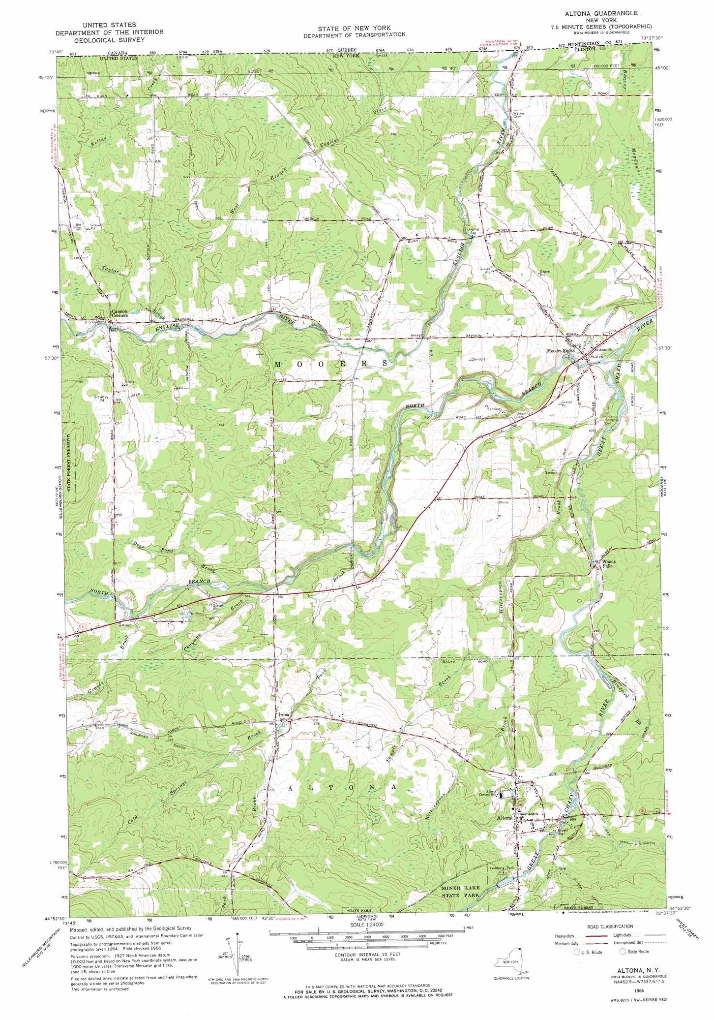
Altona Topo Map New York
To zoom in, hover over the map of Altona
USGS Topo Quad 44073h6 - 1:24,000 scale
| Topo Map Name: | Altona |
| USGS Topo Quad ID: | 44073h6 |
| Print Size: | ca. 21 1/4" wide x 27" high |
| Southeast Coordinates: | 44.875° N latitude / 73.625° W longitude |
| Map Center Coordinates: | 44.9375° N latitude / 73.6875° W longitude |
| U.S. State: | NY |
| Filename: | o44073h6.jpg |
| Download Map JPG Image: | Altona topo map 1:24,000 scale |
| Map Type: | Topographic |
| Topo Series: | 7.5´ |
| Map Scale: | 1:24,000 |
| Source of Map Images: | United States Geological Survey (USGS) |
| Alternate Map Versions: |
Altona NY 1966, updated 1968 Download PDF Buy paper map Altona NY 1966, updated 1984 Download PDF Buy paper map Altona NY 2010 Download PDF Buy paper map Altona NY 2013 Download PDF Buy paper map Altona NY 2016 Download PDF Buy paper map |
1:24,000 Topo Quads surrounding Altona
Churubusco |
Ellenburg Depot |
Altona |
Mooers |
Champlain |
Ellenburg Center |
Ellenburg Mountain |
Jericho |
West Chazy |
Beekmantown |
Lyon Mountain |
Moffitsville |
Dannemora |
Morrisonville |
Plattsburgh |
> Back to 44073e1 at 1:100,000 scale
> Back to 44072a1 at 1:250,000 scale
> Back to U.S. Topo Maps home
Altona topo map: Gazetteer
Altona: Flats
Beaver Meadows elevation 94m 308′Altona: Lakes
Deer Pond (historical) elevation 201m 659′Altona: Parks
Feinburg Park elevation 210m 688′Altona: Populated Places
Altona elevation 194m 636′Irona elevation 206m 675′
Mooers Forks elevation 114m 374′
Woods Falls elevation 146m 479′
Altona: Streams
Bradford Brook elevation 149m 488′Chapman Brook elevation 170m 557′
Cold Springs Brook elevation 206m 675′
Deer Pond Brook elevation 177m 580′
Graves Brook elevation 194m 636′
North Branch Great Chazy River elevation 99m 324′
Park Brook elevation 143m 469′
Sample Brook elevation 155m 508′
Taylor Brook elevation 184m 603′
Witherspoon Brook elevation 118m 387′
Altona digital topo map on disk
Buy this Altona topo map showing relief, roads, GPS coordinates and other geographical features, as a high-resolution digital map file on DVD:
New York, Vermont, Connecticut & Western Massachusetts
Buy digital topo maps: New York, Vermont, Connecticut & Western Massachusetts