Mount Matumbla Topo Map New York
To zoom in, hover over the map of Mount Matumbla
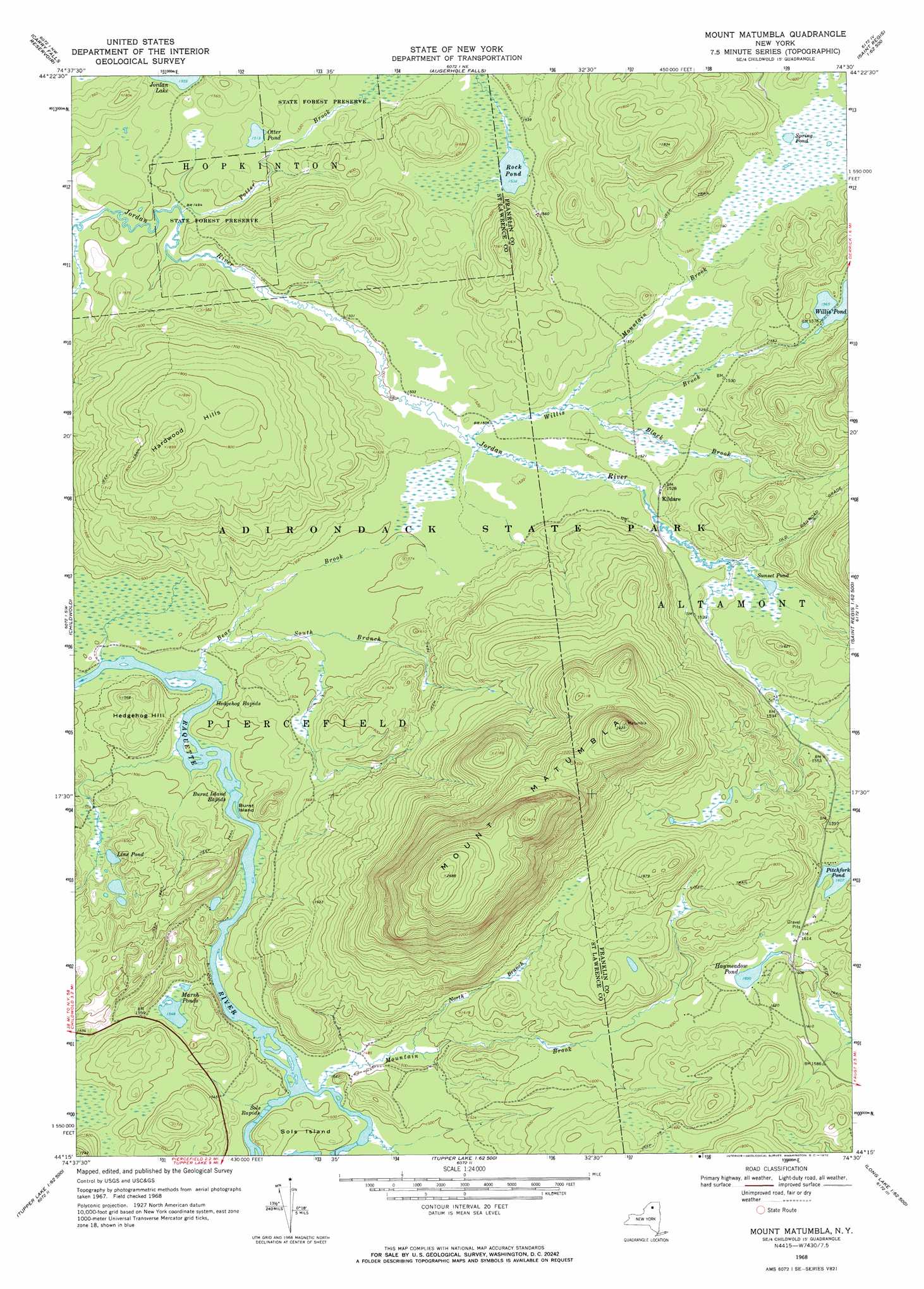
USGS Topo Quad 44074c5 - 1:24,000 scale
| Topo Map Name: | Mount Matumbla |
| USGS Topo Quad ID: | 44074c5 |
| Print Size: | ca. 21 1/4" wide x 27" high |
| Southeast Coordinates: | 44.25° N latitude / 74.5° W longitude |
| Map Center Coordinates: | 44.3125° N latitude / 74.5625° W longitude |
| U.S. State: | NY |
| Filename: | o44074c5.jpg |
| Download Map JPG Image: | Mount Matumbla topo map 1:24,000 scale |
| Map Type: | Topographic |
| Topo Series: | 7.5´ |
| Map Scale: | 1:24,000 |
| Source of Map Images: | United States Geological Survey (USGS) |
| Alternate Map Versions: |
Mount Matumbla NY 1968, updated 1970 Download PDF Buy paper map Mount Matumbla NY 1968, updated 1971 Download PDF Buy paper map Mount Matumbla NY 2010 Download PDF Buy paper map Mount Matumbla NY 2013 Download PDF Buy paper map Mount Matumbla NY 2016 Download PDF Buy paper map |
1:24,000 Topo Quads surrounding Mount Matumbla
Rainbow Falls |
Sylvan Falls |
Lake Ozonia |
Meno |
Meacham Lake |
Stark |
Carry Falls Reservoir |
Augerhole Falls |
Saint Regis Mountain |
|
Brother Ponds |
Childwold |
Mount Matumbla |
Upper Saranac Lake |
|
Cranberry Lake |
Pierce Field |
Stony Creek Mountain |
||
Wolf Mountain |
Slim Pond |
Kempshall Mountain |
> Back to 44074a1 at 1:100,000 scale
> Back to 44074a1 at 1:250,000 scale
> Back to U.S. Topo Maps home
Mount Matumbla topo map: Gazetteer
Mount Matumbla: Islands
Burnt Island elevation 445m 1459′Sols Island elevation 455m 1492′
Mount Matumbla: Lakes
Haymeadow Pond elevation 488m 1601′Line Pond elevation 466m 1528′
Marsh Ponds elevation 473m 1551′
Otter Pond elevation 461m 1512′
Pitchfork Pond elevation 489m 1604′
Rock Pond elevation 467m 1532′
Spring Pond elevation 473m 1551′
Sunset Pond elevation 467m 1532′
Mount Matumbla: Populated Places
Kildare elevation 467m 1532′Mount Matumbla: Rapids
Burnt Island Rapids elevation 445m 1459′Hedgehog Rapids elevation 445m 1459′
Sols Rapids elevation 451m 1479′
Mount Matumbla: Streams
Bear Brook elevation 445m 1459′Black Brook elevation 463m 1519′
Mountain Brook elevation 451m 1479′
Mountain Brook elevation 461m 1512′
North Branch Mountain Brook elevation 454m 1489′
Potter Brook elevation 451m 1479′
South Branch Bear Brook elevation 450m 1476′
Willis Brook elevation 459m 1505′
Mount Matumbla: Summits
Hardwood Hills elevation 578m 1896′Hedgehog Hill elevation 484m 1587′
Mount Matumbla elevation 818m 2683′
Mount Matumbla digital topo map on disk
Buy this Mount Matumbla topo map showing relief, roads, GPS coordinates and other geographical features, as a high-resolution digital map file on DVD:
New York, Vermont, Connecticut & Western Massachusetts
Buy digital topo maps: New York, Vermont, Connecticut & Western Massachusetts