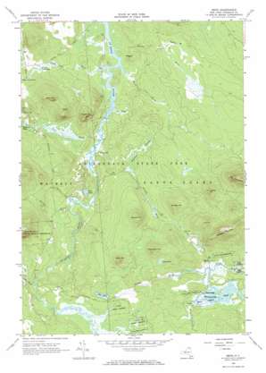
Meno Topo Map New York
To zoom in, hover over the map of Meno
USGS Topo Quad 44074e4 - 1:24,000 scale
| Topo Map Name: | Meno |
| USGS Topo Quad ID: | 44074e4 |
| Print Size: | ca. 21 1/4" wide x 27" high |
| Southeast Coordinates: | 44.5° N latitude / 74.375° W longitude |
| Map Center Coordinates: | 44.5625° N latitude / 74.4375° W longitude |
| U.S. State: | NY |
| Filename: | o44074e4.jpg |
| Download Map JPG Image: | Meno topo map 1:24,000 scale |
| Map Type: | Topographic |
| Topo Series: | 7.5´ |
| Map Scale: | 1:24,000 |
| Source of Map Images: | United States Geological Survey (USGS) |
| Alternate Map Versions: |
Meno NY 1964, updated 1966 Download PDF Buy paper map Meno NY 1964, updated 1966 Download PDF Buy paper map Meno NY 2010 Download PDF Buy paper map Meno NY 2013 Download PDF Buy paper map Meno NY 2016 Download PDF Buy paper map |
1:24,000 Topo Quads surrounding Meno
> Back to 44074e1 at 1:100,000 scale
> Back to 44074a1 at 1:250,000 scale
> Back to U.S. Topo Maps home
Meno topo map: Gazetteer
Meno: Lakes
Benz Pond elevation 469m 1538′Duck Pond elevation 424m 1391′
Grass Pond elevation 497m 1630′
Grassy Pond elevation 497m 1630′
Lower Goose Pond elevation 431m 1414′
Madawaska Pond elevation 484m 1587′
Whackers Pond elevation 424m 1391′
Meno: Populated Places
Gile elevation 457m 1499′Madawaska elevation 485m 1591′
Meno elevation 488m 1601′
Spring Cove elevation 420m 1377′
Meno: Streams
Alder Brook elevation 446m 1463′Balsam Brook elevation 414m 1358′
Beaver Brook elevation 402m 1318′
Cox Brook elevation 402m 1318′
Downey Brook elevation 410m 1345′
Goodnow Brook elevation 442m 1450′
Goose Pond Brook elevation 402m 1318′
Onion River elevation 481m 1578′
Quebec Brook elevation 463m 1519′
Trout Brook elevation 402m 1318′
Twin Brook elevation 406m 1332′
Meno: Summits
Bearcove Hill elevation 441m 1446′Black Hill elevation 564m 1850′
Downey Hill elevation 573m 1879′
Hardwood Hill elevation 575m 1886′
Hurd Hill elevation 609m 1998′
Jennings Mountain elevation 724m 2375′
Leboeuf Hill elevation 586m 1922′
Middle Hill elevation 568m 1863′
Porcupine Hill elevation 578m 1896′
Reeves Hill elevation 574m 1883′
West Hill elevation 586m 1922′
Meno: Swamps
Jennings Swamp elevation 457m 1499′Meno digital topo map on disk
Buy this Meno topo map showing relief, roads, GPS coordinates and other geographical features, as a high-resolution digital map file on DVD:
New York, Vermont, Connecticut & Western Massachusetts
Buy digital topo maps: New York, Vermont, Connecticut & Western Massachusetts


