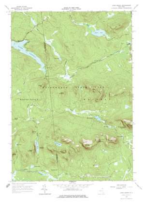
Lake Ozonia Topo Map New York
To zoom in, hover over the map of Lake Ozonia
USGS Topo Quad 44074e5 - 1:24,000 scale
| Topo Map Name: | Lake Ozonia |
| USGS Topo Quad ID: | 44074e5 |
| Print Size: | ca. 21 1/4" wide x 27" high |
| Southeast Coordinates: | 44.5° N latitude / 74.5° W longitude |
| Map Center Coordinates: | 44.5625° N latitude / 74.5625° W longitude |
| U.S. State: | NY |
| Filename: | o44074e5.jpg |
| Download Map JPG Image: | Lake Ozonia topo map 1:24,000 scale |
| Map Type: | Topographic |
| Topo Series: | 7.5´ |
| Map Scale: | 1:24,000 |
| Source of Map Images: | United States Geological Survey (USGS) |
| Alternate Map Versions: |
Lake Ozonia NY 1964, updated 1966 Download PDF Buy paper map Lake Ozonia NY 1964, updated 1977 Download PDF Buy paper map Lake Ozonia NY 2010 Download PDF Buy paper map Lake Ozonia NY 2013 Download PDF Buy paper map Lake Ozonia NY 2016 Download PDF Buy paper map |
1:24,000 Topo Quads surrounding Lake Ozonia
> Back to 44074e1 at 1:100,000 scale
> Back to 44074a1 at 1:250,000 scale
> Back to U.S. Topo Maps home
Lake Ozonia topo map: Gazetteer
Lake Ozonia: Cliffs
Stacy Bluff elevation 621m 2037′Lake Ozonia: Flats
The Meadows elevation 436m 1430′Lake Ozonia: Gaps
Arquett Pond Pass elevation 454m 1489′Deer Pass elevation 615m 2017′
Eagle Pass elevation 512m 1679′
Lake Ozonia: Lakes
Arquett Pond elevation 436m 1430′Bens Pond elevation 454m 1489′
Blind Pond elevation 491m 1610′
Dexter Lake elevation 424m 1391′
East Pond elevation 399m 1309′
Lake Ozonia elevation 421m 1381′
McCavanaugh Pond elevation 449m 1473′
Mud Pond elevation 480m 1574′
Swamp Pond elevation 467m 1532′
Train Pond elevation 539m 1768′
Upper Goose Pond elevation 433m 1420′
Weller Pond elevation 454m 1489′
Lake Ozonia: Streams
Alder Brook elevation 436m 1430′Blind Pond Outlet elevation 427m 1400′
Leach Pine Brook elevation 408m 1338′
Weller Pond Outlet elevation 414m 1358′
Lake Ozonia: Summits
Azure Mountain elevation 708m 2322′Brushy Top Mountain elevation 708m 2322′
Buck Hill elevation 491m 1610′
Cat Hill elevation 624m 2047′
County Line Mountain elevation 655m 2148′
Eagle Mountain elevation 653m 2142′
Flat Top Mountain elevation 744m 2440′
Ladder Mountain elevation 559m 1833′
Lost Mountain elevation 696m 2283′
Miners Hill elevation 575m 1886′
Riverdale Mountain elevation 577m 1893′
Sharp Top Mountain elevation 574m 1883′
Weller Mountain elevation 596m 1955′
West Mountain elevation 744m 2440′
Lake Ozonia digital topo map on disk
Buy this Lake Ozonia topo map showing relief, roads, GPS coordinates and other geographical features, as a high-resolution digital map file on DVD:
New York, Vermont, Connecticut & Western Massachusetts
Buy digital topo maps: New York, Vermont, Connecticut & Western Massachusetts


