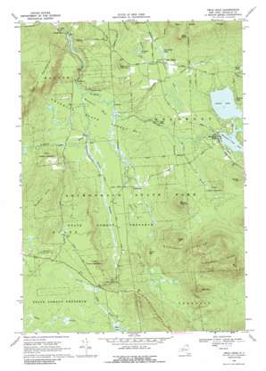
Owls Head Topo Map New York
To zoom in, hover over the map of Owls Head
USGS Topo Quad 44074f2 - 1:24,000 scale
| Topo Map Name: | Owls Head |
| USGS Topo Quad ID: | 44074f2 |
| Print Size: | ca. 21 1/4" wide x 27" high |
| Southeast Coordinates: | 44.625° N latitude / 74.125° W longitude |
| Map Center Coordinates: | 44.6875° N latitude / 74.1875° W longitude |
| U.S. State: | NY |
| Filename: | o44074f2.jpg |
| Download Map JPG Image: | Owls Head topo map 1:24,000 scale |
| Map Type: | Topographic |
| Topo Series: | 7.5´ |
| Map Scale: | 1:24,000 |
| Source of Map Images: | United States Geological Survey (USGS) |
| Alternate Map Versions: |
Owls Head NY 1968, updated 1970 Download PDF Buy paper map Owls Head NY 1968, updated 1971 Download PDF Buy paper map Owls Head NY 1968, updated 1988 Download PDF Buy paper map Owls Head NY 2010 Download PDF Buy paper map Owls Head NY 2013 Download PDF Buy paper map Owls Head NY 2016 Download PDF Buy paper map |
1:24,000 Topo Quads surrounding Owls Head
> Back to 44074e1 at 1:100,000 scale
> Back to 44074a1 at 1:250,000 scale
> Back to U.S. Topo Maps home
Owls Head topo map: Gazetteer
Owls Head: Bends
Needles Eye elevation 393m 1289′Oxbow elevation 397m 1302′
The Bend elevation 440m 1443′
Owls Head: Falls
High Falls elevation 435m 1427′Owls Head: Forests
Franklin State Forest Number One elevation 398m 1305′Owls Head: Lakes
Childs Ponds elevation 454m 1489′Fishpole Pond elevation 449m 1473′
Indian Lake elevation 453m 1486′
Mountain View Lake elevation 453m 1486′
Owls Head Pond elevation 469m 1538′
Papoose Lake elevation 456m 1496′
Owls Head: Populated Places
Mountain View elevation 457m 1499′Owls Head elevation 467m 1532′
Porcaville elevation 398m 1305′
Owls Head: Ridges
Goldsmith Range elevation 631m 2070′Owls Head Range elevation 655m 2148′
Owls Head: Streams
Barnes Brook elevation 445m 1459′Bell Brook elevation 449m 1473′
Brickyard Brook elevation 414m 1358′
Debar Brook elevation 460m 1509′
Duane Stream elevation 390m 1279′
Hatch Brook elevation 390m 1279′
Ingraham Stream elevation 391m 1282′
Townline Brook elevation 396m 1299′
Owls Head: Summits
Barnes Pinnacle elevation 605m 1984′Burnt Hill elevation 482m 1581′
Doctor Hill elevation 555m 1820′
Mount Tom elevation 831m 2726′
Owls Head elevation 679m 2227′
Owls Head Pinnacle elevation 517m 1696′
Peak Mountain elevation 687m 2253′
Studley Hill elevation 610m 2001′
Sugar Hill elevation 616m 2020′
Titusville Mountain elevation 665m 2181′
Owls Head: Swamps
Huckleberry Marsh elevation 392m 1286′Owls Head digital topo map on disk
Buy this Owls Head topo map showing relief, roads, GPS coordinates and other geographical features, as a high-resolution digital map file on DVD:
New York, Vermont, Connecticut & Western Massachusetts
Buy digital topo maps: New York, Vermont, Connecticut & Western Massachusetts


