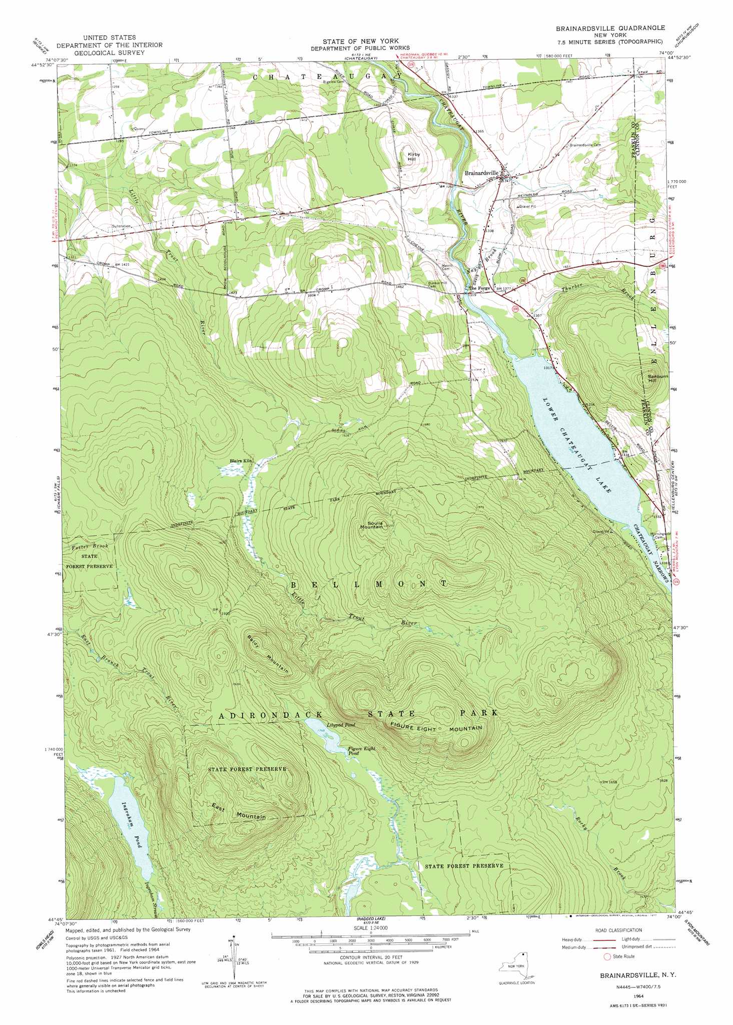
Brainardsville Topo Map New York
To zoom in, hover over the map of Brainardsville
USGS Topo Quad 44074g1 - 1:24,000 scale
| Topo Map Name: | Brainardsville |
| USGS Topo Quad ID: | 44074g1 |
| Print Size: | ca. 21 1/4" wide x 27" high |
| Southeast Coordinates: | 44.75° N latitude / 74° W longitude |
| Map Center Coordinates: | 44.8125° N latitude / 74.0625° W longitude |
| U.S. State: | NY |
| Filename: | o44074g1.jpg |
| Download Map JPG Image: | Brainardsville topo map 1:24,000 scale |
| Map Type: | Topographic |
| Topo Series: | 7.5´ |
| Map Scale: | 1:24,000 |
| Source of Map Images: | United States Geological Survey (USGS) |
| Alternate Map Versions: |
Brainardsville NY 1964, updated 1966 Download PDF Buy paper map Brainardsville NY 1964, updated 1977 Download PDF Buy paper map Brainardsville NY 2010 Download PDF Buy paper map Brainardsville NY 2013 Download PDF Buy paper map Brainardsville NY 2016 Download PDF Buy paper map |
1:24,000 Topo Quads surrounding Brainardsville
Constable |
Burke |
Chateaugay |
Churubusco |
Ellenburg Depot |
Malone |
Chasm Falls |
Brainardsville |
Ellenburg Center |
Ellenburg Mountain |
Lake Titus |
Owls Head |
Ragged Lake |
Lyon Mountain |
Moffitsville |
Meacham Lake |
Debar Mountain |
Loon Lake |
Alder Brook |
Redford |
> Back to 44074e1 at 1:100,000 scale
> Back to 44074a1 at 1:250,000 scale
> Back to U.S. Topo Maps home
Brainardsville topo map: Gazetteer
Brainardsville: Lakes
Figure Eight Pond elevation 539m 1768′Ingraham Pond elevation 501m 1643′
Lilypad Pond elevation 539m 1768′
Brainardsville: Populated Places
Brainardsville elevation 409m 1341′Brainardsville: Reservoirs
Lower Chateaugay Lake elevation 390m 1279′Brainardsville: Streams
Chateaugay River elevation 393m 1289′Nay Brook elevation 385m 1263′
Thurber Brook elevation 399m 1309′
Brainardsville: Summits
Baldy Mountain elevation 651m 2135′East Mountain elevation 742m 2434′
Figure Eight Mountain elevation 745m 2444′
Kirby Hill elevation 464m 1522′
Sanburn Hill elevation 574m 1883′
Soulia Mountain elevation 643m 2109′
Brainardsville digital topo map on disk
Buy this Brainardsville topo map showing relief, roads, GPS coordinates and other geographical features, as a high-resolution digital map file on DVD:
New York, Vermont, Connecticut & Western Massachusetts
Buy digital topo maps: New York, Vermont, Connecticut & Western Massachusetts