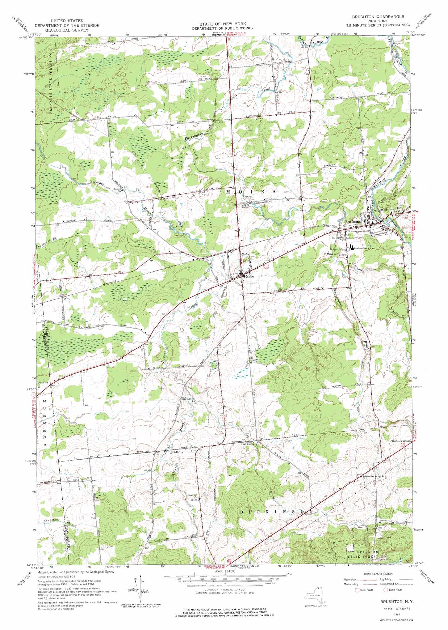
Brushton Topo Map New York
To zoom in, hover over the map of Brushton
USGS Topo Quad 44074g5 - 1:24,000 scale
| Topo Map Name: | Brushton |
| USGS Topo Quad ID: | 44074g5 |
| Print Size: | ca. 21 1/4" wide x 27" high |
| Southeast Coordinates: | 44.75° N latitude / 74.5° W longitude |
| Map Center Coordinates: | 44.8125° N latitude / 74.5625° W longitude |
| U.S. State: | NY |
| Filename: | o44074g5.jpg |
| Download Map JPG Image: | Brushton topo map 1:24,000 scale |
| Map Type: | Topographic |
| Topo Series: | 7.5´ |
| Map Scale: | 1:24,000 |
| Source of Map Images: | United States Geological Survey (USGS) |
| Alternate Map Versions: |
Brushton NY 1964, updated 1966 Download PDF Buy paper map Brushton NY 1964, updated 1976 Download PDF Buy paper map Brushton NY 2010 Download PDF Buy paper map Brushton NY 2013 Download PDF Buy paper map Brushton NY 2016 Download PDF Buy paper map |
1:24,000 Topo Quads surrounding Brushton
Cornwall West |
||||
Raquette River |
Hogansburg |
Bombay |
Fort Covington |
Constable |
Brasher Falls |
North Lawrence |
Brushton |
Bangor |
Malone |
Parishville |
Nicholville |
Saint Regis Falls |
Santa Clara |
Lake Titus |
Rainbow Falls |
Sylvan Falls |
Lake Ozonia |
Meno |
Meacham Lake |
> Back to 44074e1 at 1:100,000 scale
> Back to 44074a1 at 1:250,000 scale
> Back to U.S. Topo Maps home
Brushton topo map: Gazetteer
Brushton: Airports
Ursone Airport elevation 168m 551′Brushton: Populated Places
Alburg elevation 140m 459′Brushton elevation 128m 419′
Moira elevation 128m 419′
Brushton: Streams
Alburg Brook elevation 124m 406′Joy Brook elevation 125m 410′
Stony Brook elevation 126m 413′
Brushton digital topo map on disk
Buy this Brushton topo map showing relief, roads, GPS coordinates and other geographical features, as a high-resolution digital map file on DVD:
New York, Vermont, Connecticut & Western Massachusetts
Buy digital topo maps: New York, Vermont, Connecticut & Western Massachusetts