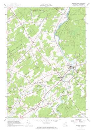
Brasher Falls Topo Map New York
To zoom in, hover over the map of Brasher Falls
USGS Topo Quad 44074g7 - 1:24,000 scale
| Topo Map Name: | Brasher Falls |
| USGS Topo Quad ID: | 44074g7 |
| Print Size: | ca. 21 1/4" wide x 27" high |
| Southeast Coordinates: | 44.75° N latitude / 74.75° W longitude |
| Map Center Coordinates: | 44.8125° N latitude / 74.8125° W longitude |
| U.S. State: | NY |
| Filename: | o44074g7.jpg |
| Download Map JPG Image: | Brasher Falls topo map 1:24,000 scale |
| Map Type: | Topographic |
| Topo Series: | 7.5´ |
| Map Scale: | 1:24,000 |
| Source of Map Images: | United States Geological Survey (USGS) |
| Alternate Map Versions: |
Brasher Falls NY 1946, updated 1946 Download PDF Buy paper map Brasher Falls NY 1964, updated 1966 Download PDF Buy paper map Brasher Falls NY 1964, updated 1966 Download PDF Buy paper map Brasher Falls NY 2010 Download PDF Buy paper map Brasher Falls NY 2013 Download PDF Buy paper map Brasher Falls NY 2016 Download PDF Buy paper map |
1:24,000 Topo Quads surrounding Brasher Falls
> Back to 44074e1 at 1:100,000 scale
> Back to 44074a1 at 1:250,000 scale
> Back to U.S. Topo Maps home
Brasher Falls topo map: Gazetteer
Brasher Falls: Populated Places
Brasher Center elevation 79m 259′Brasher Falls elevation 88m 288′
East Part elevation 110m 360′
Skinnerville elevation 105m 344′
Stockholm Center elevation 111m 364′
Winthrop elevation 99m 324′
Brasher Falls: Streams
Bell Brook elevation 78m 255′Trout Brook elevation 91m 298′
West Branch Saint Regis River elevation 90m 295′
Brasher Falls: Summits
Grasshopper Hill elevation 129m 423′Brasher Falls digital topo map on disk
Buy this Brasher Falls topo map showing relief, roads, GPS coordinates and other geographical features, as a high-resolution digital map file on DVD:
New York, Vermont, Connecticut & Western Massachusetts
Buy digital topo maps: New York, Vermont, Connecticut & Western Massachusetts


