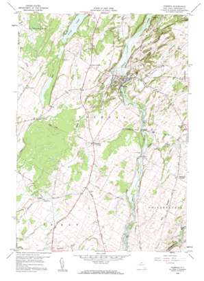
Theresa Topo Map New York
To zoom in, hover over the map of Theresa
USGS Topo Quad 44075b7 - 1:24,000 scale
| Topo Map Name: | Theresa |
| USGS Topo Quad ID: | 44075b7 |
| Print Size: | ca. 21 1/4" wide x 27" high |
| Southeast Coordinates: | 44.125° N latitude / 75.75° W longitude |
| Map Center Coordinates: | 44.1875° N latitude / 75.8125° W longitude |
| U.S. State: | NY |
| Filename: | o44075b7.jpg |
| Download Map JPG Image: | Theresa topo map 1:24,000 scale |
| Map Type: | Topographic |
| Topo Series: | 7.5´ |
| Map Scale: | 1:24,000 |
| Source of Map Images: | United States Geological Survey (USGS) |
| Alternate Map Versions: |
Theresa NY 1948 Download PDF Buy paper map Theresa NY 1958, updated 1960 Download PDF Buy paper map Theresa NY 1958, updated 1960 Download PDF Buy paper map Theresa NY 2011 Download PDF Buy paper map Theresa NY 2013 Download PDF Buy paper map Theresa NY 2016 Download PDF Buy paper map |
1:24,000 Topo Quads surrounding Theresa
> Back to 44075a1 at 1:100,000 scale
> Back to 44074a1 at 1:250,000 scale
> Back to U.S. Topo Maps home
Theresa topo map: Gazetteer
Theresa: Benches
Corbin Ledge elevation 116m 380′Theresa: Bridges
Coon Bridge elevation 120m 393′Joachim Bridge elevation 119m 390′
Kelsey Bridge elevation 116m 380′
Theresa: Capes
Stony Point elevation 102m 334′Theresa: Lakes
Hyde Lake elevation 117m 383′Theresa: Parks
Santway Park elevation 113m 370′Theresa: Populated Places
Douglas Crossing elevation 121m 396′Rivergate elevation 118m 387′
Stroughs Crossing elevation 116m 380′
Theresa elevation 124m 406′
Theresa: Ridges
Elm Ridge elevation 161m 528′Theresa: Streams
Black Creek elevation 94m 308′Casey Creek elevation 94m 308′
Otter Creek elevation 116m 380′
Soapstone Creek elevation 96m 314′
Theresa digital topo map on disk
Buy this Theresa topo map showing relief, roads, GPS coordinates and other geographical features, as a high-resolution digital map file on DVD:
New York, Vermont, Connecticut & Western Massachusetts
Buy digital topo maps: New York, Vermont, Connecticut & Western Massachusetts


