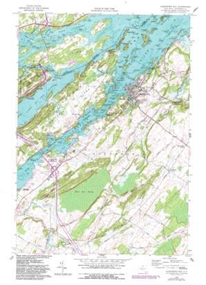
Alexandria Bay Topo Map New York
To zoom in, hover over the map of Alexandria Bay
USGS Topo Quad 44075c8 - 1:24,000 scale
| Topo Map Name: | Alexandria Bay |
| USGS Topo Quad ID: | 44075c8 |
| Print Size: | ca. 21 1/4" wide x 27" high |
| Southeast Coordinates: | 44.25° N latitude / 75.875° W longitude |
| Map Center Coordinates: | 44.3125° N latitude / 75.9375° W longitude |
| U.S. State: | NY |
| Filename: | o44075c8.jpg |
| Download Map JPG Image: | Alexandria Bay topo map 1:24,000 scale |
| Map Type: | Topographic |
| Topo Series: | 7.5´ |
| Map Scale: | 1:24,000 |
| Source of Map Images: | United States Geological Survey (USGS) |
| Alternate Map Versions: |
Alexandria Bay NY 1958, updated 1960 Download PDF Buy paper map Alexandria Bay NY 1958, updated 1982 Download PDF Buy paper map Alexandria Bay NY 2011 Download PDF Buy paper map Alexandria Bay NY 2013 Download PDF Buy paper map Alexandria Bay NY 2016 Download PDF Buy paper map |
1:24,000 Topo Quads surrounding Alexandria Bay
> Back to 44075a1 at 1:100,000 scale
> Back to 44074a1 at 1:250,000 scale
> Back to U.S. Topo Maps home
Alexandria Bay topo map: Gazetteer
Alexandria Bay: Airports
Maxson Airfield elevation 100m 328′NCH Heliport elevation 82m 269′
Alexandria Bay: Bars
Broadway Shoal elevation 74m 242′Comfort Island Shoal elevation 74m 242′
Excelsior Shoals elevation 74m 242′
Fronenac Shoal elevation 74m 242′
Pullman Shoal elevation 74m 242′
Russel Shoal elevation 74m 242′
Alexandria Bay: Bays
Brown Bay elevation 74m 242′Carnegie Bay elevation 74m 242′
Crossmon Bay elevation 74m 242′
Densmore Bay elevation 74m 242′
Greens Bay elevation 74m 242′
Mance Marine Basin elevation 75m 246′
Otter Creek Bay elevation 74m 242′
Swan Bay elevation 74m 242′
Alexandria Bay: Bridges
Thousand Islands Bridge elevation 74m 242′Alexandria Bay: Capes
Anthony Point elevation 79m 259′De Wolf Point elevation 74m 242′
Dingman Point elevation 79m 259′
Hollands Point elevation 75m 246′
Iroquois Point elevation 74m 242′
Keewaydin Point elevation 80m 262′
Mary Island elevation 76m 249′
Otter Point elevation 77m 252′
Point Marguerite elevation 78m 255′
Alexandria Bay: Channels
American Narrows elevation 74m 242′Alexandria Bay: Harbors
Bonnie Castle Yacht Basin elevation 74m 242′Alexandria Bay: Islands
Baileys Island elevation 75m 246′Belle Island elevation 77m 252′
Canary Island elevation 75m 246′
Casino Island elevation 74m 242′
Cherry Island elevation 82m 269′
Comfort Island elevation 82m 269′
Cuba Island elevation 75m 246′
Deer Island elevation 92m 301′
Devils Oven Island elevation 74m 242′
Douglas Island elevation 86m 282′
East Mary Island elevation 80m 262′
Elephant Back elevation 74m 242′
Excelsior Group elevation 80m 262′
Fairyland Island elevation 88m 288′
Florence Island elevation 78m 255′
Friendly Island elevation 83m 272′
Gypsy Island elevation 80m 262′
Harbor Island elevation 89m 291′
Heart Island elevation 75m 246′
Holiday Island elevation 74m 242′
Holiday Island elevation 76m 249′
Hub Island elevation 74m 242′
Huguenot Island elevation 78m 255′
Idlewild Island elevation 83m 272′
Imperial Isle elevation 75m 246′
Ina Island elevation 74m 242′
Kipp Island elevation 76m 249′
Little Watch Island elevation 76m 249′
Little Watch Island elevation 76m 249′
Longue Vue Island elevation 75m 246′
Lotus Island elevation 87m 285′
Malomar Island elevation 74m 242′
Manhattan Group elevation 80m 262′
Manhattan Island elevation 79m 259′
Maple Island elevation 75m 246′
Marsh Island elevation 80m 262′
Nobby Island elevation 74m 242′
Pike Island elevation 76m 249′
Pullman Island elevation 76m 249′
Resort Island elevation 79m 259′
Rob Roy Island elevation 74m 242′
Saint Elmo Island elevation 84m 275′
Saint Helena Island elevation 79m 259′
Sand Island elevation 77m 252′
Schooner Island elevation 78m 255′
Seven Isles elevation 77m 252′
Ski Island elevation 76m 249′
Steamboat Island elevation 77m 252′
Stony Crest elevation 77m 252′
Summerland Group elevation 83m 272′
Summerland Island elevation 97m 318′
Sunken Rock Island elevation 74m 242′
Sunnyside Island elevation 78m 255′
Thousand Islands elevation 90m 295′
Wauwinel Island elevation 75m 246′
Welcome Island elevation 80m 262′
Alexandria Bay: Lakes
Lake of the Isles elevation 74m 242′Alexandria Bay: Parks
Cranberry Creek Wildlife Management Area elevation 78m 255′Grass Point State Park elevation 81m 265′
Keewaydin Point State Park elevation 89m 291′
Mary Island State Park elevation 80m 262′
Alexandria Bay: Populated Places
Alexandria Bay elevation 82m 269′Alexandria Center elevation 110m 360′
Collins Landing elevation 80m 262′
Edgewood Park elevation 80m 262′
Godfreys Corner elevation 109m 357′
Moore Landing elevation 80m 262′
Omar elevation 86m 282′
Pinehurst Resort elevation 76m 249′
Point Vivian elevation 82m 269′
Saint Lawrence Park elevation 83m 272′
Westminster Park elevation 84m 275′
Alexandria Bay: Streams
Greens Creek elevation 74m 242′Otter Creek elevation 74m 242′
Alexandria Bay: Swamps
Barnett Marsh elevation 75m 246′Barnett Marsh elevation 74m 242′
Black Ash Swamp elevation 80m 262′
Alexandria Bay digital topo map on disk
Buy this Alexandria Bay topo map showing relief, roads, GPS coordinates and other geographical features, as a high-resolution digital map file on DVD:
New York, Vermont, Connecticut & Western Massachusetts
Buy digital topo maps: New York, Vermont, Connecticut & Western Massachusetts


