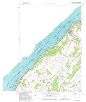
Morristown Topo Map New York
To zoom in, hover over the map of Morristown
USGS Topo Quad 44075e6 - 1:24,000 scale
| Topo Map Name: | Morristown |
| USGS Topo Quad ID: | 44075e6 |
| Print Size: | ca. 21 1/4" wide x 27" high |
| Southeast Coordinates: | 44.5° N latitude / 75.625° W longitude |
| Map Center Coordinates: | 44.5625° N latitude / 75.6875° W longitude |
| U.S. State: | NY |
| Filename: | o44075e6.jpg |
| Download Map JPG Image: | Morristown topo map 1:24,000 scale |
| Map Type: | Topographic |
| Topo Series: | 7.5´ |
| Map Scale: | 1:24,000 |
| Source of Map Images: | United States Geological Survey (USGS) |
| Alternate Map Versions: |
Morristown NY 1942, updated 1958 Download PDF Buy paper map Morristown NY 1963, updated 1964 Download PDF Buy paper map Morristown NY 1963, updated 1977 Download PDF Buy paper map Morristown NY 1963, updated 1982 Download PDF Buy paper map Morristown NY 2011 Download PDF Buy paper map Morristown NY 2013 Download PDF Buy paper map Morristown NY 2016 Download PDF Buy paper map |
1:24,000 Topo Quads surrounding Morristown
Red Mills |
||||
Ogdensburg West |
Ogdensburg East |
|||
Morristown |
Edwardsville |
Heuvelton |
||
Chippewa Bay |
Hammond |
Pope Mills |
Richville |
|
Alexandria Bay |
Redwood |
Muskellunge Lake |
Natural Dam |
Gouverneur |
> Back to 44075e1 at 1:100,000 scale
> Back to 44074a1 at 1:250,000 scale
> Back to U.S. Topo Maps home
Morristown topo map: Gazetteer
Morristown: Bars
Bay State Shoal elevation 107m 351′Oak Point Shoal elevation 74m 242′
Whaleback Shoal elevation 106m 347′
Morristown: Bays
Blackstone Bay elevation 74m 242′Eagers Bay elevation 74m 242′
Morristown Bay elevation 74m 242′
Perch Bay elevation 74m 242′
Morristown: Capes
Birch Point elevation 87m 285′Chapman Point elevation 79m 259′
Delack Point elevation 78m 255′
Holmes Point elevation 78m 255′
Morristown Point elevation 76m 249′
Point Comfort elevation 77m 252′
Morristown: Islands
American Island elevation 74m 242′Bogardus Island elevation 74m 242′
Brockville Rock elevation 74m 242′
Old Man Island elevation 78m 255′
Three Sisters Islands elevation 76m 249′
Morristown: Parks
Jacques Cartier State Park elevation 104m 341′Morristown: Populated Places
Brier Hill elevation 104m 341′Edgewater Park elevation 79m 259′
Morristown elevation 88m 288′
Terrace Park elevation 91m 298′
Morristown: Streams
Louce Creek elevation 80m 262′Morristown digital topo map on disk
Buy this Morristown topo map showing relief, roads, GPS coordinates and other geographical features, as a high-resolution digital map file on DVD:
New York, Vermont, Connecticut & Western Massachusetts
Buy digital topo maps: New York, Vermont, Connecticut & Western Massachusetts


