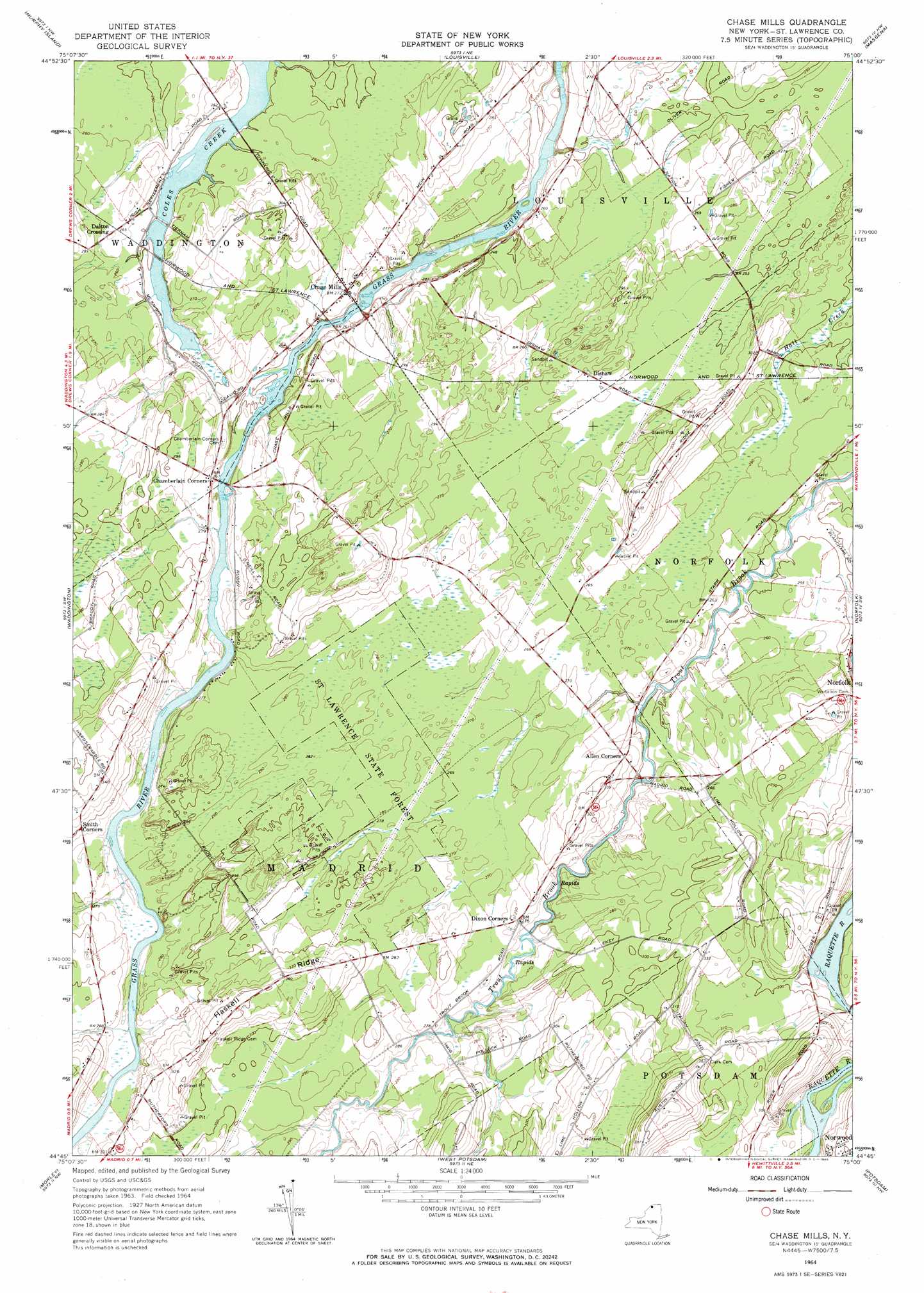
Chase Mills Topo Map New York
To zoom in, hover over the map of Chase Mills
USGS Topo Quad 44075g1 - 1:24,000 scale
| Topo Map Name: | Chase Mills |
| USGS Topo Quad ID: | 44075g1 |
| Print Size: | ca. 21 1/4" wide x 27" high |
| Southeast Coordinates: | 44.75° N latitude / 75° W longitude |
| Map Center Coordinates: | 44.8125° N latitude / 75.0625° W longitude |
| U.S. State: | NY |
| Filename: | o44075g1.jpg |
| Download Map JPG Image: | Chase Mills topo map 1:24,000 scale |
| Map Type: | Topographic |
| Topo Series: | 7.5´ |
| Map Scale: | 1:24,000 |
| Source of Map Images: | United States Geological Survey (USGS) |
| Alternate Map Versions: |
Chase Mills NY 1942, updated 1961 Download PDF Buy paper map Chase Mills NY 1964, updated 1966 Download PDF Buy paper map Chase Mills NY 2010 Download PDF Buy paper map Chase Mills NY 2013 Download PDF Buy paper map Chase Mills NY 2016 Download PDF Buy paper map |
1:24,000 Topo Quads surrounding Chase Mills
Cornwall West |
||||
Morrisburg |
Louisville |
Massena |
Raquette River |
|
Sparrowhawk Point |
Waddington |
Chase Mills |
Norfolk |
Brasher Falls |
Lisbon |
Morley |
West Potsdam |
Potsdam |
Parishville |
Rensselaer Falls |
Canton |
Pierrepont |
Colton |
Rainbow Falls |
> Back to 44075e1 at 1:100,000 scale
> Back to 44074a1 at 1:250,000 scale
> Back to U.S. Topo Maps home
Chase Mills topo map: Gazetteer
Chase Mills: Populated Places
Chase Mills elevation 82m 269′Dalton Crossing elevation 81m 265′
Dishaw elevation 81m 265′
Chase Mills: Ridges
Haskell Ridge elevation 101m 331′Chase Mills digital topo map on disk
Buy this Chase Mills topo map showing relief, roads, GPS coordinates and other geographical features, as a high-resolution digital map file on DVD:
New York, Vermont, Connecticut & Western Massachusetts
Buy digital topo maps: New York, Vermont, Connecticut & Western Massachusetts