Dexter Topo Map New York
To zoom in, hover over the map of Dexter
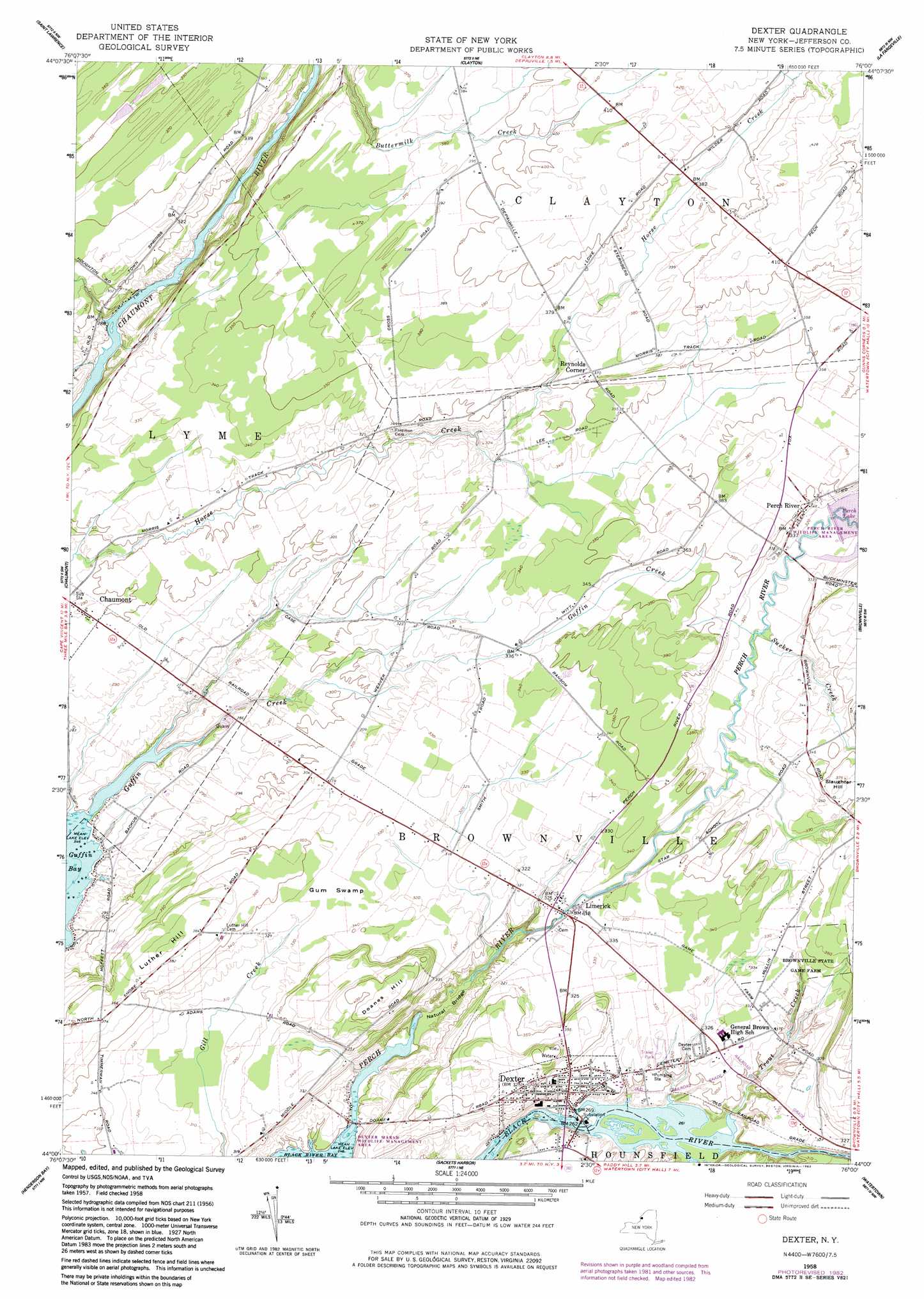
USGS Topo Quad 44076a1 - 1:24,000 scale
| Topo Map Name: | Dexter |
| USGS Topo Quad ID: | 44076a1 |
| Print Size: | ca. 21 1/4" wide x 27" high |
| Southeast Coordinates: | 44° N latitude / 76° W longitude |
| Map Center Coordinates: | 44.0625° N latitude / 76.0625° W longitude |
| U.S. State: | NY |
| Filename: | o44076a1.jpg |
| Download Map JPG Image: | Dexter topo map 1:24,000 scale |
| Map Type: | Topographic |
| Topo Series: | 7.5´ |
| Map Scale: | 1:24,000 |
| Source of Map Images: | United States Geological Survey (USGS) |
| Alternate Map Versions: |
Dexter NY 1958, updated 1960 Download PDF Buy paper map Dexter NY 1958, updated 1976 Download PDF Buy paper map Dexter NY 1958, updated 1983 Download PDF Buy paper map Dexter NY 2010 Download PDF Buy paper map Dexter NY 2013 Download PDF Buy paper map Dexter NY 2016 Download PDF Buy paper map |
1:24,000 Topo Quads surrounding Dexter
Gananoque |
Thousand Island Park |
Alexandria Bay |
Redwood |
|
Cape Vincent North |
Saint Lawrence |
Clayton |
La Fargeville |
Theresa |
Cape Vincent South |
Chaumont |
Dexter |
Brownville |
Black River |
Point Peninsula |
Henderson Bay |
Sackets Harbor |
Watertown |
Rutland Center |
Stony Point |
Henderson |
Adams |
Rodman |
Barnes Corners |
> Back to 44076a1 at 1:100,000 scale
> Back to 44076a1 at 1:250,000 scale
> Back to U.S. Topo Maps home
Dexter topo map: Gazetteer
Dexter: Arches
Natural Bridge of New York elevation 82m 269′Dexter: Parks
Brownville State Game Farm elevation 100m 328′Dexter: Populated Places
Dexter elevation 86m 282′Limerick elevation 97m 318′
Perch River elevation 105m 344′
Reynolds Corner elevation 112m 367′
Dexter: Streams
Guffin Creek elevation 75m 246′Sucker Creek elevation 92m 301′
Trout Creek elevation 79m 259′
Dexter: Summits
Doanes Hill elevation 127m 416′Luther Hill elevation 119m 390′
Slaughter Hill elevation 112m 367′
Dexter: Swamps
Gum Swamp elevation 102m 334′Dexter digital topo map on disk
Buy this Dexter topo map showing relief, roads, GPS coordinates and other geographical features, as a high-resolution digital map file on DVD:
New York, Vermont, Connecticut & Western Massachusetts
Buy digital topo maps: New York, Vermont, Connecticut & Western Massachusetts