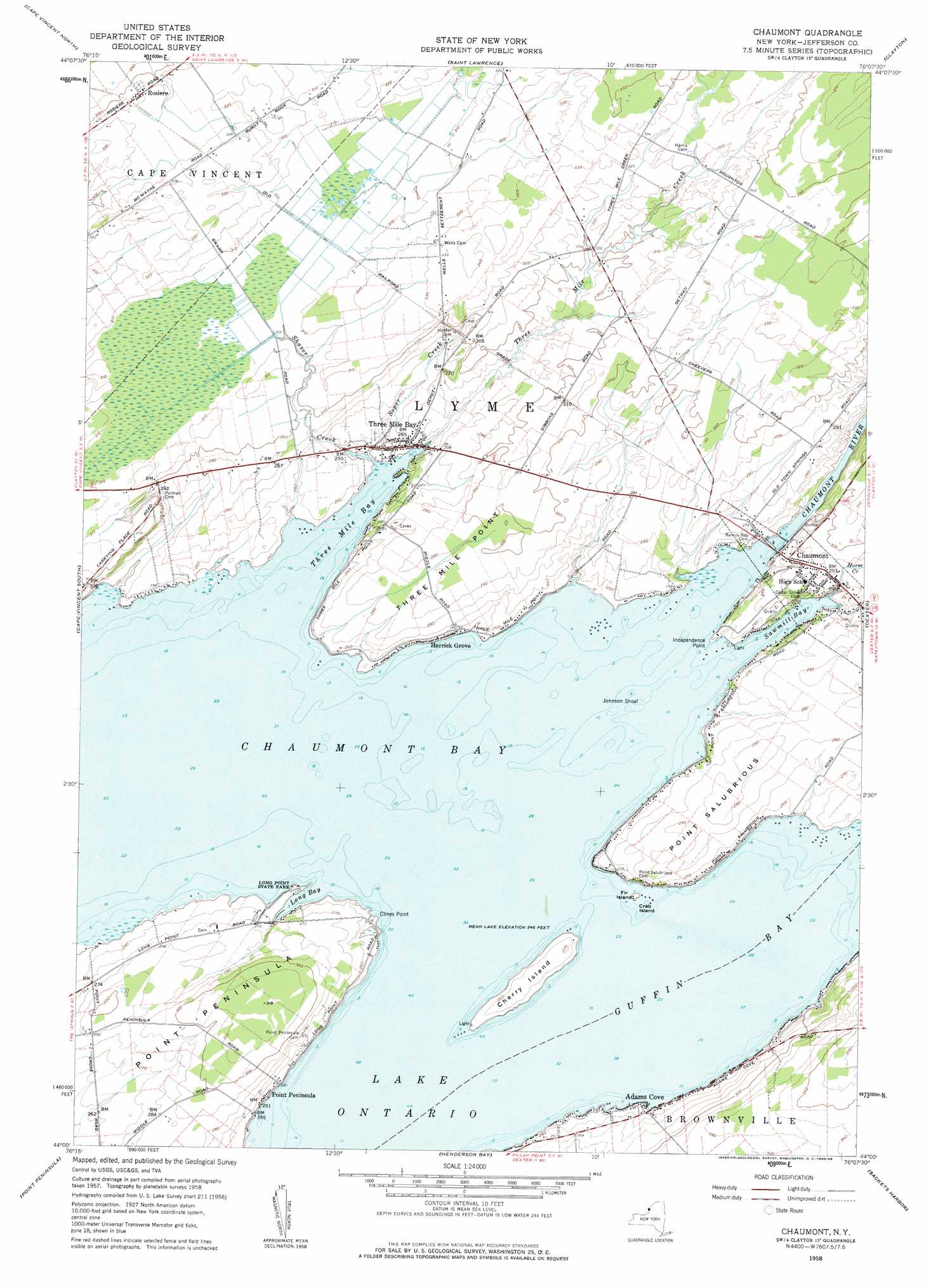
Chaumont Topo Map New York
To zoom in, hover over the map of Chaumont
USGS Topo Quad 44076a2 - 1:24,000 scale
| Topo Map Name: | Chaumont |
| USGS Topo Quad ID: | 44076a2 |
| Print Size: | ca. 21 1/4" wide x 27" high |
| Southeast Coordinates: | 44° N latitude / 76.125° W longitude |
| Map Center Coordinates: | 44.0625° N latitude / 76.1875° W longitude |
| U.S. State: | NY |
| Filename: | o44076a2.jpg |
| Download Map JPG Image: | Chaumont topo map 1:24,000 scale |
| Map Type: | Topographic |
| Topo Series: | 7.5´ |
| Map Scale: | 1:24,000 |
| Source of Map Images: | United States Geological Survey (USGS) |
| Alternate Map Versions: |
Chaumont NY 1958 Download PDF Buy paper map Chaumont NY 1958, updated 1960 Download PDF Buy paper map Chaumont NY 2011 Download PDF Buy paper map Chaumont NY 2013 Download PDF Buy paper map Chaumont NY 2016 Download PDF Buy paper map |
1:24,000 Topo Quads surrounding Chaumont
Gananoque |
Thousand Island Park |
Alexandria Bay |
||
Cape Vincent North |
Saint Lawrence |
Clayton |
La Fargeville |
|
Cape Vincent South |
Chaumont |
Dexter |
Brownville |
|
Galloo Island |
Point Peninsula |
Henderson Bay |
Sackets Harbor |
Watertown |
Stony Point |
Henderson |
Adams |
Rodman |
> Back to 44076a1 at 1:100,000 scale
> Back to 44076a1 at 1:250,000 scale
> Back to U.S. Topo Maps home
Chaumont topo map: Gazetteer
Chaumont: Airports
Chaumont Bay Airport elevation 81m 265′Chaumont: Bars
Herrick Shoal elevation 75m 246′Johnson Shoal elevation 75m 246′
Middle Shoal elevation 75m 246′
Chaumont: Bays
Chaumont Bay elevation 75m 246′Duck Bay elevation 75m 246′
Guffin Bay elevation 75m 246′
Long Bay elevation 75m 246′
Sawmill Bay elevation 75m 246′
Three Mile Bay elevation 75m 246′
Chaumont: Capes
Clines Point elevation 76m 249′Hickory Point elevation 75m 246′
Independence Point elevation 77m 252′
Point Peninsula elevation 96m 314′
Point Salubrious elevation 88m 288′
Three Mile Point elevation 88m 288′
Chaumont: Islands
Cherry Island elevation 80m 262′Crab Island elevation 75m 246′
Croyle Island elevation 76m 249′
Fir Island elevation 78m 255′
Squaw Island elevation 75m 246′
Chaumont: Parks
Long Point State Park elevation 77m 252′Chaumont: Populated Places
Adams Cove elevation 75m 246′Chaumont elevation 88m 288′
Herrick Grove elevation 75m 246′
Point Peninsula elevation 77m 252′
Rosiere elevation 94m 308′
Three Mile Bay elevation 79m 259′
Chaumont: Streams
Chaumont River elevation 75m 246′Horse Creek elevation 75m 246′
Shaver Creek elevation 75m 246′
Soper Creek elevation 75m 246′
Three Mile Creek elevation 76m 249′
Chaumont digital topo map on disk
Buy this Chaumont topo map showing relief, roads, GPS coordinates and other geographical features, as a high-resolution digital map file on DVD:
New York, Vermont, Connecticut & Western Massachusetts
Buy digital topo maps: New York, Vermont, Connecticut & Western Massachusetts