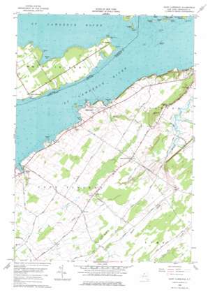
Saint Lawrence Topo Map New York
To zoom in, hover over the map of Saint Lawrence
USGS Topo Quad 44076b2 - 1:24,000 scale
| Topo Map Name: | Saint Lawrence |
| USGS Topo Quad ID: | 44076b2 |
| Print Size: | ca. 21 1/4" wide x 27" high |
| Southeast Coordinates: | 44.125° N latitude / 76.125° W longitude |
| Map Center Coordinates: | 44.1875° N latitude / 76.1875° W longitude |
| U.S. State: | NY |
| Filename: | o44076b2.jpg |
| Download Map JPG Image: | Saint Lawrence topo map 1:24,000 scale |
| Map Type: | Topographic |
| Topo Series: | 7.5´ |
| Map Scale: | 1:24,000 |
| Source of Map Images: | United States Geological Survey (USGS) |
| Alternate Map Versions: |
Saint Lawrence NY 1958, updated 1961 Download PDF Buy paper map Saint Lawrence NY 1958, updated 1977 Download PDF Buy paper map Saint Lawrence NY 2011 Download PDF Buy paper map Saint Lawrence NY 2013 Download PDF Buy paper map Saint Lawrence NY 2016 Download PDF Buy paper map |
1:24,000 Topo Quads surrounding Saint Lawrence
> Back to 44076a1 at 1:100,000 scale
> Back to 44076a1 at 1:250,000 scale
> Back to U.S. Topo Maps home
Saint Lawrence topo map: Gazetteer
Saint Lawrence: Bars
Blanket Shoals elevation 74m 242′Gull Rock elevation 74m 242′
Saint Lawrence: Bays
Dodge Bay elevation 74m 242′Millen Bay elevation 75m 246′
Rose Bay elevation 99m 324′
Sand Bay elevation 74m 242′
Sawmill Bay elevation 74m 242′
Saint Lawrence: Capes
Beadle Point elevation 79m 259′Cedar Point elevation 77m 252′
Cummings Point elevation 76m 249′
Saint Lawrence: Islands
Blanket Island elevation 74m 242′Club Island elevation 77m 252′
Gull Rock elevation 74m 242′
Gull Rock Island (historical) elevation 74m 242′
Linda Island elevation 78m 255′
Papoose Island elevation 75m 246′
Rock West elevation 74m 242′
Rock West Island (historical) elevation 74m 242′
Whiskey Island elevation 74m 242′
Saint Lawrence: Parks
Cedar Point State Park elevation 90m 295′Saint Lawrence: Populated Places
Millen Bay elevation 76m 249′Saint Lawrence elevation 107m 351′
Warren elevation 101m 331′
Saint Lawrence: Springs
Frontenac Springs elevation 87m 285′Saint Lawrence: Streams
Wheeler Creek elevation 76m 249′Saint Lawrence: Summits
Burnt Rock elevation 107m 351′Saint Lawrence digital topo map on disk
Buy this Saint Lawrence topo map showing relief, roads, GPS coordinates and other geographical features, as a high-resolution digital map file on DVD:
New York, Vermont, Connecticut & Western Massachusetts
Buy digital topo maps: New York, Vermont, Connecticut & Western Massachusetts


