Au Gres Topo Map Michigan
To zoom in, hover over the map of Au Gres
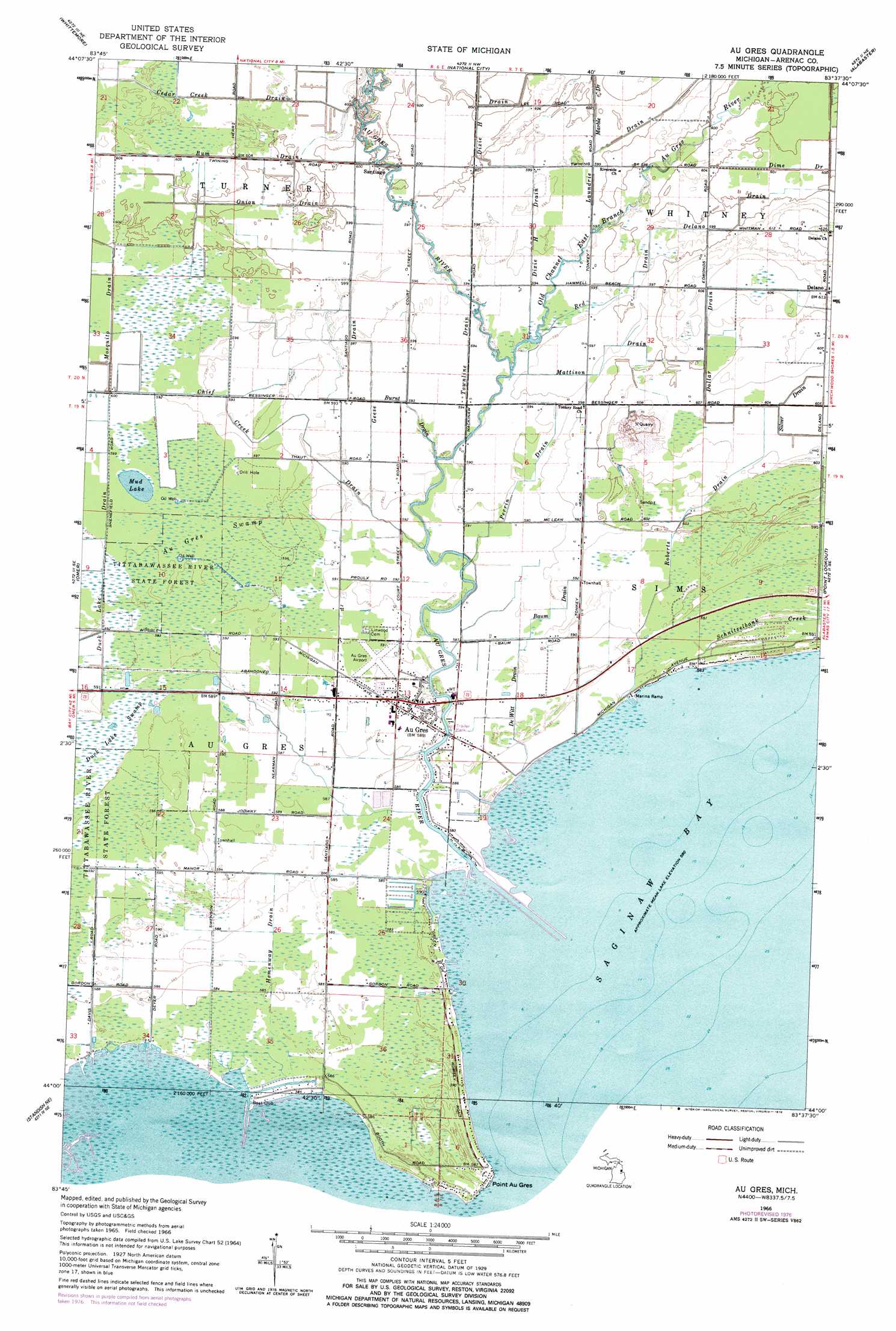
USGS Topo Quad 44083a6 - 1:24,000 scale
| Topo Map Name: | Au Gres |
| USGS Topo Quad ID: | 44083a6 |
| Print Size: | ca. 21 1/4" wide x 27" high |
| Southeast Coordinates: | 44° N latitude / 83.625° W longitude |
| Map Center Coordinates: | 44.0625° N latitude / 83.6875° W longitude |
| U.S. State: | MI |
| Filename: | o44083a6.jpg |
| Download Map JPG Image: | Au Gres topo map 1:24,000 scale |
| Map Type: | Topographic |
| Topo Series: | 7.5´ |
| Map Scale: | 1:24,000 |
| Source of Map Images: | United States Geological Survey (USGS) |
| Alternate Map Versions: |
Au Gres MI 1966, updated 1968 Download PDF Buy paper map Au Gres MI 1966, updated 1978 Download PDF Buy paper map Au Gres MI 2011 Download PDF Buy paper map Au Gres MI 2014 Download PDF Buy paper map Au Gres MI 2016 Download PDF Buy paper map |
1:24,000 Topo Quads surrounding Au Gres
Sage Lake |
Hale Se |
Floyd Lake |
Tawas City |
East Tawas |
Prescott |
Whittemore |
National City |
Alabaster |
|
Omer Sw |
Omer |
Au Gres |
Point Lookout |
Charity Island |
Standish |
Standish Ne |
Au Gres |
Sand Point |
|
Pinconning |
Bay Port West |
> Back to 44083a1 at 1:100,000 scale
> Back to 44082a1 at 1:250,000 scale
> Back to U.S. Topo Maps home
Au Gres topo map: Gazetteer
Au Gres: Airports
Au Gres Airport elevation 180m 590′Au Gres: Canals
Delano Drain elevation 181m 593′Dollar Drain elevation 184m 603′
Hemenway Drain elevation 178m 583′
Onion Drain elevation 183m 600′
Perrin Drain elevation 179m 587′
Au Gres: Harbors
Point Lookout Harbor elevation 178m 583′Au Gres: Lakes
Duck Lake elevation 179m 587′Mud Lake elevation 182m 597′
Au Gres: Parks
Au Gres City Park elevation 178m 583′Au Gres: Populated Places
Au Gres elevation 179m 587′Delano elevation 186m 610′
Santiago elevation 183m 600′
Au Gres: Post Offices
Au Gres Post Office elevation 180m 590′Santiago Post Office (historical) elevation 183m 600′
Au Gres: Streams
Au Gres River elevation 177m 580′Baum Drain elevation 178m 583′
Bum Drain elevation 182m 597′
Burnt Drain elevation 179m 587′
Cedar Creek Drain elevation 182m 597′
Chief Creek Drain elevation 179m 587′
De Witt Drain elevation 177m 580′
Dixie H Drain elevation 180m 590′
Geese Drain elevation 178m 583′
Laundrie Drain elevation 181m 593′
Marble Drain elevation 181m 593′
Mattison Drain elevation 181m 593′
Mosquito Drain elevation 182m 597′
Old Channel East Branch Au Gres River elevation 180m 590′
Red Drain elevation 180m 590′
Roberts Drain elevation 178m 583′
Schnitzelbank Creek elevation 178m 583′
Townline Drain elevation 178m 583′
Au Gres: Swamps
Au Gres Swamp elevation 182m 597′Duck Lake Swamp elevation 179m 587′
Au Gres digital topo map on disk
Buy this Au Gres topo map showing relief, roads, GPS coordinates and other geographical features, as a high-resolution digital map file on DVD:
 map DVD")