Omer Sw Topo Map Michigan
To zoom in, hover over the map of Omer Sw
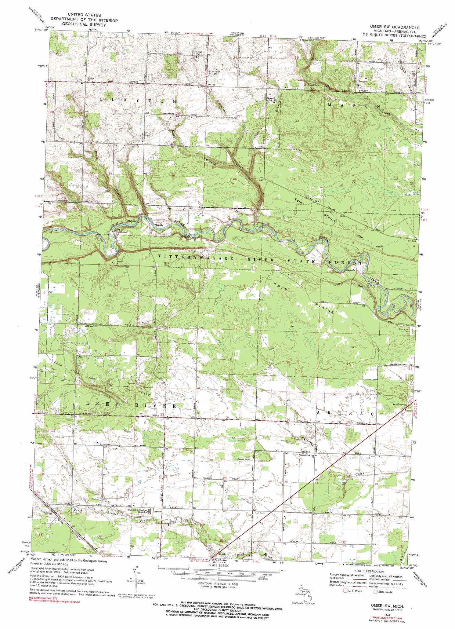
USGS Topo Quad 44083a8 - 1:24,000 scale
| Topo Map Name: | Omer Sw |
| USGS Topo Quad ID: | 44083a8 |
| Print Size: | ca. 21 1/4" wide x 27" high |
| Southeast Coordinates: | 44° N latitude / 83.875° W longitude |
| Map Center Coordinates: | 44.0625° N latitude / 83.9375° W longitude |
| U.S. State: | MI |
| Filename: | o44083a8.jpg |
| Download Map JPG Image: | Omer Sw topo map 1:24,000 scale |
| Map Type: | Topographic |
| Topo Series: | 7.5´ |
| Map Scale: | 1:24,000 |
| Source of Map Images: | United States Geological Survey (USGS) |
| Alternate Map Versions: |
Omer SW MI 1968, updated 1971 Download PDF Buy paper map Omer SW MI 1968, updated 1991 Download PDF Buy paper map Omer SW MI 2011 Download PDF Buy paper map Omer SW MI 2014 Download PDF Buy paper map Omer SW MI 2016 Download PDF Buy paper map |
1:24,000 Topo Quads surrounding Omer Sw
West Branch |
Selkirk |
Sage Lake |
Hale Se |
Floyd Lake |
Sterling Nw |
Skidway Lake |
Prescott |
Whittemore |
National City |
Sterling Sw |
Sterling |
Omer Sw |
Omer |
Au Gres |
Bentley |
Mount Forest |
Standish |
Standish Ne |
Au Gres |
Estey |
Crump |
Pinconning |
> Back to 44083a1 at 1:100,000 scale
> Back to 44082a1 at 1:250,000 scale
> Back to U.S. Topo Maps home
Omer Sw topo map: Gazetteer
Omer Sw: Flats
Omer Plains elevation 204m 669′Tyler Plains elevation 208m 682′
Omer Sw: Oilfields
Deep River Gas and Oil Field elevation 224m 734′Omer Sw: Populated Places
Knights Mill elevation 246m 807′Omer Sw: Post Offices
Deepriver Post Office (historical) elevation 201m 659′Omer Sw: Streams
Fritz Creek elevation 196m 643′North Branch Pine River elevation 186m 610′
North Branch Townline Creek elevation 201m 659′
South Branch Townline Creek elevation 204m 669′
Townline Creek elevation 190m 623′
Omer Sw digital topo map on disk
Buy this Omer Sw topo map showing relief, roads, GPS coordinates and other geographical features, as a high-resolution digital map file on DVD:
 map DVD")