National City Topo Map Michigan
To zoom in, hover over the map of National City
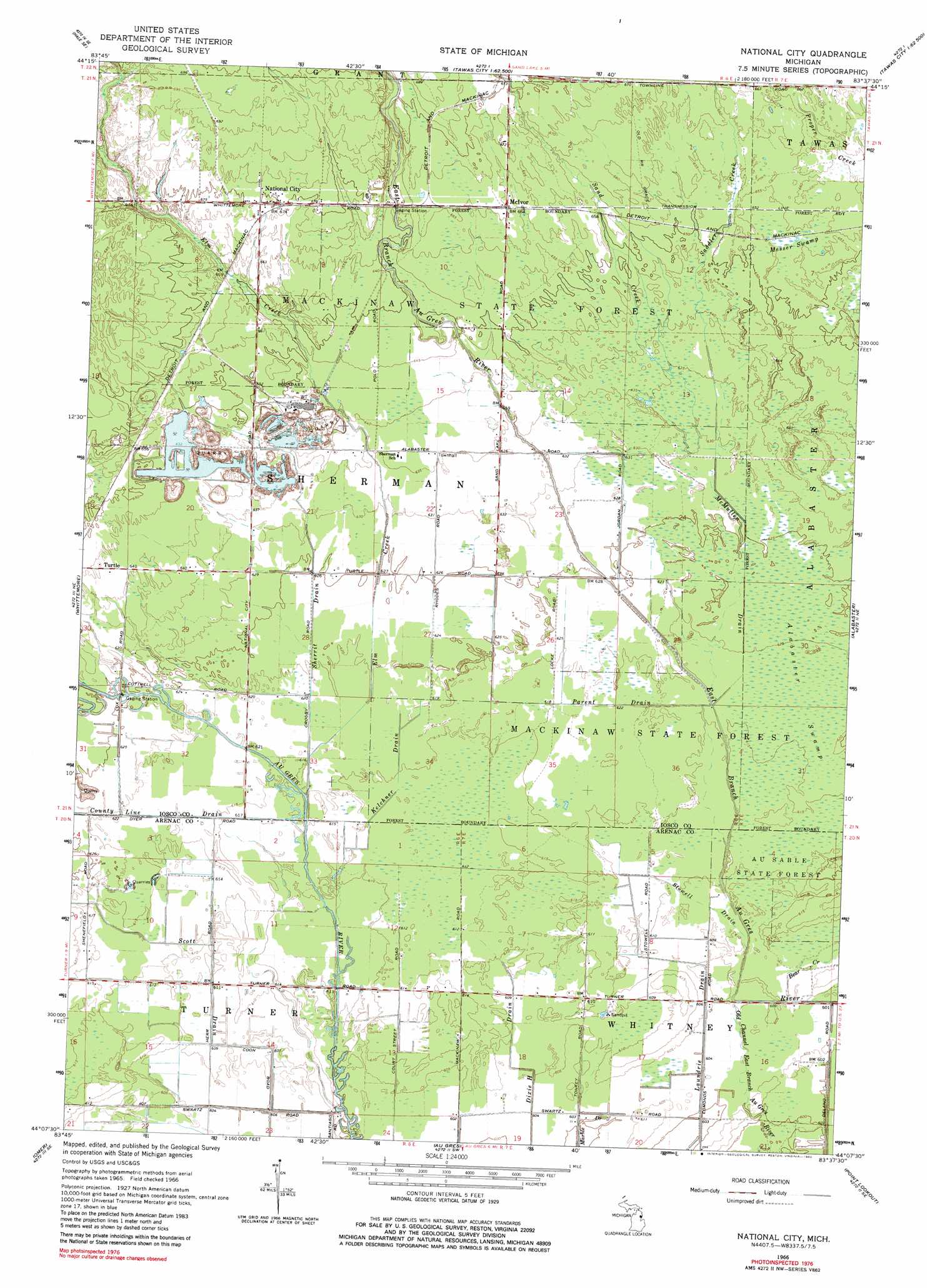
USGS Topo Quad 44083b6 - 1:24,000 scale
| Topo Map Name: | National City |
| USGS Topo Quad ID: | 44083b6 |
| Print Size: | ca. 21 1/4" wide x 27" high |
| Southeast Coordinates: | 44.125° N latitude / 83.625° W longitude |
| Map Center Coordinates: | 44.1875° N latitude / 83.6875° W longitude |
| U.S. State: | MI |
| Filename: | o44083b6.jpg |
| Download Map JPG Image: | National City topo map 1:24,000 scale |
| Map Type: | Topographic |
| Topo Series: | 7.5´ |
| Map Scale: | 1:24,000 |
| Source of Map Images: | United States Geological Survey (USGS) |
| Alternate Map Versions: |
National City MI 1966, updated 1968 Download PDF Buy paper map National City MI 1966, updated 1982 Download PDF Buy paper map National City MI 2011 Download PDF Buy paper map National City MI 2014 Download PDF Buy paper map National City MI 2016 Download PDF Buy paper map |
1:24,000 Topo Quads surrounding National City
South Branch |
Hale |
Loud Dam |
Sid Town |
Foote Site Village |
Sage Lake |
Hale Se |
Floyd Lake |
Tawas City |
East Tawas |
Prescott |
Whittemore |
National City |
Alabaster |
|
Omer Sw |
Omer |
Au Gres |
Point Lookout |
Charity Island |
Standish |
Standish Ne |
Au Gres |
Sand Point |
> Back to 44083a1 at 1:100,000 scale
> Back to 44082a1 at 1:250,000 scale
> Back to U.S. Topo Maps home
National City topo map: Gazetteer
National City: Populated Places
McIvor elevation 203m 666′National City elevation 206m 675′
Turtle elevation 195m 639′
National City: Post Offices
McIvor Post Office (historical) elevation 203m 666′National City Post Office elevation 205m 672′
Turtle Post Office (historical) elevation 195m 639′
National City: Streams
Bear Creek elevation 184m 603′County Line Drain elevation 186m 610′
Elm Creek elevation 187m 613′
Kelchner Drain elevation 186m 610′
McMullen Drain elevation 187m 613′
Parent Drain elevation 187m 613′
Saddler Creek elevation 195m 639′
Sand Creek elevation 192m 629′
Scott Drain elevation 184m 603′
Sherrit Drain elevation 187m 613′
Stowell Drain elevation 185m 606′
National City: Swamps
Messer Swamp elevation 199m 652′National City digital topo map on disk
Buy this National City topo map showing relief, roads, GPS coordinates and other geographical features, as a high-resolution digital map file on DVD:
 map DVD")