Spencer Lake Topo Map Michigan
To zoom in, hover over the map of Spencer Lake
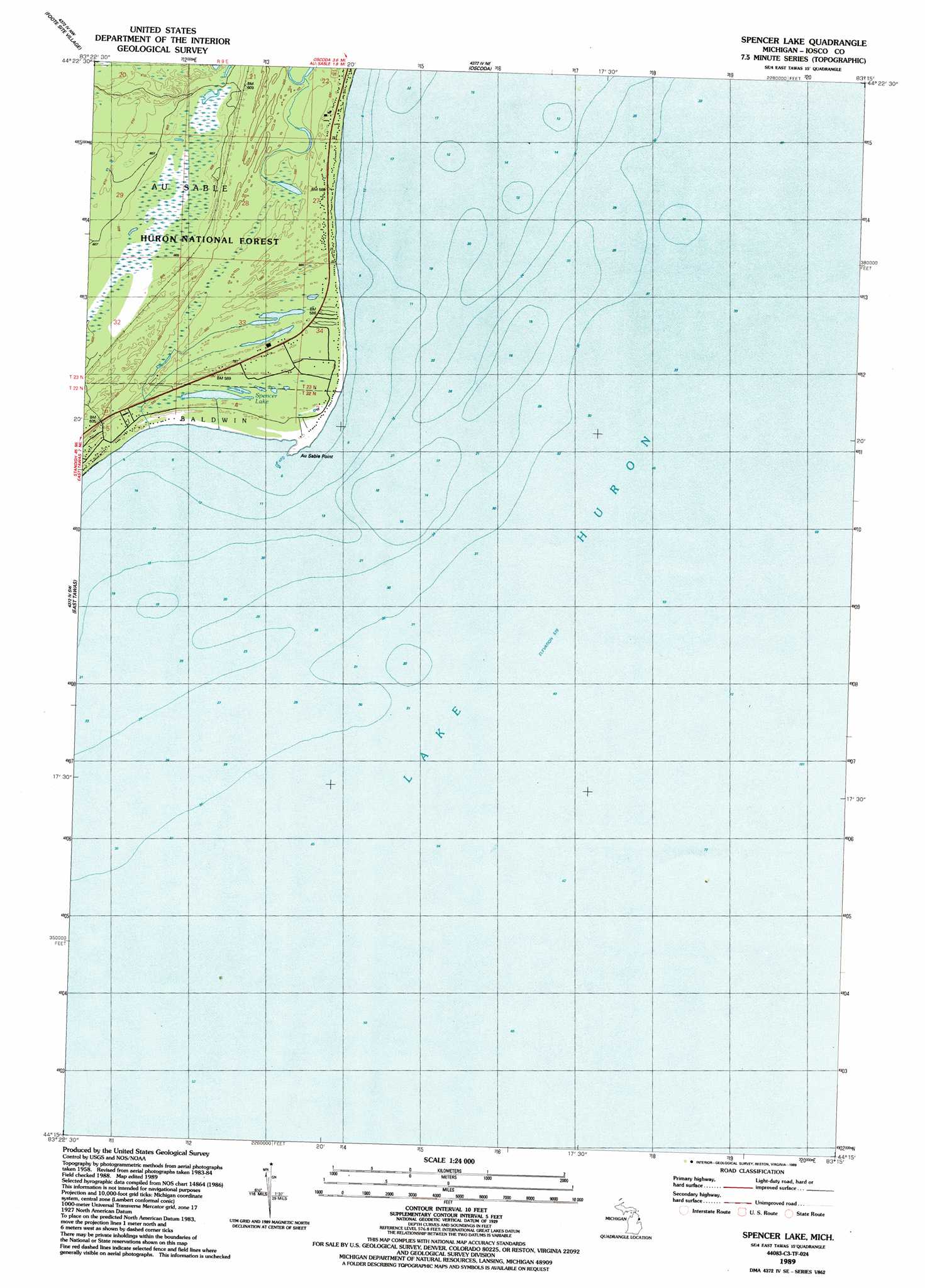
USGS Topo Quad 44083c3 - 1:24,000 scale
| Topo Map Name: | Spencer Lake |
| USGS Topo Quad ID: | 44083c3 |
| Print Size: | ca. 21 1/4" wide x 27" high |
| Southeast Coordinates: | 44.25° N latitude / 83.25° W longitude |
| Map Center Coordinates: | 44.3125° N latitude / 83.3125° W longitude |
| U.S. State: | MI |
| Filename: | o44083c3.jpg |
| Download Map JPG Image: | Spencer Lake topo map 1:24,000 scale |
| Map Type: | Topographic |
| Topo Series: | 7.5´ |
| Map Scale: | 1:24,000 |
| Source of Map Images: | United States Geological Survey (USGS) |
| Alternate Map Versions: |
Spencer Lake MI 1989, updated 1989 Download PDF Buy paper map Spencer Lake MI 2012 Download PDF Buy paper map Spencer Lake MI 2014 Download PDF Buy paper map Spencer Lake MI 2016 Download PDF Buy paper map |
| FStopo: | US Forest Service topo Spencer Lake is available: Download FStopo PDF Download FStopo TIF |
1:24,000 Topo Quads surrounding Spencer Lake
Sprinkler Creek |
Mikado |
Greenbush |
||
Sid Town |
Foote Site Village |
Oscoda |
||
Tawas City |
East Tawas |
Spencer Lake |
||
Alabaster |
||||
Point Lookout |
Charity Island |
Port Austin West |
> Back to 44083a1 at 1:100,000 scale
> Back to 44082a1 at 1:250,000 scale
> Back to U.S. Topo Maps home
Spencer Lake topo map: Gazetteer
Spencer Lake: Capes
Au Sable Point elevation 177m 580′Spencer Lake: Forests
Huron National Forest elevation 183m 600′Spencer Lake: Lakes
Spencer Lake elevation 178m 583′Spencer Lake: Parks
Tawas City Park elevation 177m 580′Spencer Lake digital topo map on disk
Buy this Spencer Lake topo map showing relief, roads, GPS coordinates and other geographical features, as a high-resolution digital map file on DVD:
 map DVD")