Tawas City Topo Map Michigan
To zoom in, hover over the map of Tawas City
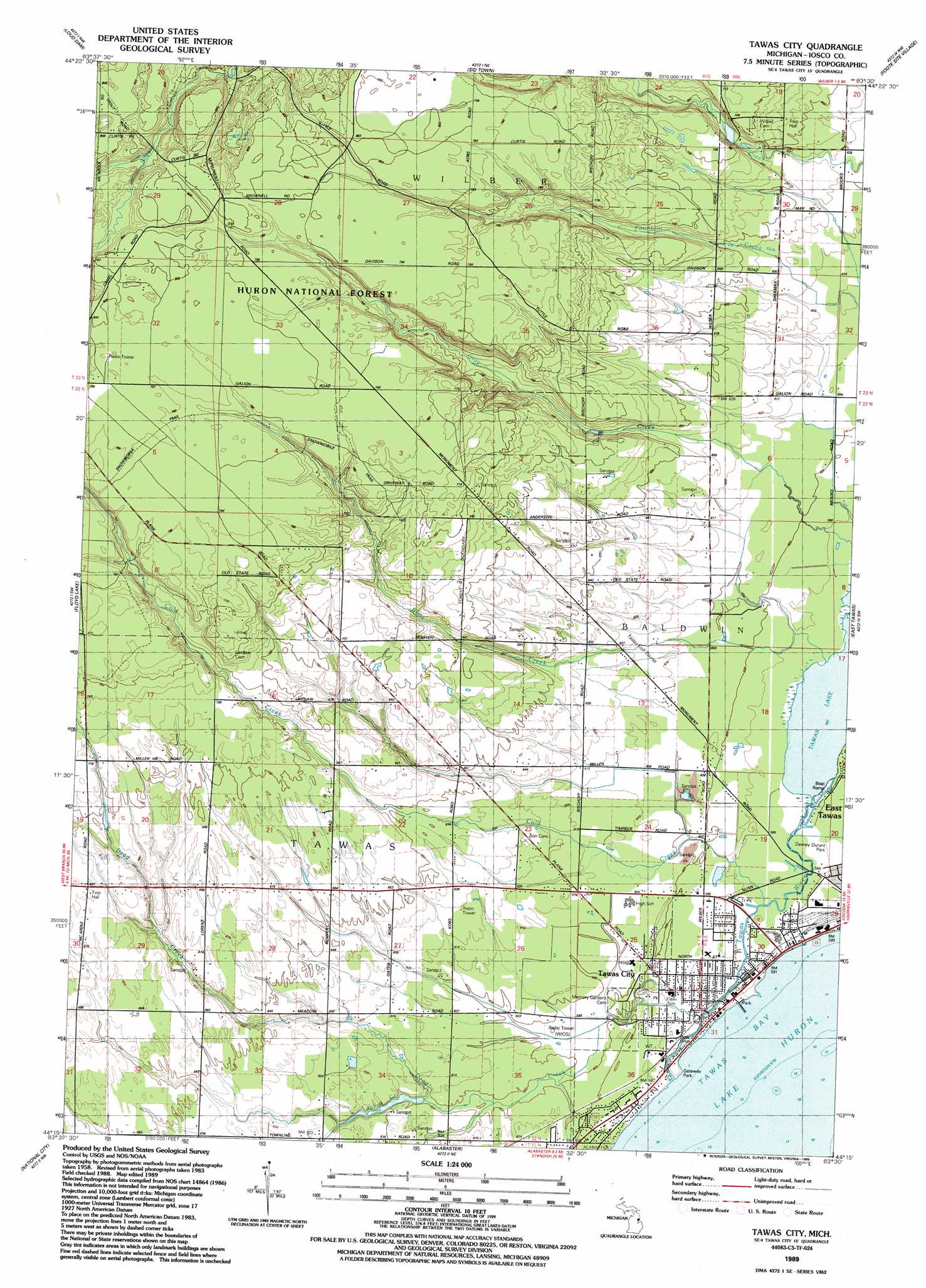
USGS Topo Quad 44083c5 - 1:24,000 scale
| Topo Map Name: | Tawas City |
| USGS Topo Quad ID: | 44083c5 |
| Print Size: | ca. 21 1/4" wide x 27" high |
| Southeast Coordinates: | 44.25° N latitude / 83.5° W longitude |
| Map Center Coordinates: | 44.3125° N latitude / 83.5625° W longitude |
| U.S. State: | MI |
| Filename: | o44083c5.jpg |
| Download Map JPG Image: | Tawas City topo map 1:24,000 scale |
| Map Type: | Topographic |
| Topo Series: | 7.5´ |
| Map Scale: | 1:24,000 |
| Source of Map Images: | United States Geological Survey (USGS) |
| Alternate Map Versions: |
Tawas City MI 1989, updated 1989 Download PDF Buy paper map Tawas City MI 2012 Download PDF Buy paper map Tawas City MI 2014 Download PDF Buy paper map Tawas City MI 2016 Download PDF Buy paper map |
| FStopo: | US Forest Service topo Tawas City is available: Download FStopo PDF Download FStopo TIF |
1:24,000 Topo Quads surrounding Tawas City
Alcona Dam Pond |
Glennie |
Sprinkler Creek |
Mikado |
Greenbush |
Hale |
Loud Dam |
Sid Town |
Foote Site Village |
Oscoda |
Hale Se |
Floyd Lake |
Tawas City |
East Tawas |
Spencer Lake |
Whittemore |
National City |
Alabaster |
||
Omer |
Au Gres |
Point Lookout |
Charity Island |
> Back to 44083a1 at 1:100,000 scale
> Back to 44082a1 at 1:250,000 scale
> Back to U.S. Topo Maps home
Tawas City topo map: Gazetteer
Tawas City: Lakes
Lost Lake elevation 227m 744′Tawas City: Parks
Gateway Park elevation 178m 583′Tawas City: Populated Places
Tawas City elevation 180m 590′Tawas River Trailer Park elevation 179m 587′
Tawas City: Post Offices
Tawas City Post Office elevation 181m 593′Vine Post Office (historical) elevation 192m 629′
Tawas City: Streams
Cold Creek elevation 178m 583′Dead Creek elevation 177m 580′
Johns Creek elevation 182m 597′
Sims Creek elevation 178m 583′
Tawas River elevation 177m 580′
Tawas City digital topo map on disk
Buy this Tawas City topo map showing relief, roads, GPS coordinates and other geographical features, as a high-resolution digital map file on DVD:
 map DVD")